Le Mesnil-en-Thelle elevation
Le Mesnil-en-Thelle (Hauts-de-France, Département de l'Oise), France elevation is 46 meters and Le Mesnil-en-Thelle elevation in feet is 151 ft above sea level [src 1]. Le Mesnil-en-Thelle is a populated place (feature code) with elevation that is 128 meters (420 ft) smaller than average city elevation in France.
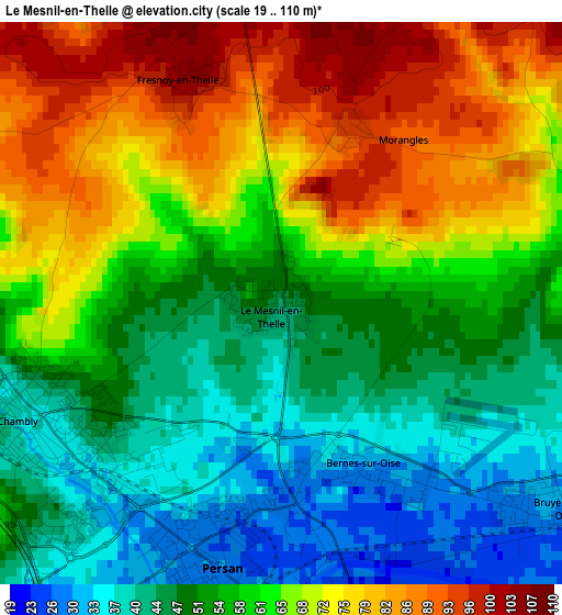
Below is the Elevation map of Le Mesnil-en-Thelle, which displays elevation range with different colors. Scale of the first map is from 19 to 110 m (62 to 361 ft) with average elevation of 59.3 meters (=195 ft) [note 1]
These maps also provides idea of topography and contour of this city, they are displayed at different zoom levels. More info about maps, scale and edge coordinates you can find below images.
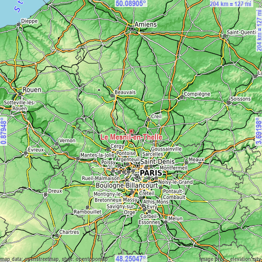
| \ | Map #1 | Topo.Map |
| Scale [m] | 19..110 m | × |
| Scale [ft] | 62..361 ft | × |
| Average | 59.3 m = 195 ft | × |
| Width | 6.39 km = 4 mi | 204.4 km = 127 mi |
| Height | 6.39 km = 4 mi | 204.4 km = 127 mi |
| ↑Max Latitude | 49.207019° | 50.08905° |
| Latitude at center | 49.1783° | 49.1783° |
| ↓Min Latitude | 49.149564° | 48.25047° |
| ← Min Longitude | 2.241785° | 0.87948° |
| Longitude center | 2.28573° | 2.28573° |
| →Max Longitude | 2.329675° | 3.69198° |
Nearby cities:
Cities around Le Mesnil-en-Thelle sort by population:
• Chambly elevation 37 m
2.9 km,  243°
243°
• Persan 27 m
2.9 km,  199°
199°
• Beaumont-sur-Oise 49 m
4 km,  178°
178°
• Champagne-sur-Oise 34 m
5.3 km,  216°
216°
• Bruyères-sur-Oise 30 m
3.7 km,  128°
128°
• Bornel 49 m
6 km,  291°
291°
• Neuilly-en-Thelle 124 m
5.1 km,  359°
359°
• Bernes-sur-Oise 31 m
2.2 km,  151°
151°
• Boran-sur-Oise 39 m
5.4 km,  103°
103°
• Mours 42 m
5.4 km,  194°
194°
• Ercuis 149 m
6.4 km,  12°
12°
• Crouy-en-Thelle 124 m
4.8 km,  32°
32°
Multilingual:
 En español:
Le Mesnil-en-Thelle elevación 46 m.
 En France:
Le Mesnil-en-Thelle élévation 46 m.
 Auf Deutsch:
Le Mesnil-en-Thelle höhe über dem Meeresspiegel ist 46 m.
 На русском:
Le Mesnil-en-Thelle высота над уровнем моря 46 м
Sources and notes:
- [note 1] Map square and city borders are not equal. Map elevation data is calculated only from area inside that square.
- [src 1] Elevation data from geonames database provided with same terms of usage.
- [src 2] The elevation map of Le Mesnil-en-Thelle is generated using elevation data from NASA's 3 arcsec (90m) resolution SRTM data.
- [src 3] Base (background) map © OpenStreetMap contributors tiles are generated by Geofabrik and OpenTopoMap.
Copyright & License:
This Le Mesnil-en-Thelle Elevation Map is licensed under CC BY-SA. You may reuse any part from this page, if you give a proper credit by linking to this URL:
 More info on terms of use page.