Charentay elevation
Charentay (Auvergne-Rhône-Alpes, Département du Rhône), France elevation is 207 meters and Charentay elevation in feet is 679 ft above sea level [src 1]. Charentay is a populated place (feature code) with elevation that is 33 meters (108 ft) bigger than average city elevation in France.
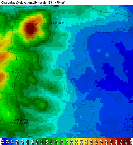
Below is the Elevation map of Charentay, which displays elevation range with different colors. Scale of the first map is from 173 to 479 m (568 to 1572 ft) with average elevation of 238.8 meters (=783 ft) [note 1]
These maps also provides idea of topography and contour of this city, they are displayed at different zoom levels. More info about maps, scale and edge coordinates you can find below images.
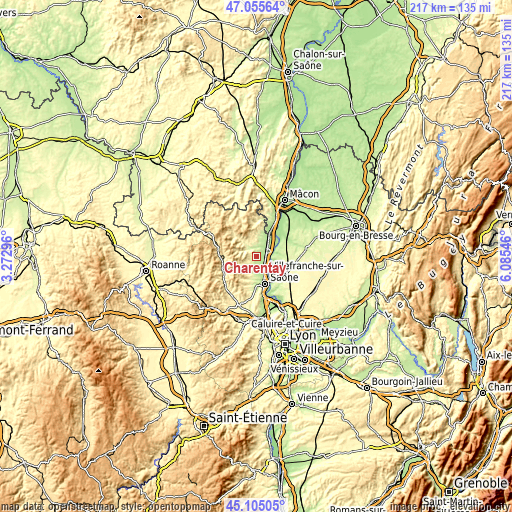
| \ | Map #1 | Topo.Map |
| Scale [m] | 173..479 m | × |
| Scale [ft] | 568..1572 ft | × |
| Average | 238.8 m = 783 ft | × |
| Width | 6.78 km = 4.2 mi | 216.9 km = 134.8 mi |
| Height | 6.78 km = 4.2 mi | 216.9 km = 134.8 mi |
| ↑Max Latitude | 46.119439° | 47.05564° |
| Latitude at center | 46.08897° | 46.08897° |
| ↓Min Latitude | 46.058484° | 45.10505° |
| ← Min Longitude | 4.635265° | 3.27296° |
| Longitude center | 4.67921° | 4.67921° |
| →Max Longitude | 4.723155° | 6.08546° |
Nearby cities:
Cities around Charentay sort by population:
• Belleville elevation 173 m
5.8 km,  67°
67°
• Saint-Georges-de-Reneins 187 m
4.5 km,  132°
132°
• Arnas 181 m
7.6 km,  162°
162°
• Montmerle-sur-Saône 216 m
6.8 km,  95°
95°
• Fareins 203 m
10 km,  140°
140°
• Saint-Étienne-des-Oullières 261 m
3.3 km,  223°
223°
• Villié-Morgon 282 m
8.2 km,  0°
0°
• Denicé 278 m
10.1 km,  194°
194°
• Blacé 299 m
6.9 km,  202°
202°
• Quincié-en-Beaujolais 292 m
5.9 km,  304°
304°
• Guéreins 181 m
7.4 km,  77°
77°
• Le Perréon 296 m
6.7 km,  244°
244°
Multilingual:
 En español:
Charentay elevación 207 m.
 En France:
Charentay élévation 207 m.
 Auf Deutsch:
Charentay höhe über dem Meeresspiegel ist 207 m.

Sources and notes:
- [note 1] Map square and city borders are not equal. Map elevation data is calculated only from area inside that square.
- [src 1] Elevation data from geonames database provided with same terms of usage.
- [src 2] The elevation map of Charentay is generated using elevation data from NASA's 3 arcsec (90m) resolution SRTM data.
- [src 3] Base (background) map © OpenStreetMap contributors tiles are generated by Geofabrik and OpenTopoMap.
Copyright & License:
This Charentay Elevation Map is licensed under CC BY-SA. You may reuse any part from this page, if you give a proper credit by linking to this URL:
 More info on terms of use page.