Denicé elevation
Denicé (Auvergne-Rhône-Alpes, Département du Rhône), France elevation is 278 meters and Denicé elevation in feet is 912 ft above sea level [src 1]. Denicé is a populated place (feature code) with elevation that is 104 meters (341 ft) bigger than average city elevation in France.
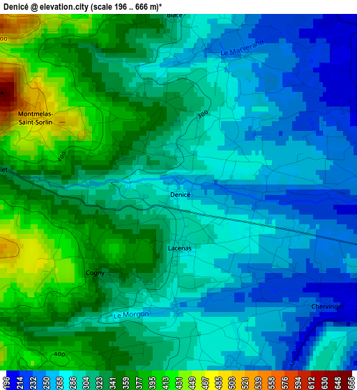
Below is the Elevation map of Denicé, which displays elevation range with different colors. Scale of the first map is from 196 to 666 m (643 to 2185 ft) with average elevation of 312.8 meters (=1026 ft) [note 1]
These maps also provides idea of topography and contour of this city, they are displayed at different zoom levels. More info about maps, scale and edge coordinates you can find below images.
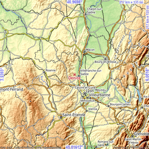
| \ | Map #1 | Topo.Map |
| Scale [m] | 196..666 m | × |
| Scale [ft] | 643..2185 ft | × |
| Average | 312.8 m = 1026 ft | × |
| Width | 6.79 km = 4.2 mi | 217.2 km = 135 mi |
| Height | 6.79 km = 4.2 mi | 217.2 km = 135 mi |
| ↑Max Latitude | 46.032098° | 46.9698° |
| Latitude at center | 46.00158° | 46.00158° |
| ↓Min Latitude | 45.971045° | 45.01612° |
| ← Min Longitude | 4.601605° | 3.2393° |
| Longitude center | 4.64555° | 4.64555° |
| →Max Longitude | 4.689495° | 6.0518° |
Nearby cities:
Cities around Denicé sort by population:
• Villefranche-sur-Saône elevation 178 m
5.9 km,  103°
103°
• Gleizé 202 m
4.2 km,  109°
109°
• Limas 211 m
5.5 km,  121°
121°
• Saint-Georges-de-Reneins 187 m
8.9 km,  41°
41°
• Arnas 181 m
5.4 km,  63°
63°
• Pommiers 315 m
6.3 km,  144°
144°
• Saint-Étienne-des-Oullières 261 m
7.3 km,  2°
2°
• Liergues 246 m
3.6 km,  158°
158°
• Blacé 299 m
3.3 km,  358°
358°
• Theizé 464 m
7.2 km,  198°
198°
• Le Perréon 296 m
7.7 km,  333°
333°
• Cogny 348 m
2.2 km,  225°
225°
Multilingual:
 En español:
Denicé elevación 278 m.
 En France:
Denicé élévation 278 m.


Sources and notes:
- [note 1] Map square and city borders are not equal. Map elevation data is calculated only from area inside that square.
- [src 1] Elevation data from geonames database provided with same terms of usage.
- [src 2] The elevation map of Denicé is generated using elevation data from NASA's 3 arcsec (90m) resolution SRTM data.
- [src 3] Base (background) map © OpenStreetMap contributors tiles are generated by Geofabrik and OpenTopoMap.
Copyright & License:
This Denicé Elevation Map is licensed under CC BY-SA. You may reuse any part from this page, if you give a proper credit by linking to this URL:
 More info on terms of use page.