Gleizé elevation
Gleizé (Auvergne-Rhône-Alpes, Département du Rhône), France elevation is 202 meters and Gleizé elevation in feet is 663 ft above sea level [src 1]. Gleizé is a populated place (feature code) with elevation that is 28 meters (92 ft) bigger than average city elevation in France.
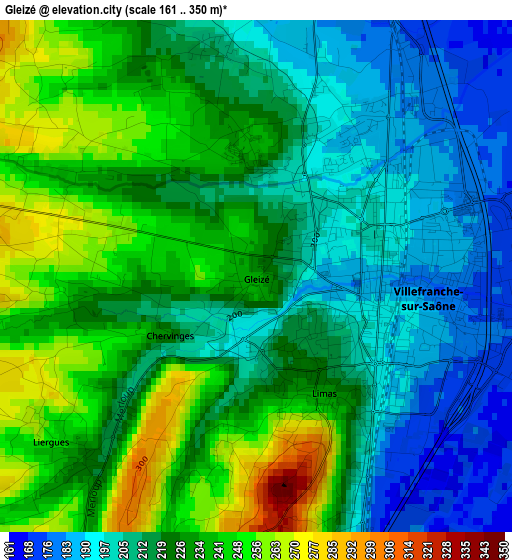
Below is the Elevation map of Gleizé, which displays elevation range with different colors. Scale of the first map is from 161 to 350 m (528 to 1148 ft) with average elevation of 221.5 meters (=727 ft) [note 1]
These maps also provides idea of topography and contour of this city, they are displayed at different zoom levels. More info about maps, scale and edge coordinates you can find below images.
| \ | Map #1 | Map #2 | Topo.Map |
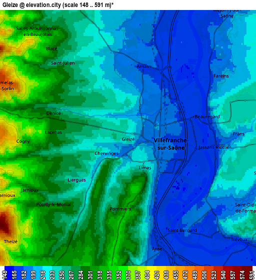
| Scale [m] | 161..350 m | 148..591 m | × |
| Scale [ft] | 528..1148 ft | 486..1939 ft | × |
| Average | 221.5 m = 727 ft | 247.9 m = 813 ft | × |
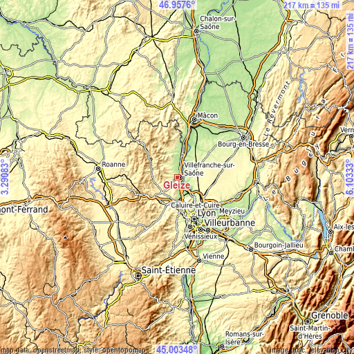
| Width | 6.79 km = 4.2 mi | 13.58 km = 8.4 mi | 217.3 km = 135 mi |
| Height | 6.79 km = 4.2 mi | 13.58 km = 8.4 mi | 217.3 km = 135 mi |
| ↑Max Latitude | 46.019685° | 46.050192° | 46.9576° |
| Latitude at center | 45.98916° | 45.98916° | 45.98916° |
| ↓Min Latitude | 45.958619° | 45.92806° | 45.00348° |
| ← Min Longitude | 4.653135° | 4.609189° | 3.29083° |
| Longitude center | 4.69708° | 4.69708° | 4.69708° |
| →Max Longitude | 4.741025° | 4.784971° | 6.10333° |
Nearby cities:
Cities around Gleizé sort by population:
• Villefranche-sur-Saône elevation 178 m
1.7 km,  88°
88°
• Jassans-Riottier 238 m
5 km,  99°
99°
• Anse 169 m
6.2 km,  163°
163°
• Limas 211 m
1.6 km, 156°
• Arnas 181 m
3.9 km,  12°
12°
• Frans 245 m
6.3 km, 86°
• Pommiers 315 m
3.8 km,  185°
185°
• Fareins 203 m
6 km,  56°
56°
• Liergues 246 m
3.3 km,  233°
233°
• Denicé 278 m
4.2 km,  289°
289°
• Blacé 299 m
6.2 km,  319°
319°
• Cogny 348 m
5.6 km,  268°
268°
Multilingual:
 En español:
Gleizé elevación 202 m.
 En France:
Gleizé élévation 202 m.


Sources and notes:
- [note 1] Map square and city borders are not equal. Map elevation data is calculated only from area inside that square.
- [src 1] Elevation data from geonames database provided with same terms of usage.
- [src 2] The elevation map of Gleizé is generated using elevation data from NASA's 3 arcsec (90m) resolution SRTM data.
- [src 3] Base (background) map © OpenStreetMap contributors tiles are generated by Geofabrik and OpenTopoMap.
Copyright & License:
This Gleizé Elevation Map is licensed under CC BY-SA. You may reuse any part from this page, if you give a proper credit by linking to this URL:
 More info on terms of use page.