Chilly-Mazarin elevation
Chilly-Mazarin (Île-de-France, Département de l'Essonne), France elevation is 83 meters and Chilly-Mazarin elevation in feet is 272 ft above sea level [src 1]. Chilly-Mazarin is a populated place (feature code) with elevation that is 91 meters (299 ft) smaller than average city elevation in France.
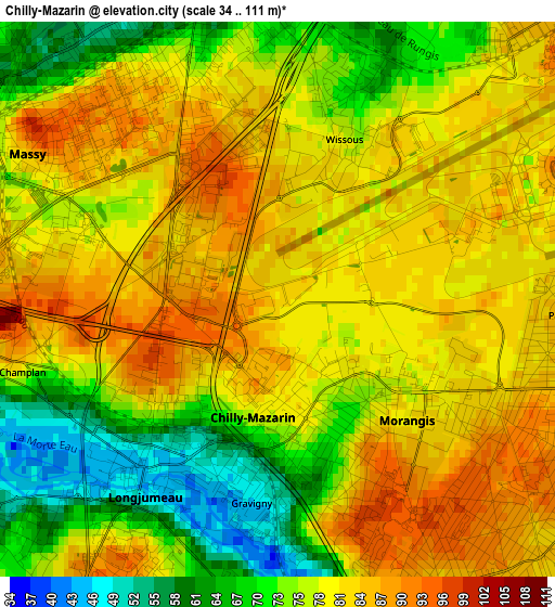
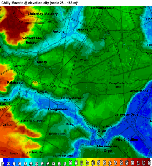
Below is the Elevation map of Chilly-Mazarin, which displays elevation range with different colors. Scale of the first map is from 34 to 111 m (112 to 364 ft) with average elevation of 78.3 meters (=257 ft) [note 1]
These maps also provides idea of topography and contour of this city, they are displayed at different zoom levels. More info about maps, scale and edge coordinates you can find below images.
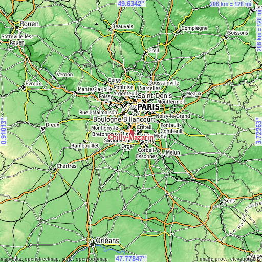
| \ | Map #1 | Map #2 | Topo.Map |
| Scale [m] | 34..111 m | 28..183 m | × |
| Scale [ft] | 112..364 ft | 92..600 ft | × |
| Average | 78.3 m = 257 ft | 83.3 m = 273 ft | × |
| Width | 6.45 km = 4 mi | 12.9 km = 8 mi | 206.3 km = 128.2 mi |
| Height | 6.45 km = 4 mi | 12.9 km = 8 mi | 206.3 km = 128.2 mi |
| ↑Max Latitude | 48.743877° | 48.772847° | 49.6342° |
| Latitude at center | 48.71489° | 48.71489° | 48.71489° |
| ↓Min Latitude | 48.685886° | 48.656866° | 47.77847° |
| ← Min Longitude | 2.272435° | 2.228489° | 0.91013° |
| Longitude center | 2.31638° | 2.31638° | 2.31638° |
| →Max Longitude | 2.360325° | 2.404271° | 3.72263° |
Nearby cities:
Cities around Chilly-Mazarin sort by population:
• Antony elevation 52 m
4.5 km,  341°
341°
• Massy 84 m
2.8 km,  298°
298°
• Fresnes 68 m
4.6 km,  5°
5°
• Longjumeau 45 m
2.3 km,  196°
196°
• Morangis 82 m
2.1 km,  126°
126°
• Épinay-sur-Orge 86 m
4.6 km,  185°
185°
• Paray-Vieille-Poste 86 m
3.4 km,  91°
91°
• Rungis 86 m
4.4 km,  37°
37°
• Saulx-les-Chartreux 72 m
4.5 km,  233°
233°
• Wissous 78 m
2.1 km, 13°
• Ballainvilliers 72 m
4.6 km, 194°
• Champlan 78 m
2.8 km,  254°
254°
Multilingual:
 En español:
Chilly-Mazarin elevación 83 m.
 En France:
Chilly-Mazarin élévation 83 m.
 Auf Deutsch:
Chilly-Mazarin höhe über dem Meeresspiegel ist 83 m.

Sources and notes:
- [note 1] Map square and city borders are not equal. Map elevation data is calculated only from area inside that square.
- [src 1] Elevation data from geonames database provided with same terms of usage.
- [src 2] The elevation map of Chilly-Mazarin is generated using elevation data from NASA's 3 arcsec (90m) resolution SRTM data.
- [src 3] Base (background) map © OpenStreetMap contributors tiles are generated by Geofabrik and OpenTopoMap.
Copyright & License:
This Chilly-Mazarin Elevation Map is licensed under CC BY-SA. You may reuse any part from this page, if you give a proper credit by linking to this URL:
 More info on terms of use page.