Choisy-au-Bac elevation
Choisy-au-Bac (Hauts-de-France, Département de l'Oise), France elevation is 38 meters and Choisy-au-Bac elevation in feet is 125 ft above sea level [src 1]. Choisy-au-Bac is a populated place (feature code) with elevation that is 136 meters (446 ft) smaller than average city elevation in France.
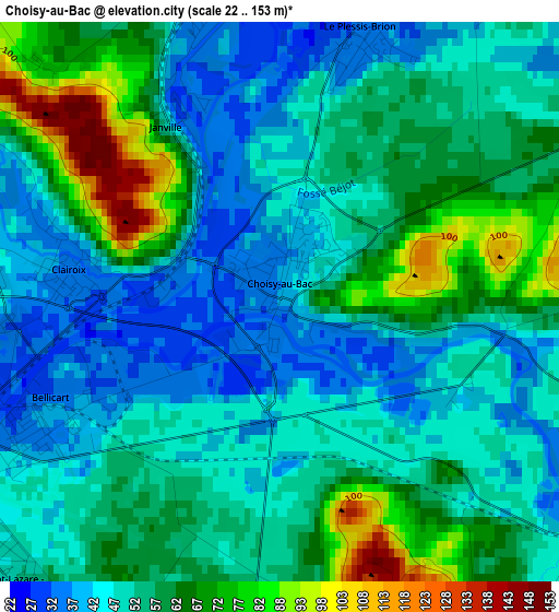
Below is the Elevation map of Choisy-au-Bac, which displays elevation range with different colors. Scale of the first map is from 22 to 153 m (72 to 502 ft) with average elevation of 55.2 meters (=181 ft) [note 1]
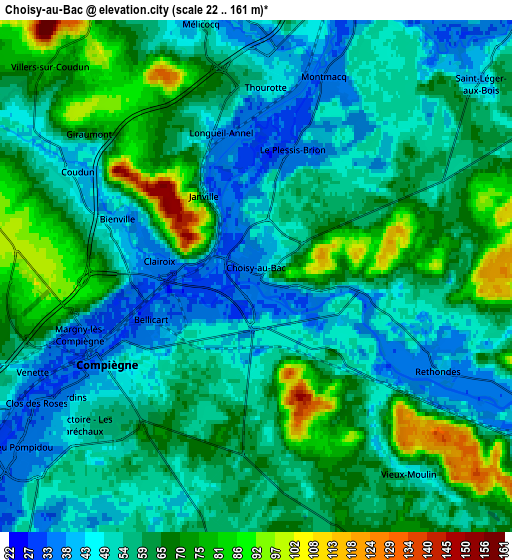
These maps also provides idea of topography and contour of this city, they are displayed at different zoom levels. More info about maps, scale and edge coordinates you can find below images.
| \ | Map #1 | Map #2 | Topo.Map |
| Scale [m] | 22..153 m | 22..161 m | × |
| Scale [ft] | 72..502 ft | 72..528 ft | × |
| Average | 55.2 m = 181 ft | 59 m = 194 ft | × |
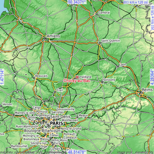
| Width | 6.35 km = 3.9 mi | 12.71 km = 7.9 mi | 203.4 km = 126.4 mi |
| Height | 6.35 km = 3.9 mi | 12.71 km = 7.9 mi | 203.3 km = 126.3 mi |
| ↑Max Latitude | 49.466338° | 49.49489° | 50.34371° |
| Latitude at center | 49.43777° | 49.43777° | 49.43777° |
| ↓Min Latitude | 49.409185° | 49.380584° | 48.51478° |
| ← Min Longitude | 2.833445° | 2.789499° | 1.47114° |
| Longitude center | 2.87739° | 2.87739° | 2.87739° |
| →Max Longitude | 2.921335° | 2.965281° | 4.28364° |
Nearby cities:
Cities around Choisy-au-Bac sort by population:
• Compiègne elevation 42 m
4.3 km,  239°
239°
• Margny-lès-Compiègne 33 m
4.5 km,  252°
252°
• Thourotte 35 m
4.3 km,  4°
4°
• Venette 32 m
5.8 km, 246°
• Longueil-Annel 34 m
3.6 km,  345°
345°
• Clairoix 37 m
2.3 km,  283°
283°
• Cambronne-lès-Ribécourt 68 m
7.9 km,  10°
10°
• Trosly-Breuil 43 m
7.7 km,  123°
123°
• Le Plessis-Brion 35 m
3.1 km,  18°
18°
• Villers-sur-Coudun 77 m
7.3 km,  313°
313°
• Montmacq 35 m
5.2 km, 20°
• Coudun 43 m
5.4 km,  299°
299°
Multilingual:
 En español:
Choisy-au-Bac elevación 38 m.
 En France:
Choisy-au-Bac élévation 38 m.
 Auf Deutsch:
Choisy-au-Bac höhe über dem Meeresspiegel ist 38 m.

Sources and notes:
- [note 1] Map square and city borders are not equal. Map elevation data is calculated only from area inside that square.
- [src 1] Elevation data from geonames database provided with same terms of usage.
- [src 2] The elevation map of Choisy-au-Bac is generated using elevation data from NASA's 3 arcsec (90m) resolution SRTM data.
- [src 3] Base (background) map © OpenStreetMap contributors tiles are generated by Geofabrik and OpenTopoMap.
Copyright & License:
This Choisy-au-Bac Elevation Map is licensed under CC BY-SA. You may reuse any part from this page, if you give a proper credit by linking to this URL:
 More info on terms of use page.