Condé-sur-Noireau elevation
Condé-sur-Noireau (Normandy, Calvados), France elevation is 83 meters and Condé-sur-Noireau elevation in feet is 272 ft above sea level [src 1]. Condé-sur-Noireau is a populated place (feature code) with elevation that is 91 meters (299 ft) smaller than average city elevation in France.
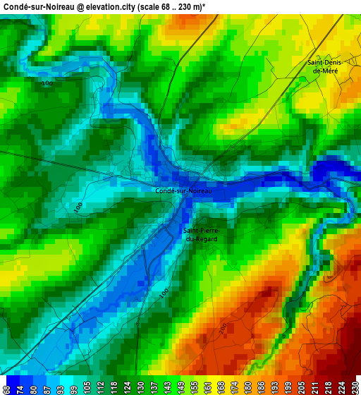
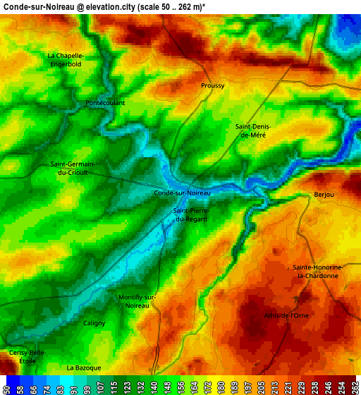
Below is the Elevation map of Condé-sur-Noireau, which displays elevation range with different colors. Scale of the first map is from 68 to 230 m (223 to 755 ft) with average elevation of 134.2 meters (=440 ft) [note 1]
These maps also provides idea of topography and contour of this city, they are displayed at different zoom levels. More info about maps, scale and edge coordinates you can find below images.
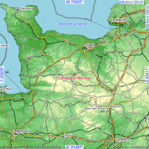
| \ | Map #1 | Map #2 | Topo.Map |
| Scale [m] | 68..230 m | 50..262 m | × |
| Scale [ft] | 223..755 ft | 164..860 ft | × |
| Average | 134.2 m = 440 ft | 165 m = 541 ft | × |
| Width | 6.43 km = 4 mi | 12.86 km = 8 mi | 205.8 km = 127.9 mi |
| Height | 6.43 km = 4 mi | 12.86 km = 8 mi | 205.8 km = 127.9 mi |
| ↑Max Latitude | 48.87772° | 48.906613° | 49.76565° |
| Latitude at center | 48.84881° | 48.84881° | 48.84881° |
| ↓Min Latitude | 48.819884° | 48.79094° | 47.91487° |
| ← Min Longitude | -0.596085° | -0.640031° | -1.95839° |
| Longitude center | -0.55214° | -0.55214° | -0.55214° |
| →Max Longitude | -0.508195° | -0.464249° | 0.85411° |
Nearby cities:
Cities around Condé-sur-Noireau sort by population:
• Flers elevation 206 m
12.5 km,  187°
187°
• Saint-Georges-des-Groseillers 222 m
8.8 km, 187°
• Athis-de-l'Orne 226 m
5.2 km,  133°
133°
• Le Theil-Bocage 218 m
12.6 km,  287°
287°
• Messei 216 m
15.3 km,  175°
175°
• La Lande-Patry 207 m
10.2 km,  199°
199°
• Vassy 150 m
9 km,  273°
273°
• La Selle-la-Forge 214 m
12.9 km, 176°
• Clécy 67 m
9.2 km,  34°
34°
• Saint-Pierre-du-Regard 126 m
0.8 km,  147°
147°
• Saint-Rémy 40 m
10.8 km,  19°
19°
• Pont-d'Ouilly 124 m
11.4 km,  74°
74°
Multilingual:
 En español:
Condé-sur-Noireau elevación 83 m.
 En France:
Condé-sur-Noireau élévation 83 m.
 Auf Deutsch:
Condé-sur-Noireau höhe über dem Meeresspiegel ist 83 m.

Sources and notes:
- [note 1] Map square and city borders are not equal. Map elevation data is calculated only from area inside that square.
- [src 1] Elevation data from geonames database provided with same terms of usage.
- [src 2] The elevation map of Condé-sur-Noireau is generated using elevation data from NASA's 3 arcsec (90m) resolution SRTM data.
- [src 3] Base (background) map © OpenStreetMap contributors tiles are generated by Geofabrik and OpenTopoMap.
Copyright & License:
This Condé-sur-Noireau Elevation Map is licensed under CC BY-SA. You may reuse any part from this page, if you give a proper credit by linking to this URL:
 More info on terms of use page.