Cotignac elevation
Cotignac (Provence-Alpes-Côte d'Azur, Var), France elevation is 239 meters and Cotignac elevation in feet is 784 ft above sea level [src 1]. Cotignac is a populated place (feature code) with elevation that is 65 meters (213 ft) bigger than average city elevation in France.
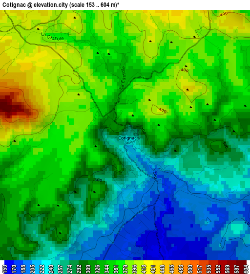
Below is the Elevation map of Cotignac, which displays elevation range with different colors. Scale of the first map is from 153 to 604 m (502 to 1982 ft) with average elevation of 322.6 meters (=1058 ft) [note 1]
These maps also provides idea of topography and contour of this city, they are displayed at different zoom levels. More info about maps, scale and edge coordinates you can find below images.
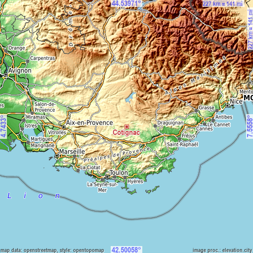
| \ | Map #1 | Topo.Map |
| Scale [m] | 153..604 m | × |
| Scale [ft] | 502..1982 ft | × |
| Average | 322.6 m = 1058 ft | × |
| Width | 7.09 km = 4.4 mi | 226.7 km = 140.9 mi |
| Height | 7.09 km = 4.4 mi | 226.7 km = 140.9 mi |
| ↑Max Latitude | 43.560613° | 44.53971° |
| Latitude at center | 43.52876° | 43.52876° |
| ↓Min Latitude | 43.49689° | 42.50058° |
| ← Min Longitude | 6.105605° | 4.7433° |
| Longitude center | 6.14955° | 6.14955° |
| →Max Longitude | 6.193495° | 7.5558° |
Nearby cities:
Cities around Cotignac sort by population:
• Brignoles elevation 229 m
15.4 km,  207°
207°
• Le Val 243 m
11.7 km, 211°
• Salernes 226 m
7.8 km,  60°
60°
• Carcès 152 m
6.5 km,  155°
155°
• Barjols 265 m
11.9 km,  285°
285°
• Aups 514 m
12.6 km,  28°
28°
• Bras 297 m
16.9 km,  247°
247°
• Le Thoronet 132 m
15.1 km,  124°
124°
• Camps-la-Source 293 m
16.4 km,  195°
195°
• Cabasse 199 m
12.7 km,  153°
153°
• Régusse 520 m
14.2 km,  354°
354°
• Villecroze 337 m
11.8 km, 59°
Multilingual:
 En español:
Cotignac elevación 239 m.
 En France:
Cotignac élévation 239 m.
 Auf Deutsch:
Cotignac höhe über dem Meeresspiegel ist 239 m.

Sources and notes:
- [note 1] Map square and city borders are not equal. Map elevation data is calculated only from area inside that square.
- [src 1] Elevation data from geonames database provided with same terms of usage.
- [src 2] The elevation map of Cotignac is generated using elevation data from NASA's 3 arcsec (90m) resolution SRTM data.
- [src 3] Base (background) map © OpenStreetMap contributors tiles are generated by Geofabrik and OpenTopoMap.
Copyright & License:
This Cotignac Elevation Map is licensed under CC BY-SA. You may reuse any part from this page, if you give a proper credit by linking to this URL:
 More info on terms of use page.