Coudoux elevation
Coudoux (Provence-Alpes-Côte d'Azur, Département des Bouches-du-Rhône), France elevation is 106 meters and Coudoux elevation in feet is 348 ft above sea level [src 1]. Coudoux is a populated place (feature code) with elevation that is 68 meters (223 ft) smaller than average city elevation in France.
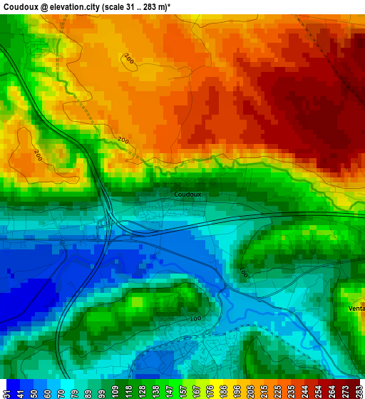
Below is the Elevation map of Coudoux, which displays elevation range with different colors. Scale of the first map is from 31 to 283 m (102 to 928 ft) with average elevation of 147.3 meters (=483 ft) [note 1]
These maps also provides idea of topography and contour of this city, they are displayed at different zoom levels. More info about maps, scale and edge coordinates you can find below images.
| \ | Map #1 | Topo.Map |
| Scale [m] | 31..283 m | × |
| Scale [ft] | 102..928 ft | × |
| Average | 147.3 m = 483 ft | × |
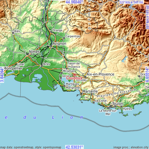
| Width | 7.08 km = 4.4 mi | 226.6 km = 140.8 mi |
| Height | 7.08 km = 4.4 mi | 226.6 km = 140.8 mi |
| ↑Max Latitude | 43.589838° | 44.56846° |
| Latitude at center | 43.558° | 43.558° |
| ↓Min Latitude | 43.526145° | 42.53031° |
| ← Min Longitude | 5.204945° | 3.84264° |
| Longitude center | 5.24889° | 5.24889° |
| →Max Longitude | 5.292835° | 6.65514° |
Nearby cities:
Cities around Coudoux sort by population:
• Vitrolles elevation 136 m
10.9 km,  180°
180°
• Berre-l'Étang 3 m
10.9 km,  215°
215°
• Rognac 37 m
7.9 km,  188°
188°
• Pélissanne 85 m
11.4 km,  316°
316°
• Lambesc 211 m
10.7 km,  5°
5°
• Velaux 81 m
3.4 km,  169°
169°
• Éguilles 271 m
8.7 km,  82°
82°
• Lançon-Provence 95 m
10.5 km,  291°
291°
• La Fare-les-Oliviers 57 m
4.5 km,  260°
260°
• Saint-Cannat 220 m
8.1 km,  29°
29°
• Ventabren 201 m
4.3 km,  120°
120°
• Rognes 316 m
14.2 km, 33°
Multilingual:
 En español:
Coudoux elevación 106 m.
 En France:
Coudoux élévation 106 m.


Sources and notes:
- [note 1] Map square and city borders are not equal. Map elevation data is calculated only from area inside that square.
- [src 1] Elevation data from geonames database provided with same terms of usage.
- [src 2] The elevation map of Coudoux is generated using elevation data from NASA's 3 arcsec (90m) resolution SRTM data.
- [src 3] Base (background) map © OpenStreetMap contributors tiles are generated by Geofabrik and OpenTopoMap.
Copyright & License:
This Coudoux Elevation Map is licensed under CC BY-SA. You may reuse any part from this page, if you give a proper credit by linking to this URL:
 More info on terms of use page.