Cours-la-Ville elevation
Cours-la-Ville (Auvergne-Rhône-Alpes, Département du Rhône), France elevation is 505 meters and Cours-la-Ville elevation in feet is 1657 ft above sea level [src 1]. Cours-la-Ville is a populated place (feature code) with elevation that is 331 meters (1086 ft) bigger than average city elevation in France.
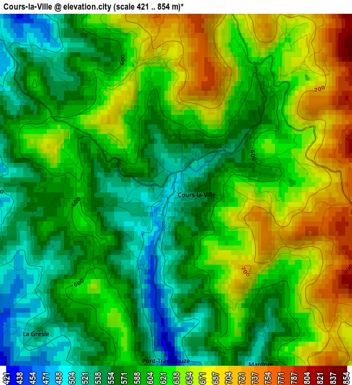
Below is the Elevation map of Cours-la-Ville, which displays elevation range with different colors. Scale of the first map is from 421 to 854 m (1381 to 2802 ft) with average elevation of 607.3 meters (=1992 ft) [note 1]
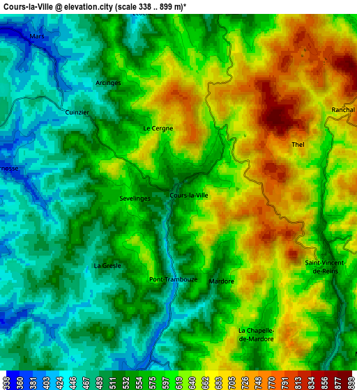
These maps also provides idea of topography and contour of this city, they are displayed at different zoom levels. More info about maps, scale and edge coordinates you can find below images.
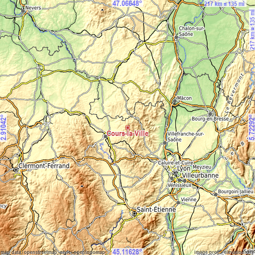
| \ | Map #1 | Map #2 | Topo.Map |
| Scale [m] | 421..854 m | 338..899 m | × |
| Scale [ft] | 1381..2802 ft | 1109..2949 ft | × |
| Average | 607.3 m = 1992 ft | 575.5 m = 1888 ft | × |
| Width | 6.78 km = 4.2 mi | 13.55 km = 8.4 mi | 216.8 km = 134.7 mi |
| Height | 6.78 km = 4.2 mi | 13.55 km = 8.4 mi | 216.8 km = 134.7 mi |
| ↑Max Latitude | 46.130463° | 46.16091° | 47.06648° |
| Latitude at center | 46.1° | 46.1° | 46.1° |
| ↓Min Latitude | 46.06952° | 46.039023° | 45.11628° |
| ← Min Longitude | 4.272725° | 4.228779° | 2.91042° |
| Longitude center | 4.31667° | 4.31667° | 4.31667° |
| →Max Longitude | 4.360615° | 4.404561° | 5.72292° |
Nearby cities:
Cities around Cours-la-Ville sort by population:
• Amplepuis elevation 462 m
14.2 km,  175°
175°
• Chauffailles 405 m
12.1 km,  8°
8°
• Charlieu 273 m
13.1 km,  301°
301°
• Bourg-de-Thizy 402 m
7.5 km,  190°
190°
• Thizy-les-Bourgs 503 m
7.8 km, 182°
• Belmont-de-la-Loire 527 m
7.7 km,  17°
17°
• Chandon 343 m
9.6 km, 304°
• Saint-Denis-de-Cabanne 349 m
11.3 km,  315°
315°
• Coutouvre 427 m
9.1 km,  250°
250°
• Cublize 500 m
10.2 km,  152°
152°
• Grandris 400 m
14.1 km,  119°
119°
• Lamure-sur-Azergues 479 m
14.1 km,  107°
107°
Multilingual:
 En español:
Cours-la-Ville elevación 505 m.
 En France:
Cours-la-Ville élévation 505 m.
 Auf Deutsch:
Cours-la-Ville höhe über dem Meeresspiegel ist 505 m.

Sources and notes:
- [note 1] Map square and city borders are not equal. Map elevation data is calculated only from area inside that square.
- [src 1] Elevation data from geonames database provided with same terms of usage.
- [src 2] The elevation map of Cours-la-Ville is generated using elevation data from NASA's 3 arcsec (90m) resolution SRTM data.
- [src 3] Base (background) map © OpenStreetMap contributors tiles are generated by Geofabrik and OpenTopoMap.
Copyright & License:
This Cours-la-Ville Elevation Map is licensed under CC BY-SA. You may reuse any part from this page, if you give a proper credit by linking to this URL:
 More info on terms of use page.