Cugand elevation
Cugand (Pays de la Loire, Département de la Vendée), France elevation is 42 meters and Cugand elevation in feet is 138 ft above sea level [src 1]. Cugand is a populated place (feature code) with elevation that is 132 meters (433 ft) smaller than average city elevation in France.
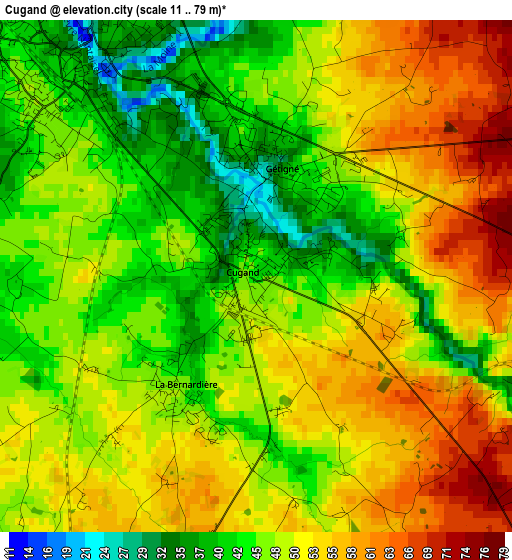
Below is the Elevation map of Cugand, which displays elevation range with different colors. Scale of the first map is from 11 to 79 m (36 to 259 ft) with average elevation of 49 meters (=161 ft) [note 1]
These maps also provides idea of topography and contour of this city, they are displayed at different zoom levels. More info about maps, scale and edge coordinates you can find below images.
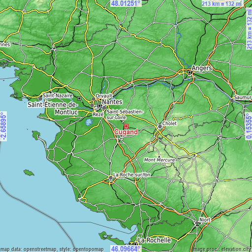
| \ | Map #1 | Topo.Map |
| Scale [m] | 11..79 m | × |
| Scale [ft] | 36..259 ft | × |
| Average | 49 m = 161 ft | × |
| Width | 6.66 km = 4.1 mi | 213 km = 132.4 mi |
| Height | 6.66 km = 4.1 mi | 213 km = 132.4 mi |
| ↑Max Latitude | 47.093107° | 48.01251° |
| Latitude at center | 47.06318° | 47.06318° |
| ↓Min Latitude | 47.033236° | 46.09664° |
| ← Min Longitude | -1.296645° | -2.65895° |
| Longitude center | -1.2527° | -1.2527° |
| →Max Longitude | -1.208755° | 0.15355° |
Nearby cities:
Cities around Cugand sort by population:
• Clisson elevation 38 m
3.5 km,  319°
319°
• Saint-Hilaire-de-Loulay 39 m
9 km,  220°
220°
• Gétigné 30 m
1.5 km,  13°
13°
• La Bruffière 67 m
6.8 km,  141°
141°
• Gorges 31 m
5.4 km, 318°
• Treize-Septiers 66 m
8.8 km,  168°
168°
• Boussay 80 m
5.5 km,  111°
111°
• Mouzillon 28 m
8.9 km,  345°
345°
• Saint-Hilaire-de-Clisson 39 m
4.2 km,  268°
268°
• Saint-Crespin-sur-Moine 75 m
6.4 km,  50°
50°
• Saint-Lumine-de-Clisson 29 m
6.7 km,  290°
290°
• La Bernardière 46 m
1.8 km,  213°
213°
Multilingual:
 En español:
Cugand elevación 42 m.
 En France:
Cugand élévation 42 m.


Sources and notes:
- [note 1] Map square and city borders are not equal. Map elevation data is calculated only from area inside that square.
- [src 1] Elevation data from geonames database provided with same terms of usage.
- [src 2] The elevation map of Cugand is generated using elevation data from NASA's 3 arcsec (90m) resolution SRTM data.
- [src 3] Base (background) map © OpenStreetMap contributors tiles are generated by Geofabrik and OpenTopoMap.
Copyright & License:
This Cugand Elevation Map is licensed under CC BY-SA. You may reuse any part from this page, if you give a proper credit by linking to this URL:
 More info on terms of use page.