Saint-Hilaire-de-Loulay elevation
Saint-Hilaire-de-Loulay (Pays de la Loire, Département de la Vendée), France elevation is 39 meters and Saint-Hilaire-de-Loulay elevation in feet is 128 ft above sea level [src 1]. Saint-Hilaire-de-Loulay is a populated place (feature code) with elevation that is 135 meters (443 ft) smaller than average city elevation in France.
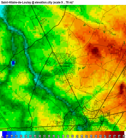
Below is the Elevation map of Saint-Hilaire-de-Loulay, which displays elevation range with different colors. Scale of the first map is from 9 to 78 m (30 to 256 ft) with average elevation of 46.7 meters (=153 ft) [note 1]
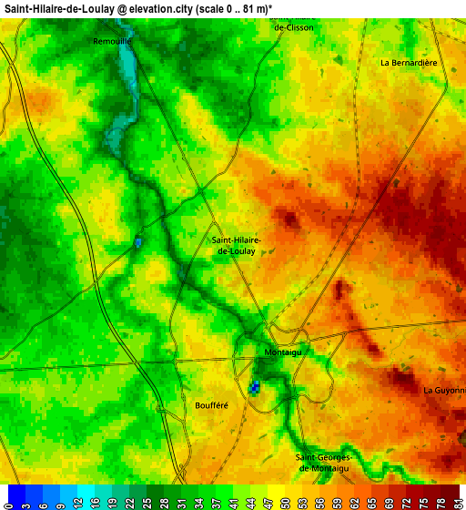
These maps also provides idea of topography and contour of this city, they are displayed at different zoom levels. More info about maps, scale and edge coordinates you can find below images.
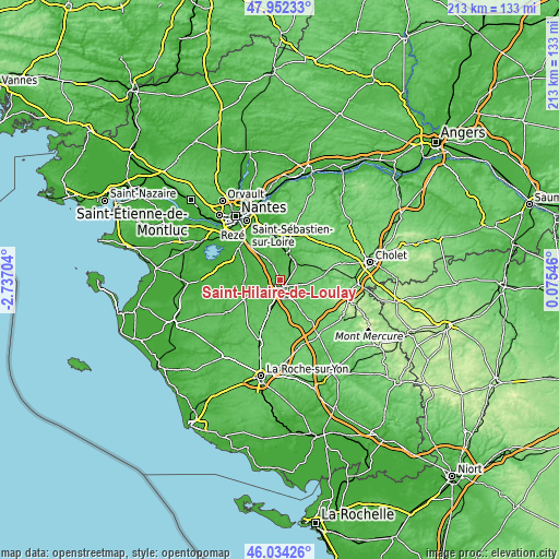
| \ | Map #1 | Map #2 | Topo.Map |
| Scale [m] | 9..78 m | 0..81 m | × |
| Scale [ft] | 30..256 ft | 0..266 ft | × |
| Average | 46.7 m = 153 ft | 46.9 m = 154 ft | × |
| Width | 6.66 km = 4.1 mi | 13.33 km = 8.3 mi | 213.3 km = 132.5 mi |
| Height | 6.66 km = 4.1 mi | 13.33 km = 8.3 mi | 213.3 km = 132.5 mi |
| ↑Max Latitude | 47.031861° | 47.061806° | 47.95233° |
| Latitude at center | 47.0019° | 47.0019° | 47.0019° |
| ↓Min Latitude | 46.971922° | 46.941927° | 46.03426° |
| ← Min Longitude | -1.374735° | -1.418681° | -2.73704° |
| Longitude center | -1.33079° | -1.33079° | -1.33079° |
| →Max Longitude | -1.286845° | -1.242899° | 0.07546° |
Nearby cities:
Cities around Saint-Hilaire-de-Loulay sort by population:
• Montaigu elevation 47 m
3.3 km,  148°
148°
• Saint-Georges-de-Montaigu 54 m
6.8 km, 154°
• Vieillevigne 41 m
8.5 km,  247°
247°
• Cugand 42 m
9 km,  40°
40°
• La Guyonnière 68 m
7.4 km,  124°
124°
• Treize-Septiers 66 m
7.9 km,  103°
103°
• La Planche 27 m
7.8 km,  281°
281°
• Boufféré 50 m
4.5 km,  188°
188°
• Saint-Hilaire-de-Clisson 39 m
6.9 km,  14°
14°
• Remouillé 36 m
6.9 km,  329°
329°
• Saint-Lumine-de-Clisson 29 m
9.1 km,  357°
357°
• La Bernardière 46 m
7.2 km, 42°
Multilingual:
 En español:
Saint-Hilaire-de-Loulay elevación 39 m.
 En France:
Saint-Hilaire-de-Loulay élévation 39 m.
 Auf Deutsch:
Saint-Hilaire-de-Loulay höhe über dem Meeresspiegel ist 39 m.
 На русском:
Saint-Hilaire-de-Loulay высота над уровнем моря 39 м
Sources and notes:
- [note 1] Map square and city borders are not equal. Map elevation data is calculated only from area inside that square.
- [src 1] Elevation data from geonames database provided with same terms of usage.
- [src 2] The elevation map of Saint-Hilaire-de-Loulay is generated using elevation data from NASA's 3 arcsec (90m) resolution SRTM data.
- [src 3] Base (background) map © OpenStreetMap contributors tiles are generated by Geofabrik and OpenTopoMap.
Copyright & License:
This Saint-Hilaire-de-Loulay Elevation Map is licensed under CC BY-SA. You may reuse any part from this page, if you give a proper credit by linking to this URL:
 More info on terms of use page.