Dieulouard elevation
Dieulouard (Grand Est, Meurthe-et-Moselle), France elevation is 191 meters and Dieulouard elevation in feet is 627 ft above sea level [src 1]. Dieulouard is a populated place (feature code) with elevation that is 17 meters (56 ft) bigger than average city elevation in France.
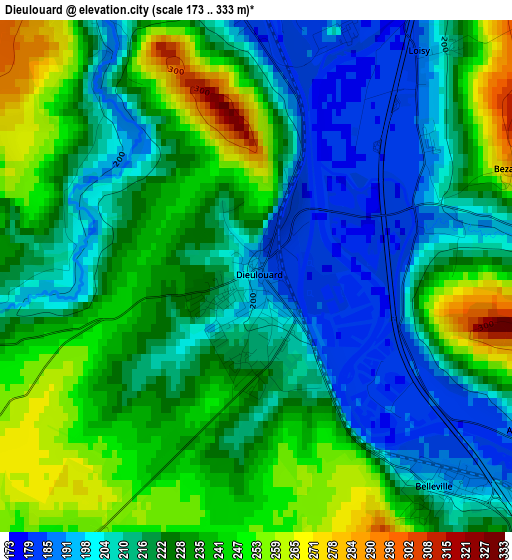
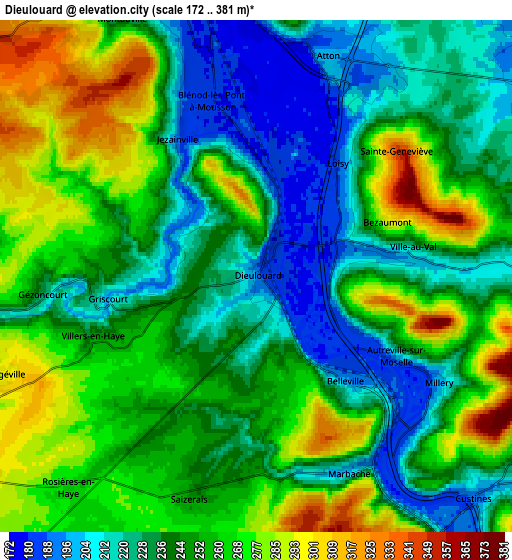
Below is the Elevation map of Dieulouard, which displays elevation range with different colors. Scale of the first map is from 173 to 333 m (568 to 1093 ft) with average elevation of 224 meters (=735 ft) [note 1]
These maps also provides idea of topography and contour of this city, they are displayed at different zoom levels. More info about maps, scale and edge coordinates you can find below images.
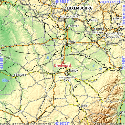
| \ | Map #1 | Map #2 | Topo.Map |
| Scale [m] | 173..333 m | 172..381 m | × |
| Scale [ft] | 568..1093 ft | 564..1250 ft | × |
| Average | 224 m = 735 ft | 248.1 m = 814 ft | × |
| Width | 6.43 km = 4 mi | 12.86 km = 8 mi | 205.8 km = 127.9 mi |
| Height | 6.43 km = 4 mi | 12.86 km = 8 mi | 205.8 km = 127.9 mi |
| ↑Max Latitude | 48.870284° | 48.899181° | 49.75835° |
| Latitude at center | 48.84137° | 48.84137° | 48.84137° |
| ↓Min Latitude | 48.812439° | 48.783492° | 47.90729° |
| ← Min Longitude | 6.023875° | 5.979929° | 4.66157° |
| Longitude center | 6.06782° | 6.06782° | 6.06782° |
| →Max Longitude | 6.111765° | 6.155711° | 7.47407° |
Nearby cities:
Cities around Dieulouard sort by population:
• Pont-à-Mousson elevation 183 m
7.3 km,  353°
353°
• Frouard 206 m
10.1 km,  153°
153°
• Liverdun 205 m
10.2 km,  181°
181°
• Pompey 190 m
9.1 km, 152°
• Blénod-lès-Pont-à-Mousson 184 m
5 km,  343°
343°
• Custines 271 m
7.9 km,  134°
134°
• Marbache 187 m
5.5 km, 149°
• Maidières 189 m
6.8 km, 342°
• Belleville 186 m
3.6 km,  135°
135°
• Faulx 258 m
10.8 km,  120°
120°
• Saizerais 250 m
5.7 km,  197°
197°
• Montauville 228 m
7.4 km,  334°
334°
Multilingual:
 En español:
Dieulouard elevación 191 m.
 En France:
Dieulouard élévation 191 m.
 Auf Deutsch:
Dieulouard höhe über dem Meeresspiegel ist 191 m.

Sources and notes:
- [note 1] Map square and city borders are not equal. Map elevation data is calculated only from area inside that square.
- [src 1] Elevation data from geonames database provided with same terms of usage.
- [src 2] The elevation map of Dieulouard is generated using elevation data from NASA's 3 arcsec (90m) resolution SRTM data.
- [src 3] Base (background) map © OpenStreetMap contributors tiles are generated by Geofabrik and OpenTopoMap.
Copyright & License:
This Dieulouard Elevation Map is licensed under CC BY-SA. You may reuse any part from this page, if you give a proper credit by linking to this URL:
 More info on terms of use page.