Frouard elevation
Frouard (Grand Est, Meurthe-et-Moselle), France elevation is 206 meters and Frouard elevation in feet is 676 ft above sea level [src 1]. Frouard is a populated place (feature code) with elevation that is 32 meters (105 ft) bigger than average city elevation in France.
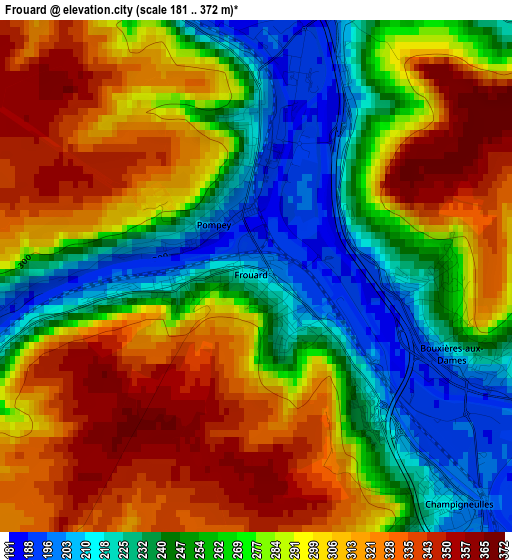
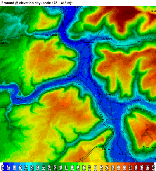
Below is the Elevation map of Frouard, which displays elevation range with different colors. Scale of the first map is from 181 to 372 m (594 to 1220 ft) with average elevation of 279.9 meters (=918 ft) [note 1]
These maps also provides idea of topography and contour of this city, they are displayed at different zoom levels. More info about maps, scale and edge coordinates you can find below images.
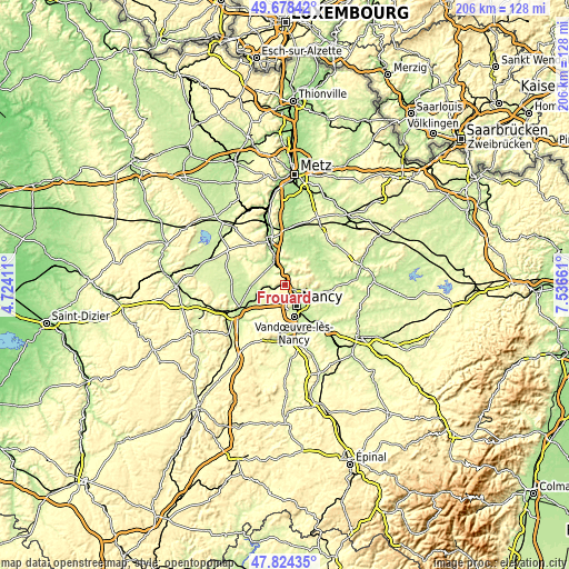
| \ | Map #1 | Map #2 | Topo.Map |
| Scale [m] | 181..372 m | 178..413 m | × |
| Scale [ft] | 594..1220 ft | 584..1355 ft | × |
| Average | 279.9 m = 918 ft | 280.9 m = 922 ft | × |
| Width | 6.44 km = 4 mi | 12.88 km = 8 mi | 206.2 km = 128.1 mi |
| Height | 6.44 km = 4 mi | 12.88 km = 8 mi | 206.1 km = 128.1 mi |
| ↑Max Latitude | 48.788901° | 48.817845° | 49.67842° |
| Latitude at center | 48.75994° | 48.75994° | 48.75994° |
| ↓Min Latitude | 48.730962° | 48.701968° | 47.82435° |
| ← Min Longitude | 6.086415° | 6.042469° | 4.72411° |
| Longitude center | 6.13036° | 6.13036° | 6.13036° |
| →Max Longitude | 6.174305° | 6.218251° | 7.53661° |
Nearby cities:
Cities around Frouard sort by population:
• Maxéville elevation 198 m
5.8 km,  152°
152°
• Malzéville 272 m
6.6 km,  143°
143°
• Champigneulles 193 m
3.7 km, 141°
• Liverdun 205 m
5 km,  256°
256°
• Pompey 190 m
1 km,  343°
343°
• Bouxières-aux-Dames 263 m
2.5 km,  104°
104°
• Custines 271 m
3.6 km,  16°
16°
• Lay-Saint-Christophe 202 m
5.1 km, 103°
• Marbache 187 m
4.7 km, 337°
• Belleville 186 m
6.8 km, 342°
• Faulx 258 m
6 km,  52°
52°
• Eulmont 246 m
7.2 km, 98°
Multilingual:
 En español:
Frouard elevación 206 m.
 En France:
Frouard élévation 206 m.


Sources and notes:
- [note 1] Map square and city borders are not equal. Map elevation data is calculated only from area inside that square.
- [src 1] Elevation data from geonames database provided with same terms of usage.
- [src 2] The elevation map of Frouard is generated using elevation data from NASA's 3 arcsec (90m) resolution SRTM data.
- [src 3] Base (background) map © OpenStreetMap contributors tiles are generated by Geofabrik and OpenTopoMap.
Copyright & License:
This Frouard Elevation Map is licensed under CC BY-SA. You may reuse any part from this page, if you give a proper credit by linking to this URL:
 More info on terms of use page.