Dompierre-sur-Besbre elevation
Dompierre-sur-Besbre (Auvergne-Rhône-Alpes, Département de l'Allier), France elevation is 220 meters and Dompierre-sur-Besbre elevation in feet is 722 ft above sea level [src 1]. Dompierre-sur-Besbre is a populated place (feature code) with elevation that is 46 meters (151 ft) bigger than average city elevation in France.
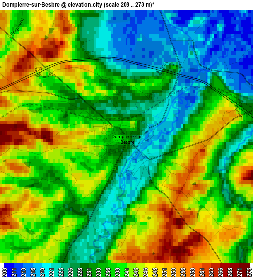
Below is the Elevation map of Dompierre-sur-Besbre, which displays elevation range with different colors. Scale of the first map is from 208 to 273 m (682 to 896 ft) with average elevation of 236.1 meters (=775 ft) [note 1]
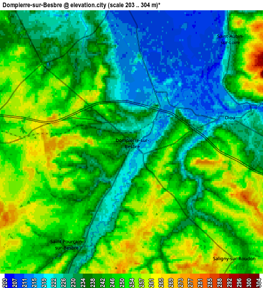
These maps also provides idea of topography and contour of this city, they are displayed at different zoom levels. More info about maps, scale and edge coordinates you can find below images.
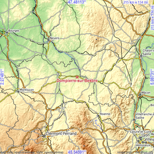
| \ | Map #1 | Map #2 | Topo.Map |
| Scale [m] | 208..273 m | 203..304 m | × |
| Scale [ft] | 682..896 ft | 666..997 ft | × |
| Average | 236.1 m = 775 ft | 241 m = 791 ft | × |
| Width | 6.72 km = 4.2 mi | 13.45 km = 8.4 mi | 215.2 km = 133.7 mi |
| Height | 6.72 km = 4.2 mi | 13.45 km = 8.4 mi | 215.2 km = 133.7 mi |
| ↑Max Latitude | 46.552369° | 46.582582° | 47.48113° |
| Latitude at center | 46.52214° | 46.52214° | 46.52214° |
| ↓Min Latitude | 46.491894° | 46.461631° | 45.54591° |
| ← Min Longitude | 3.637115° | 3.593169° | 2.27481° |
| Longitude center | 3.68106° | 3.68106° | 3.68106° |
| →Max Longitude | 3.725005° | 3.768951° | 5.08731° |
Nearby cities:
Cities around Dompierre-sur-Besbre sort by population:
• Saint-François elevation 290 m
20.9 km,  124°
124°
• Digoin 236 m
23.3 km,  101°
101°
• Bourbon-Lancy 254 m
13 km,  31°
31°
• Diou 214 m
5 km,  74°
74°
• Beaulon 213 m
8.9 km,  356°
356°
• Lusigny 245 m
16.2 km,  296°
296°
• Neuilly-le-Réal 247 m
20.1 km,  251°
251°
• La Motte-Saint-Jean 299 m
21.8 km, 97°
• Le Donjon 302 m
20.9 km,  155°
155°
• Molinet 240 m
20.5 km,  107°
107°
• Toulon-sur-Allier 233 m
24.6 km,  269°
269°
• Lucenay-lès-Aix 214 m
25.1 km,  323°
323°
Multilingual:
 En español:
Dompierre-sur-Besbre elevación 220 m.
 En France:
Dompierre-sur-Besbre élévation 220 m.
 Auf Deutsch:
Dompierre-sur-Besbre höhe über dem Meeresspiegel ist 220 m.
 На русском:
Dompierre-sur-Besbre высота над уровнем моря 220 м
Sources and notes:
- [note 1] Map square and city borders are not equal. Map elevation data is calculated only from area inside that square.
- [src 1] Elevation data from geonames database provided with same terms of usage.
- [src 2] The elevation map of Dompierre-sur-Besbre is generated using elevation data from NASA's 3 arcsec (90m) resolution SRTM data.
- [src 3] Base (background) map © OpenStreetMap contributors tiles are generated by Geofabrik and OpenTopoMap.
Copyright & License:
This Dompierre-sur-Besbre Elevation Map is licensed under CC BY-SA. You may reuse any part from this page, if you give a proper credit by linking to this URL:
 More info on terms of use page.