Douchy elevation
Douchy (Centre, Loiret), France elevation is 127 meters and Douchy elevation in feet is 417 ft above sea level [src 1]. Douchy is a populated place (feature code) with elevation that is 47 meters (154 ft) smaller than average city elevation in France.
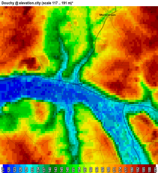
Below is the Elevation map of Douchy, which displays elevation range with different colors. Scale of the first map is from 117 to 191 m (384 to 627 ft) with average elevation of 157.2 meters (=516 ft) [note 1]
These maps also provides idea of topography and contour of this city, they are displayed at different zoom levels. More info about maps, scale and edge coordinates you can find below images.
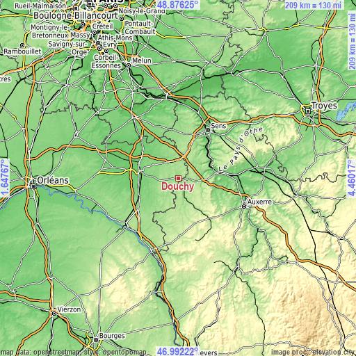
| \ | Map #1 | Topo.Map |
| Scale [m] | 117..191 m | × |
| Scale [ft] | 384..627 ft | × |
| Average | 157.2 m = 516 ft | × |
| Width | 6.55 km = 4.1 mi | 209.5 km = 130.2 mi |
| Height | 6.55 km = 4.1 mi | 209.5 km = 130.2 mi |
| ↑Max Latitude | 47.972249° | 48.87625° |
| Latitude at center | 47.94282° | 47.94282° |
| ↓Min Latitude | 47.913374° | 46.99222° |
| ← Min Longitude | 3.009975° | 1.64767° |
| Longitude center | 3.05392° | 3.05392° |
| →Max Longitude | 3.097865° | 4.46017° |
Nearby cities:
Cities around Douchy sort by population:
• Amilly elevation 115 m
21.3 km,  279°
279°
• Courtenay 170 m
10.7 km,  1°
1°
• Saint-Julien-du-Sault 90 m
20.5 km,  61°
61°
• Château-Renard 116 m
9 km,  263°
263°
• Châtillon-Coligny 125 m
20.5 km,  229°
229°
• Saint-Germain-des-Prés 116 m
15.4 km,  274°
274°
• Charny 136 m
7 km,  153°
153°
• Montcresson 112 m
18.8 km, 257°
• Triguères 120 m
5.1 km, 266°
• Cézy 79 m
22.1 km,  75°
75°
• Champignelles 181 m
18.2 km,  175°
175°
• Égriselles-le-Bocage 182 m
22 km,  25°
25°
Multilingual:
 En español:
Douchy elevación 127 m.
 En France:
Douchy élévation 127 m.


Sources and notes:
- [note 1] Map square and city borders are not equal. Map elevation data is calculated only from area inside that square.
- [src 1] Elevation data from geonames database provided with same terms of usage.
- [src 2] The elevation map of Douchy is generated using elevation data from NASA's 3 arcsec (90m) resolution SRTM data.
- [src 3] Base (background) map © OpenStreetMap contributors tiles are generated by Geofabrik and OpenTopoMap.
Copyright & License:
This Douchy Elevation Map is licensed under CC BY-SA. You may reuse any part from this page, if you give a proper credit by linking to this URL:
 More info on terms of use page.