Eckbolsheim elevation
Eckbolsheim (Grand Est, Bas-Rhin), France elevation is 146 meters and Eckbolsheim elevation in feet is 479 ft above sea level [src 1]. Eckbolsheim is a populated place (feature code) with elevation that is 28 meters (92 ft) smaller than average city elevation in France.
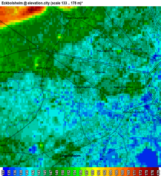
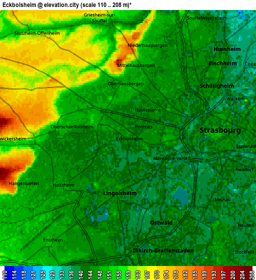
Below is the Elevation map of Eckbolsheim, which displays elevation range with different colors. Scale of the first map is from 133 to 178 m (436 to 584 ft) with average elevation of 144.4 meters (=474 ft) [note 1]
These maps also provides idea of topography and contour of this city, they are displayed at different zoom levels. More info about maps, scale and edge coordinates you can find below images.
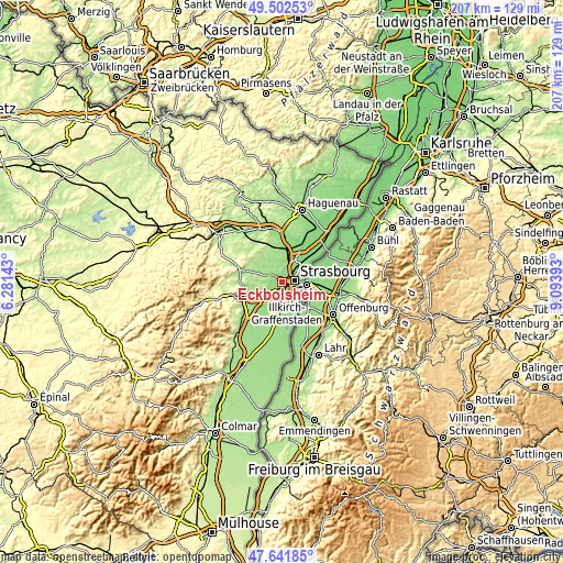
| \ | Map #1 | Map #2 | Topo.Map |
| Scale [m] | 133..178 m | 110..208 m | × |
| Scale [ft] | 436..584 ft | 361..682 ft | × |
| Average | 144.4 m = 474 ft | 149.1 m = 489 ft | × |
| Width | 6.47 km = 4 mi | 12.93 km = 8 mi | 206.9 km = 128.6 mi |
| Height | 6.47 km = 4 mi | 12.93 km = 8 mi | 206.9 km = 128.6 mi |
| ↑Max Latitude | 48.609814° | 48.638862° | 49.50253° |
| Latitude at center | 48.58075° | 48.58075° | 48.58075° |
| ↓Min Latitude | 48.551669° | 48.522571° | 47.64185° |
| ← Min Longitude | 7.643735° | 7.599789° | 6.28143° |
| Longitude center | 7.68768° | 7.68768° | 7.68768° |
| →Max Longitude | 7.731625° | 7.775571° | 9.09393° |
Nearby cities:
Cities around Eckbolsheim sort by population:
• Strasbourg elevation 147 m
4.3 km,  85°
85°
• Schiltigheim 144 m
5.4 km,  56°
56°
• Lingolsheim 148 m
2.6 km,  188°
188°
• Ostwald 142 m
4.5 km,  157°
157°
• Oberhausbergen 149 m
2.8 km,  1°
1°
• Wolfisheim 151 m
1.7 km,  295°
295°
• Holtzheim 149 m
4.1 km,  231°
231°
• Achenheim 155 m
4.4 km,  269°
269°
• Oberschaeffolsheim 151 m
2.8 km,  282°
282°
• Mittelhausbergen 154 m
3.7 km, 2°
• Niederhausbergen 149 m
4.9 km,  12°
12°
• Dingsheim 155 m
5.7 km,  346°
346°
Multilingual:
 En español:
Eckbolsheim elevación 146 m.
 En France:
Eckbolsheim élévation 146 m.
 Auf Deutsch:
Eckbolsheim höhe über dem Meeresspiegel ist 146 m.

Sources and notes:
- [note 1] Map square and city borders are not equal. Map elevation data is calculated only from area inside that square.
- [src 1] Elevation data from geonames database provided with same terms of usage.
- [src 2] The elevation map of Eckbolsheim is generated using elevation data from NASA's 3 arcsec (90m) resolution SRTM data.
- [src 3] Base (background) map © OpenStreetMap contributors tiles are generated by Geofabrik and OpenTopoMap.
Copyright & License:
This Eckbolsheim Elevation Map is licensed under CC BY-SA. You may reuse any part from this page, if you give a proper credit by linking to this URL:
 More info on terms of use page.