Schiltigheim elevation
Schiltigheim (Grand Est, Bas-Rhin), France elevation is 144 meters and Schiltigheim elevation in feet is 472 ft above sea level [src 1]. Schiltigheim is a populated place (feature code) with elevation that is 30 meters (98 ft) smaller than average city elevation in France.
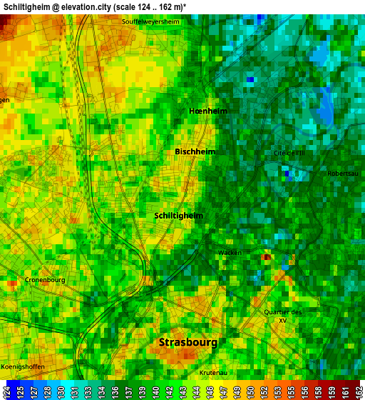
Below is the Elevation map of Schiltigheim, which displays elevation range with different colors. Scale of the first map is from 124 to 162 m (407 to 531 ft) with average elevation of 141.3 meters (=464 ft) [note 1]
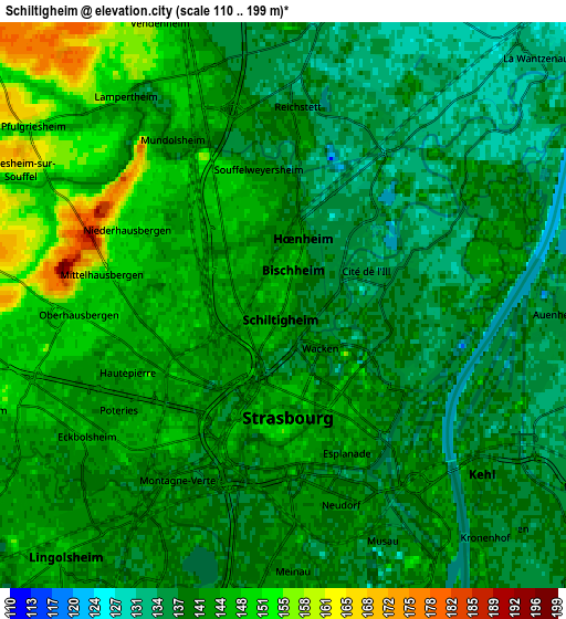
These maps also provides idea of topography and contour of this city, they are displayed at different zoom levels. More info about maps, scale and edge coordinates you can find below images.
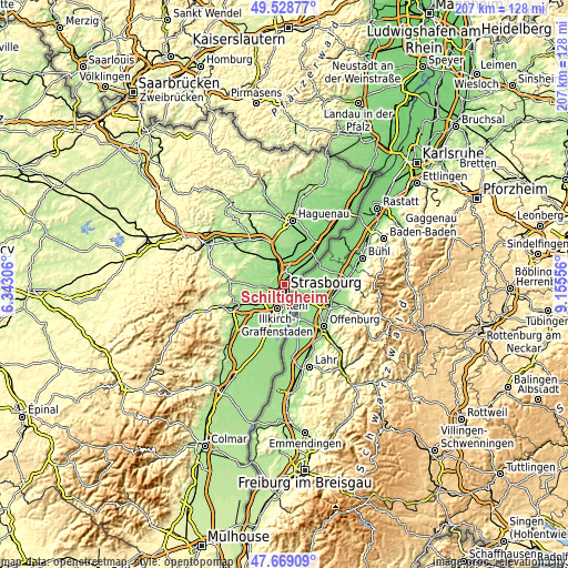
| \ | Map #1 | Map #2 | Topo.Map |
| Scale [m] | 124..162 m | 110..199 m | × |
| Scale [ft] | 407..531 ft | 361..653 ft | × |
| Average | 141.3 m = 464 ft | 141.7 m = 465 ft | × |
| Width | 6.46 km = 4 mi | 12.92 km = 8 mi | 206.8 km = 128.5 mi |
| Height | 6.46 km = 4 mi | 12.92 km = 8 mi | 206.8 km = 128.5 mi |
| ↑Max Latitude | 48.636539° | 48.665571° | 49.52877° |
| Latitude at center | 48.60749° | 48.60749° | 48.60749° |
| ↓Min Latitude | 48.578424° | 48.549342° | 47.66909° |
| ← Min Longitude | 7.705365° | 7.661419° | 6.34306° |
| Longitude center | 7.74931° | 7.74931° | 7.74931° |
| →Max Longitude | 7.793255° | 7.837201° | 9.15556° |
Nearby cities:
Cities around Schiltigheim sort by population:
• Strasbourg elevation 147 m
2.6 km,  186°
186°
• Bischheim 147 m
1 km,  17°
17°
• Hœnheim 144 m
1.7 km, 15°
• Souffelweyersheim 142 m
3.2 km,  349°
349°
• Eckbolsheim 146 m
5.4 km,  236°
236°
• Mundolsheim 143 m
4.7 km,  325°
325°
• Reichstett 140 m
4.6 km,  4°
4°
• Oberhausbergen 149 m
4.5 km,  267°
267°
• Lampertheim 149 m
6.1 km,  322°
322°
• Mittelhausbergen 154 m
4.4 km,  279°
279°
• Niederhausbergen 149 m
3.9 km,  297°
297°
• Dingsheim 155 m
6.4 km,  293°
293°
Multilingual:
 En español:
Schiltigheim elevación 144 m.
 En France:
Schiltigheim élévation 144 m.
 Auf Deutsch:
Schiltigheim höhe über dem Meeresspiegel ist 144 m.

Sources and notes:
- [note 1] Map square and city borders are not equal. Map elevation data is calculated only from area inside that square.
- [src 1] Elevation data from geonames database provided with same terms of usage.
- [src 2] The elevation map of Schiltigheim is generated using elevation data from NASA's 3 arcsec (90m) resolution SRTM data.
- [src 3] Base (background) map © OpenStreetMap contributors tiles are generated by Geofabrik and OpenTopoMap.
Copyright & License:
This Schiltigheim Elevation Map is licensed under CC BY-SA. You may reuse any part from this page, if you give a proper credit by linking to this URL:
 More info on terms of use page.