Faverges elevation
Faverges (Auvergne-Rhône-Alpes, Haute-Savoie), France elevation is 508 meters and Faverges elevation in feet is 1667 ft above sea level [src 1]. Faverges is a populated place (feature code) with elevation that is 334 meters (1096 ft) bigger than average city elevation in France.
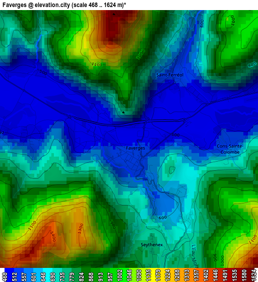
Below is the Elevation map of Faverges, which displays elevation range with different colors. Scale of the first map is from 468 to 1624 m (1535 to 5328 ft) with average elevation of 771.5 meters (=2531 ft) [note 1]
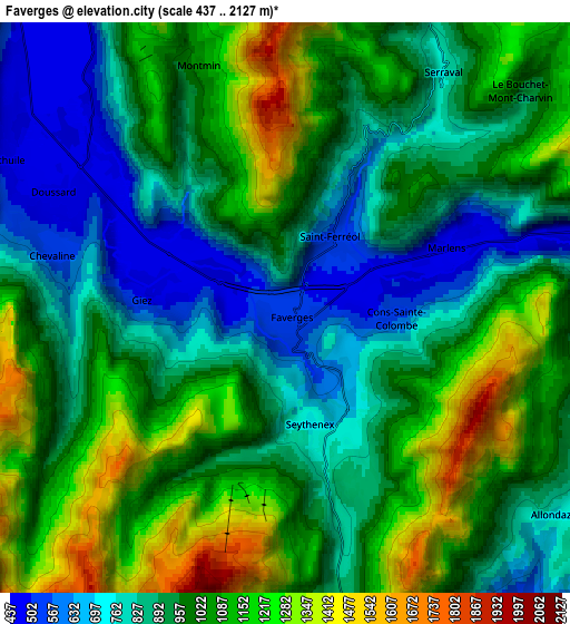
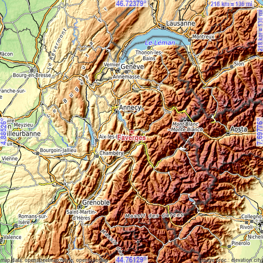
These maps also provides idea of topography and contour of this city, they are displayed at different zoom levels. More info about maps, scale and edge coordinates you can find below images.
| \ | Map #1 | Map #2 | Topo.Map |
| Scale [m] | 468..1624 m | 437..2127 m | × |
| Scale [ft] | 1535..5328 ft | 1434..6978 ft | × |
| Average | 771.5 m = 2531 ft | 980 m = 3215 ft | × |
| Width | 6.82 km = 4.2 mi | 13.64 km = 8.5 mi | 218.2 km = 135.6 mi |
| Height | 6.82 km = 4.2 mi | 13.64 km = 8.5 mi | 218.2 km = 135.6 mi |
| ↑Max Latitude | 45.781816° | 45.812454° | 46.72379° |
| Latitude at center | 45.75116° | 45.75116° | 45.75116° |
| ↓Min Latitude | 45.720488° | 45.689798° | 44.76129° |
| ← Min Longitude | 6.247565° | 6.203619° | 4.88526° |
| Longitude center | 6.29151° | 6.29151° | 6.29151° |
| →Max Longitude | 6.335455° | 6.379401° | 7.69776° |
Nearby cities:
Cities around Faverges sort by population:
• Albertville elevation 346 m
11.5 km,  137°
137°
• Ugine 471 m
9.6 km,  86°
86°
• Thônes 627 m
14.7 km,  10°
10°
• Saint-Jorioz 478 m
13.6 km,  310°
310°
• Doussard 466 m
5.8 km,  297°
297°
• Gilly-sur-Isère 341 m
11.2 km,  155°
155°
• Mercury 552 m
9.2 km, 157°
• Grignon 331 m
13 km,  148°
148°
• Menthon-Saint-Bernard 487 m
14.2 km,  328°
328°
• Frontenex 319 m
13.2 km,  173°
173°
• Talloires 469 m
11.7 km, 328°
• Marthod 417 m
9.1 km,  107°
107°
Multilingual:
 En español:
Faverges elevación 508 m.
 En France:
Faverges élévation 508 m.
 Auf Deutsch:
Faverges höhe über dem Meeresspiegel ist 508 m.

Sources and notes:
- [note 1] Map square and city borders are not equal. Map elevation data is calculated only from area inside that square.
- [src 1] Elevation data from geonames database provided with same terms of usage.
- [src 2] The elevation map of Faverges is generated using elevation data from NASA's 3 arcsec (90m) resolution SRTM data.
- [src 3] Base (background) map © OpenStreetMap contributors tiles are generated by Geofabrik and OpenTopoMap.
Copyright & License:
This Faverges Elevation Map is licensed under CC BY-SA. You may reuse any part from this page, if you give a proper credit by linking to this URL:
 More info on terms of use page.