Faverney elevation
Faverney (Bourgogne-Franche-Comté, Département de la Haute-Saône), France elevation is 226 meters and Faverney elevation in feet is 741 ft above sea level [src 1]. Faverney is a populated place (feature code) with elevation that is 52 meters (171 ft) bigger than average city elevation in France.
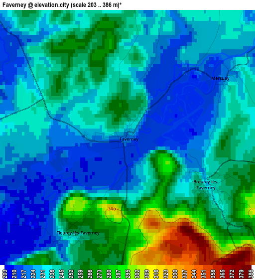
Below is the Elevation map of Faverney, which displays elevation range with different colors. Scale of the first map is from 203 to 386 m (666 to 1266 ft) with average elevation of 243.6 meters (=799 ft) [note 1]
These maps also provides idea of topography and contour of this city, they are displayed at different zoom levels. More info about maps, scale and edge coordinates you can find below images.
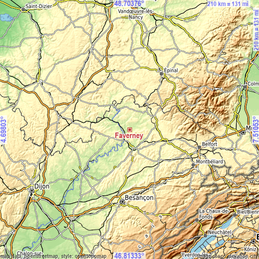
| \ | Map #1 | Topo.Map |
| Scale [m] | 203..386 m | × |
| Scale [ft] | 666..1266 ft | × |
| Average | 243.6 m = 799 ft | × |
| Width | 6.57 km = 4.1 mi | 210.2 km = 130.6 mi |
| Height | 6.57 km = 4.1 mi | 210.2 km = 130.6 mi |
| ↑Max Latitude | 47.796659° | 48.70376° |
| Latitude at center | 47.76713° | 47.76713° |
| ↓Min Latitude | 47.737584° | 46.81333° |
| ← Min Longitude | 6.060335° | 4.69803° |
| Longitude center | 6.10428° | 6.10428° |
| →Max Longitude | 6.148225° | 7.51053° |
Nearby cities:
Cities around Faverney sort by population:
• Vesoul elevation 287 m
15.9 km,  169°
169°
• Saint-Loup-sur-Semouse 246 m
18.2 km,  44°
44°
• Port-sur-Saône 231 m
9.7 km,  204°
204°
• Échenoz-la-Méline 241 m
18.6 km, 172°
• Vaivre-et-Montoille 227 m
15.2 km,  180°
180°
• Noidans-lès-Vesoul 230 m
17.2 km, 174°
• Jussey 224 m
16.4 km,  293°
293°
• Navenne 245 m
18.1 km, 166°
• Scey-sur-Saône-et-Saint-Albin 211 m
15 km,  220°
220°
• Frotey-lès-Vesoul 247 m
17.4 km,  158°
158°
• Pusey 220 m
12.9 km, 172°
• Quincey 258 m
18.3 km, 160°
Multilingual:
 En español:
Faverney elevación 226 m.
 En France:
Faverney élévation 226 m.
 Auf Deutsch:
Faverney höhe über dem Meeresspiegel ist 226 m.

Sources and notes:
- [note 1] Map square and city borders are not equal. Map elevation data is calculated only from area inside that square.
- [src 1] Elevation data from geonames database provided with same terms of usage.
- [src 2] The elevation map of Faverney is generated using elevation data from NASA's 3 arcsec (90m) resolution SRTM data.
- [src 3] Base (background) map © OpenStreetMap contributors tiles are generated by Geofabrik and OpenTopoMap.
Copyright & License:
This Faverney Elevation Map is licensed under CC BY-SA. You may reuse any part from this page, if you give a proper credit by linking to this URL:
 More info on terms of use page.