Saint-Loup-sur-Semouse elevation
Saint-Loup-sur-Semouse (Bourgogne-Franche-Comté, Département de la Haute-Saône), France elevation is 246 meters and Saint-Loup-sur-Semouse elevation in feet is 807 ft above sea level [src 1]. Saint-Loup-sur-Semouse is a populated place (feature code) with elevation that is 72 meters (236 ft) bigger than average city elevation in France.
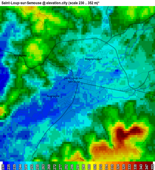
Below is the Elevation map of Saint-Loup-sur-Semouse, which displays elevation range with different colors. Scale of the first map is from 230 to 352 m (755 to 1155 ft) with average elevation of 264.4 meters (=867 ft) [note 1]
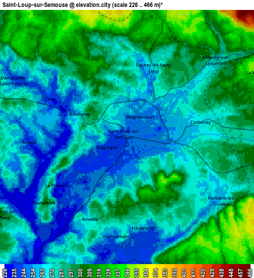
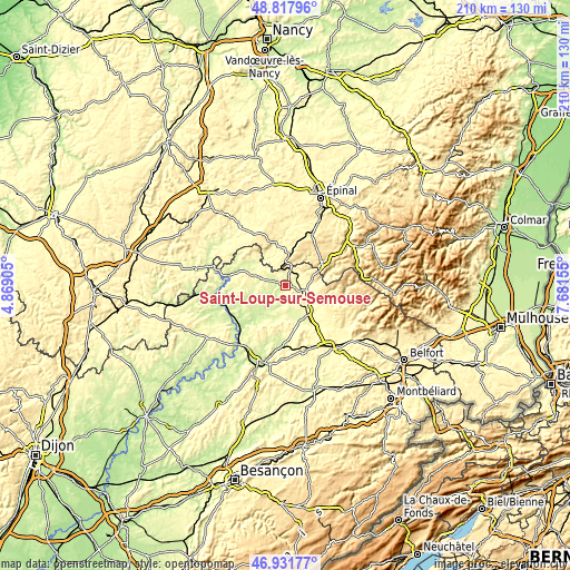
These maps also provides idea of topography and contour of this city, they are displayed at different zoom levels. More info about maps, scale and edge coordinates you can find below images.
| \ | Map #1 | Map #2 | Topo.Map |
| Scale [m] | 230..352 m | 226..466 m | × |
| Scale [ft] | 755..1155 ft | 741..1529 ft | × |
| Average | 264.4 m = 867 ft | 281.6 m = 924 ft | × |
| Width | 6.55 km = 4.1 mi | 13.11 km = 8.1 mi | 209.7 km = 130.3 mi |
| Height | 6.55 km = 4.1 mi | 13.11 km = 8.1 mi | 209.7 km = 130.3 mi |
| ↑Max Latitude | 47.912913° | 47.94236° | 48.81796° |
| Latitude at center | 47.88345° | 47.88345° | 47.88345° |
| ↓Min Latitude | 47.85397° | 47.824473° | 46.93177° |
| ← Min Longitude | 6.231355° | 6.187409° | 4.86905° |
| Longitude center | 6.2753° | 6.2753° | 6.2753° |
| →Max Longitude | 6.319245° | 6.363191° | 7.68155° |
Nearby cities:
Cities around Saint-Loup-sur-Semouse sort by population:
• Luxeuil-les-Bains elevation 299 m
10 km,  137°
137°
• Fougerolles 306 m
9.6 km,  88°
88°
• Xertigny 512 m
20.4 km,  29°
29°
• Saint-Sauveur 285 m
12 km, 136°
• Froideconche 303 m
12.5 km,  123°
123°
• Plombières-les-Bains 426 m
16.2 km,  56°
56°
• Aillevillers-et-Lyaumont 278 m
6.2 km,  48°
48°
• Bains-les-Bains 309 m
13.1 km,  356°
356°
• Fontaine-lès-Luxeuil 264 m
5.4 km, 124°
• Corbenay 269 m
4.2 km,  75°
75°
• Uzemain 332 m
23.1 km,  12°
12°
• Faverney 226 m
18.2 km,  224°
224°
Multilingual:
 En español:
Saint-Loup-sur-Semouse elevación 246 m.
 En France:
Saint-Loup-sur-Semouse élévation 246 m.
 Auf Deutsch:
Saint-Loup-sur-Semouse höhe über dem Meeresspiegel ist 246 m.

Sources and notes:
- [note 1] Map square and city borders are not equal. Map elevation data is calculated only from area inside that square.
- [src 1] Elevation data from geonames database provided with same terms of usage.
- [src 2] The elevation map of Saint-Loup-sur-Semouse is generated using elevation data from NASA's 3 arcsec (90m) resolution SRTM data.
- [src 3] Base (background) map © OpenStreetMap contributors tiles are generated by Geofabrik and OpenTopoMap.
Copyright & License:
This Saint-Loup-sur-Semouse Elevation Map is licensed under CC BY-SA. You may reuse any part from this page, if you give a proper credit by linking to this URL:
 More info on terms of use page.