Fellering elevation
Fellering (Grand Est, Haut-Rhin), France elevation is 440 meters and Fellering elevation in feet is 1444 ft above sea level [src 1]. Fellering is a populated place (feature code) with elevation that is 266 meters (873 ft) bigger than average city elevation in France.
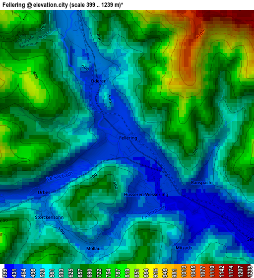
Below is the Elevation map of Fellering, which displays elevation range with different colors. Scale of the first map is from 399 to 1239 m (1309 to 4065 ft) with average elevation of 622.6 meters (=2043 ft) [note 1]
These maps also provides idea of topography and contour of this city, they are displayed at different zoom levels. More info about maps, scale and edge coordinates you can find below images.
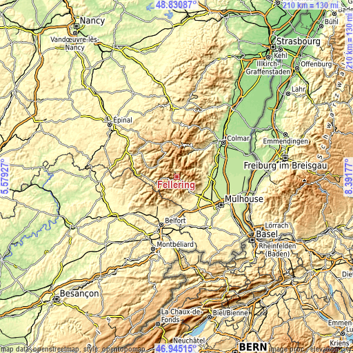
| \ | Map #1 | Topo.Map |
| Scale [m] | 399..1239 m | × |
| Scale [ft] | 1309..4065 ft | × |
| Average | 622.6 m = 2043 ft | × |
| Width | 6.55 km = 4.1 mi | 209.7 km = 130.3 mi |
| Height | 6.55 km = 4.1 mi | 209.7 km = 130.3 mi |
| ↑Max Latitude | 47.926046° | 48.83087° |
| Latitude at center | 47.89659° | 47.89659° |
| ↓Min Latitude | 47.867118° | 46.94515° |
| ← Min Longitude | 6.941575° | 5.57927° |
| Longitude center | 6.98552° | 6.98552° |
| →Max Longitude | 7.029465° | 8.39177° |
Nearby cities:
Cities around Fellering sort by population:
• Thann elevation 335 m
13.2 km,  138°
138°
• Cornimont 505 m
13.5 km,  301°
301°
• Masevaux 407 m
13.4 km,  176°
176°
• Saint-Amarin 413 m
4.1 km,  126°
126°
• Bitschwiller-lès-Thann 418 m
10.2 km, 136°
• Moosch 419 m
6.2 km, 130°
• Bussang 600 m
10 km,  262°
262°
• Saint-Maurice-sur-Moselle 553 m
12.7 km,  250°
250°
• Oderen 467 m
1.7 km,  332°
332°
• Kruth 493 m
4.1 km,  337°
337°
• Lautenbachzell 427 m
13 km,  67°
67°
• Husseren-Wesserling 430 m
1.5 km,  167°
167°
Multilingual:
 En español:
Fellering elevación 440 m.
 En France:
Fellering élévation 440 m.
 Auf Deutsch:
Fellering höhe über dem Meeresspiegel ist 440 m.

Sources and notes:
- [note 1] Map square and city borders are not equal. Map elevation data is calculated only from area inside that square.
- [src 1] Elevation data from geonames database provided with same terms of usage.
- [src 2] The elevation map of Fellering is generated using elevation data from NASA's 3 arcsec (90m) resolution SRTM data.
- [src 3] Base (background) map © OpenStreetMap contributors tiles are generated by Geofabrik and OpenTopoMap.
Copyright & License:
This Fellering Elevation Map is licensed under CC BY-SA. You may reuse any part from this page, if you give a proper credit by linking to this URL:
 More info on terms of use page.