Thann elevation
Thann (Grand Est, Haut-Rhin), France elevation is 335 meters and Thann elevation in feet is 1099 ft above sea level [src 1]. Thann is a seat of a third-order administrative division (feature code) with elevation that is 161 meters (528 ft) bigger than average city elevation in France.
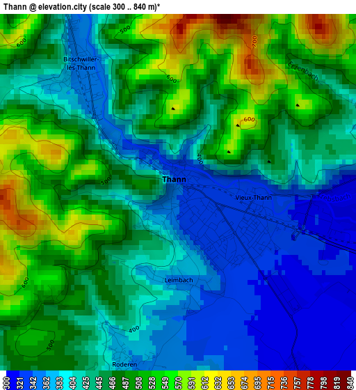
Below is the Elevation map of Thann, which displays elevation range with different colors. Scale of the first map is from 300 to 840 m (984 to 2756 ft) with average elevation of 448.3 meters (=1471 ft) [note 1]
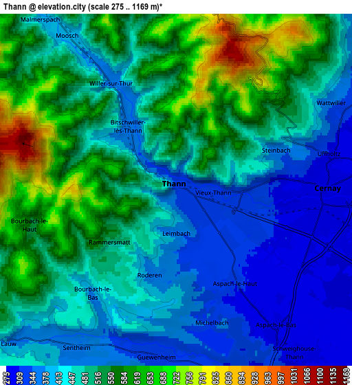
These maps also provides idea of topography and contour of this city, they are displayed at different zoom levels. More info about maps, scale and edge coordinates you can find below images.
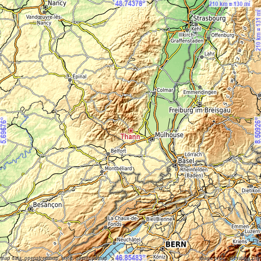
| \ | Map #1 | Map #2 | Topo.Map |
| Scale [m] | 300..840 m | 275..1169 m | × |
| Scale [ft] | 984..2756 ft | 902..3835 ft | × |
| Average | 448.3 m = 1471 ft | 484.4 m = 1589 ft | × |
| Width | 6.56 km = 4.1 mi | 13.13 km = 8.2 mi | 210 km = 130.5 mi |
| Height | 6.56 km = 4.1 mi | 13.13 km = 8.2 mi | 210 km = 130.5 mi |
| ↑Max Latitude | 47.837396° | 47.866885° | 48.74378° |
| Latitude at center | 47.80789° | 47.80789° | 47.80789° |
| ↓Min Latitude | 47.778367° | 47.748827° | 46.85483° |
| ← Min Longitude | 7.059065° | 7.015119° | 5.69676° |
| Longitude center | 7.10301° | 7.10301° | 7.10301° |
| →Max Longitude | 7.146955° | 7.190901° | 8.50926° |
Nearby cities:
Cities around Thann sort by population:
• Cernay elevation 297 m
5.5 km,  87°
87°
• Masevaux 407 m
8.7 km,  246°
246°
• Vieux-Thann 328 m
1.4 km,  108°
108°
• Bitschwiller-lès-Thann 418 m
3 km,  323°
323°
• Moosch 419 m
7.1 km,  325°
325°
• Wattwiller 362 m
6.4 km,  60°
60°
• Uffholtz 313 m
5.8 km,  75°
75°
• Sentheim 356 m
6.9 km,  212°
212°
• Steinbach 359 m
4 km,  67°
67°
• Guewenheim 333 m
6.2 km,  187°
187°
• Aspach-le-Haut 311 m
4.1 km,  148°
148°
• Aspach-le-Bas 296 m
6.3 km, 145°
Multilingual:
 En español:
Thann elevación 335 m.
 En France:
Thann élévation 335 m.


Sources and notes:
- [note 1] Map square and city borders are not equal. Map elevation data is calculated only from area inside that square.
- [src 1] Elevation data from geonames database provided with same terms of usage.
- [src 2] The elevation map of Thann is generated using elevation data from NASA's 3 arcsec (90m) resolution SRTM data.
- [src 3] Base (background) map © OpenStreetMap contributors tiles are generated by Geofabrik and OpenTopoMap.
Copyright & License:
This Thann Elevation Map is licensed under CC BY-SA. You may reuse any part from this page, if you give a proper credit by linking to this URL:
 More info on terms of use page.