Firminy elevation
Firminy (Auvergne-Rhône-Alpes, Département de la Loire), France elevation is 507 meters and Firminy elevation in feet is 1663 ft above sea level [src 1]. Firminy is a populated place (feature code) with elevation that is 333 meters (1093 ft) bigger than average city elevation in France.
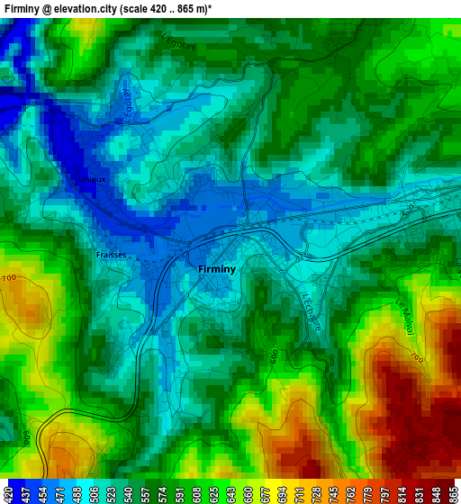
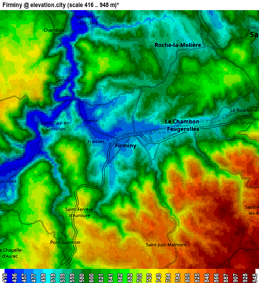
Below is the Elevation map of Firminy, which displays elevation range with different colors. Scale of the first map is from 420 to 865 m (1378 to 2838 ft) with average elevation of 572.8 meters (=1879 ft) [note 1]
These maps also provides idea of topography and contour of this city, they are displayed at different zoom levels. More info about maps, scale and edge coordinates you can find below images.
| \ | Map #1 | Map #2 | Topo.Map |
| Scale [m] | 420..865 m | 416..948 m | × |
| Scale [ft] | 1378..2838 ft | 1365..3110 ft | × |
| Average | 572.8 m = 1879 ft | 643.1 m = 2110 ft | × |
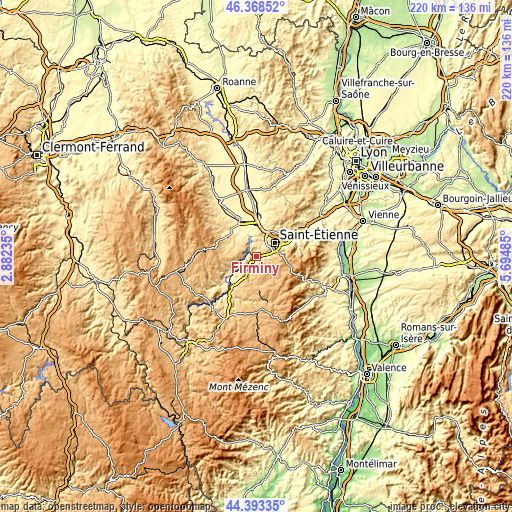
| Width | 6.86 km = 4.3 mi | 13.73 km = 8.5 mi | 219.6 km = 136.5 mi |
| Height | 6.86 km = 4.3 mi | 13.73 km = 8.5 mi | 219.6 km = 136.5 mi |
| ↑Max Latitude | 45.420414° | 45.45125° | 46.36852° |
| Latitude at center | 45.38956° | 45.38956° | 45.38956° |
| ↓Min Latitude | 45.35869° | 45.327802° | 44.39335° |
| ← Min Longitude | 4.244655° | 4.200709° | 2.88235° |
| Longitude center | 4.2886° | 4.2886° | 4.2886° |
| →Max Longitude | 4.332545° | 4.376491° | 5.69485° |
Nearby cities:
Cities around Firminy sort by population:
• Saint-Étienne elevation 529 m
9.3 km,  58°
58°
• Le Chambon-Feugerolles 587 m
2.6 km,  85°
85°
• Roche-la-Molière 561 m
5.5 km,  33°
33°
• Unieux 504 m
2.1 km,  319°
319°
• La Ricamarie 648 m
6.6 km,  74°
74°
• Saint-Genest-Lerpt 498 m
7.2 km, 33°
• Aurec-sur-Loire 508 m
7.2 km,  251°
251°
• Saint-Just-Malmont 839 m
5.9 km,  161°
161°
• Fraisses 467 m
1.9 km,  266°
266°
• Pont-Salomon 743 m
6.6 km,  208°
208°
• Saint-Paul 494 m
5 km,  281°
281°
• Saint-Maurice-en-Gourgois 788 m
8.4 km, 278°
Multilingual:
 En español:
Firminy elevación 507 m.
 En France:
Firminy élévation 507 m.


Sources and notes:
- [note 1] Map square and city borders are not equal. Map elevation data is calculated only from area inside that square.
- [src 1] Elevation data from geonames database provided with same terms of usage.
- [src 2] The elevation map of Firminy is generated using elevation data from NASA's 3 arcsec (90m) resolution SRTM data.
- [src 3] Base (background) map © OpenStreetMap contributors tiles are generated by Geofabrik and OpenTopoMap.
Copyright & License:
This Firminy Elevation Map is licensed under CC BY-SA. You may reuse any part from this page, if you give a proper credit by linking to this URL:
 More info on terms of use page.