Francheville elevation
Francheville (Normandy, Département de l'Eure), France elevation is 181 meters and Francheville elevation in feet is 594 ft above sea level [src 1]. Francheville is a populated place (feature code) with elevation that is 7 meters (23 ft) bigger than average city elevation in France.
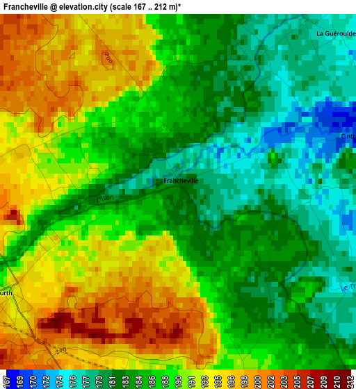
Below is the Elevation map of Francheville, which displays elevation range with different colors. Scale of the first map is from 167 to 212 m (548 to 696 ft) with average elevation of 187.4 meters (=615 ft) [note 1]
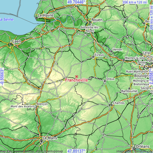
These maps also provides idea of topography and contour of this city, they are displayed at different zoom levels. More info about maps, scale and edge coordinates you can find below images.
| \ | Map #1 | Topo.Map |
| Scale [m] | 167..212 m | × |
| Scale [ft] | 548..696 ft | × |
| Average | 187.4 m = 615 ft | × |
| Width | 6.44 km = 4 mi | 206 km = 128 mi |
| Height | 6.44 km = 4 mi | 206 km = 128 mi |
| ↑Max Latitude | 48.815416° | 49.70446° |
| Latitude at center | 48.78647° | 48.78647° |
| ↓Min Latitude | 48.757508° | 47.85137° |
| ← Min Longitude | 0.805675° | -0.55663° |
| Longitude center | 0.84962° | 0.84962° |
| →Max Longitude | 0.893565° | 2.25587° |
Nearby cities:
Cities around Francheville sort by population:
• Verneuil-sur-Avre elevation 176 m
7.7 km,  132°
132°
• Conches-en-Ouche 152 m
20.2 km,  19°
19°
• Breteuil 168 m
7.2 km,  43°
43°
• Rugles 181 m
11 km,  291°
291°
• Nonancourt 114 m
25.6 km,  93°
93°
• Damville 142 m
18.9 km,  60°
60°
• Rai 210 m
19.9 km,  258°
258°
• Brezolles 164 m
19.6 km,  123°
123°
• Aube-sur-Rîle 245 m
22.5 km, 256°
• Saint-Sulpice-sur-Risle 206 m
14.1 km,  267°
267°
• Tillières-sur-Avre 135 m
15.4 km,  102°
102°
• Bourth 193 m
3.6 km,  235°
235°
Multilingual:
 En español:
Francheville elevación 181 m.
 En France:
Francheville élévation 181 m.
 Auf Deutsch:
Francheville höhe über dem Meeresspiegel ist 181 m.

Sources and notes:
- [note 1] Map square and city borders are not equal. Map elevation data is calculated only from area inside that square.
- [src 1] Elevation data from geonames database provided with same terms of usage.
- [src 2] The elevation map of Francheville is generated using elevation data from NASA's 3 arcsec (90m) resolution SRTM data.
- [src 3] Base (background) map © OpenStreetMap contributors tiles are generated by Geofabrik and OpenTopoMap.
Copyright & License:
This Francheville Elevation Map is licensed under CC BY-SA. You may reuse any part from this page, if you give a proper credit by linking to this URL:
 More info on terms of use page.