Ganges elevation
Ganges (Occitanie, Département de l'Hérault), France elevation is 165 meters and Ganges elevation in feet is 541 ft above sea level [src 1]. Ganges is a populated place (feature code) with elevation that is 9 meters (30 ft) smaller than average city elevation in France.
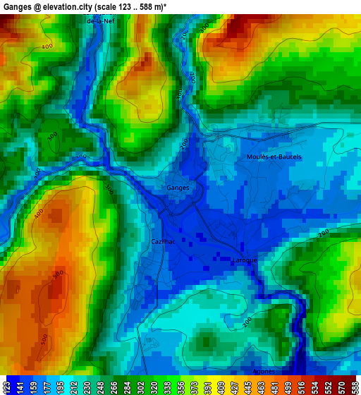
Below is the Elevation map of Ganges, which displays elevation range with different colors. Scale of the first map is from 123 to 588 m (404 to 1929 ft) with average elevation of 279.5 meters (=917 ft) [note 1]
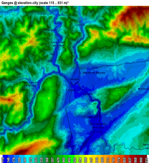
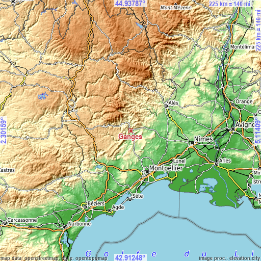
These maps also provides idea of topography and contour of this city, they are displayed at different zoom levels. More info about maps, scale and edge coordinates you can find below images.
| \ | Map #1 | Map #2 | Topo.Map |
| Scale [m] | 123..588 m | 115..931 m | × |
| Scale [ft] | 404..1929 ft | 377..3054 ft | × |
| Average | 279.5 m = 917 ft | 341.1 m = 1119 ft | × |
| Width | 7.04 km = 4.4 mi | 14.08 km = 8.7 mi | 225.2 km = 139.9 mi |
| Height | 7.04 km = 4.4 mi | 14.08 km = 8.7 mi | 225.2 km = 139.9 mi |
| ↑Max Latitude | 43.965438° | 43.99706° | 44.93787° |
| Latitude at center | 43.9338° | 43.9338° | 43.9338° |
| ↓Min Latitude | 43.902145° | 43.870473° | 42.91248° |
| ← Min Longitude | 3.663895° | 3.619949° | 2.30159° |
| Longitude center | 3.70784° | 3.70784° | 3.70784° |
| →Max Longitude | 3.751785° | 3.795731° | 5.11409° |
Nearby cities:
Cities around Ganges sort by population:
• Saint-Hippolyte-du-Fort elevation 168 m
12.3 km,  74°
74°
• Saint-Martin-de-Londres 195 m
16 km,  173°
173°
• Sauve 107 m
19.3 km,  87°
87°
• Sumène 201 m
5.2 km,  6°
6°
• Claret 169 m
17.7 km,  116°
116°
• Saint-Bauzille-de-Putois 139 m
4.9 km,  152°
152°
• Laroque 148 m
1.7 km,  132°
132°
• Cazilhac 165 m
1.6 km,  194°
194°
• Avèze 258 m
9.5 km,  295°
295°
• Lasalle 284 m
17.1 km,  43°
43°
• Valleraugue 374 m
17.2 km,  342°
342°
• Le Vigan 275 m
10.5 km,  308°
308°
Multilingual:
 En español:
Ganges elevación 165 m.
 En France:
Ganges élévation 165 m.


Sources and notes:
- [note 1] Map square and city borders are not equal. Map elevation data is calculated only from area inside that square.
- [src 1] Elevation data from geonames database provided with same terms of usage.
- [src 2] The elevation map of Ganges is generated using elevation data from NASA's 3 arcsec (90m) resolution SRTM data.
- [src 3] Base (background) map © OpenStreetMap contributors tiles are generated by Geofabrik and OpenTopoMap.
Copyright & License:
This Ganges Elevation Map is licensed under CC BY-SA. You may reuse any part from this page, if you give a proper credit by linking to this URL:
 More info on terms of use page.