Gérardmer elevation
Gérardmer (Grand Est, Vosges), France elevation is 663 meters and Gérardmer elevation in feet is 2175 ft above sea level [src 1]. Gérardmer is a populated place (feature code) with elevation that is 489 meters (1604 ft) bigger than average city elevation in France.
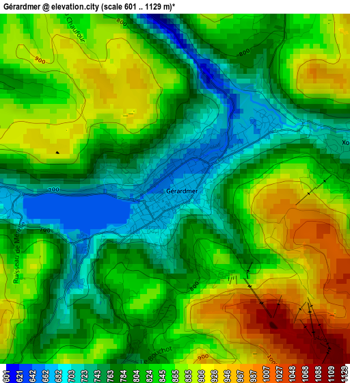
Below is the Elevation map of Gérardmer, which displays elevation range with different colors. Scale of the first map is from 601 to 1129 m (1972 to 3704 ft) with average elevation of 829.2 meters (=2720 ft) [note 1]
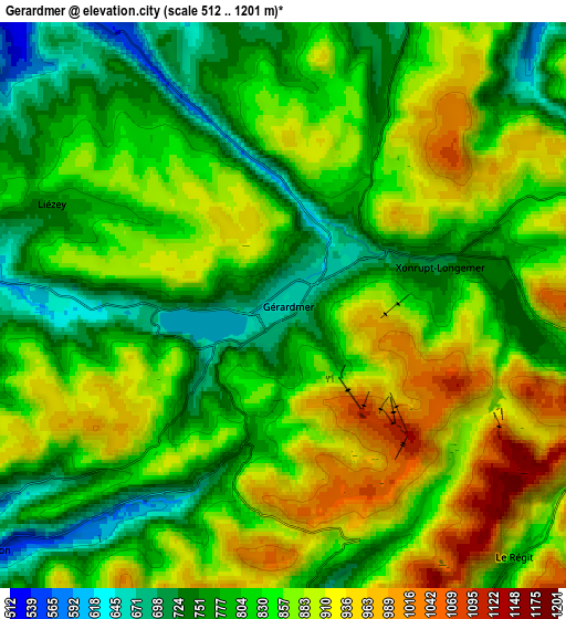
These maps also provides idea of topography and contour of this city, they are displayed at different zoom levels. More info about maps, scale and edge coordinates you can find below images.
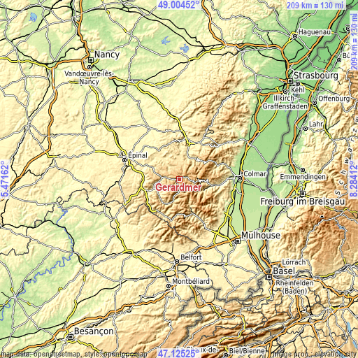
| \ | Map #1 | Map #2 | Topo.Map |
| Scale [m] | 601..1129 m | 512..1201 m | × |
| Scale [ft] | 1972..3704 ft | 1680..3940 ft | × |
| Average | 829.2 m = 2720 ft | 838 m = 2749 ft | × |
| Width | 6.53 km = 4.1 mi | 13.06 km = 8.1 mi | 209 km = 129.9 mi |
| Height | 6.53 km = 4.1 mi | 13.06 km = 8.1 mi | 208.9 km = 129.8 mi |
| ↑Max Latitude | 48.102815° | 48.132153° | 49.00452° |
| Latitude at center | 48.07346° | 48.07346° | 48.07346° |
| ↓Min Latitude | 48.044088° | 48.0147° | 47.12525° |
| ← Min Longitude | 6.833925° | 6.789979° | 5.47162° |
| Longitude center | 6.87787° | 6.87787° | 6.87787° |
| →Max Longitude | 6.921815° | 6.965761° | 8.28412° |
Nearby cities:
Cities around Gérardmer sort by population:
• La Bresse elevation 617 m
8.3 km,  186°
186°
• Cornimont 505 m
13.1 km,  195°
195°
• Vagney 406 m
14.1 km,  237°
237°
• Fraize 495 m
15.4 km,  35°
35°
• Anould 460 m
13.4 km,  22°
22°
• Granges-sur-Vologne 498 m
10.3 km,  321°
321°
• Le Syndicat 393 m
15.7 km,  246°
246°
• Plainfaing 535 m
15 km, 42°
• Corcieux 538 m
11 km,  1°
1°
• Le Tholy 595 m
10 km,  275°
275°
• Xonrupt-Longemer 719 m
4 km,  75°
75°
• Metzeral 568 m
15.9 km,  115°
115°
Multilingual:
 En español:
Gérardmer elevación 663 m.
 En France:
Gérardmer élévation 663 m.
 Auf Deutsch:
Gérardmer höhe über dem Meeresspiegel ist 663 m.

Sources and notes:
- [note 1] Map square and city borders are not equal. Map elevation data is calculated only from area inside that square.
- [src 1] Elevation data from geonames database provided with same terms of usage.
- [src 2] The elevation map of Gérardmer is generated using elevation data from NASA's 3 arcsec (90m) resolution SRTM data.
- [src 3] Base (background) map © OpenStreetMap contributors tiles are generated by Geofabrik and OpenTopoMap.
Copyright & License:
This Gérardmer Elevation Map is licensed under CC BY-SA. You may reuse any part from this page, if you give a proper credit by linking to this URL:
 More info on terms of use page.