Gonesse elevation
Gonesse (Île-de-France, Département du Val-d’Oise), France elevation is 50 meters and Gonesse elevation in feet is 164 ft above sea level [src 1]. Gonesse is a populated place (feature code) with elevation that is 124 meters (407 ft) smaller than average city elevation in France.
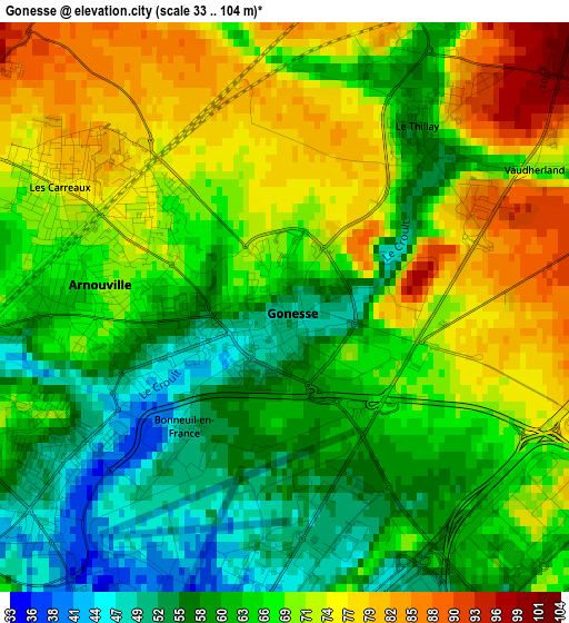
Below is the Elevation map of Gonesse, which displays elevation range with different colors. Scale of the first map is from 33 to 104 m (108 to 341 ft) with average elevation of 66.3 meters (=218 ft) [note 1]
These maps also provides idea of topography and contour of this city, they are displayed at different zoom levels. More info about maps, scale and edge coordinates you can find below images.
| \ | Map #1 | Map #2 | Topo.Map |
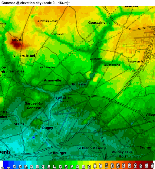
| Scale [m] | 33..104 m | 0..164 m | × |
| Scale [ft] | 108..341 ft | 0..538 ft | × |
| Average | 66.3 m = 218 ft | 70.8 m = 232 ft | × |
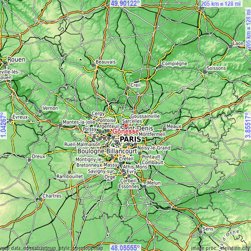
| Width | 6.41 km = 4 mi | 12.83 km = 8 mi | 205.2 km = 127.5 mi |
| Height | 6.41 km = 4 mi | 12.83 km = 8 mi | 205.2 km = 127.5 mi |
| ↑Max Latitude | 49.01576° | 49.044573° | 49.90122° |
| Latitude at center | 48.98693° | 48.98693° | 48.98693° |
| ↓Min Latitude | 48.958083° | 48.92922° | 48.05555° |
| ← Min Longitude | 2.404975° | 2.361029° | 1.04267° |
| Longitude center | 2.44892° | 2.44892° | 2.44892° |
| →Max Longitude | 2.492865° | 2.536811° | 3.85517° |
Nearby cities:
Cities around Gonesse sort by population:
• Aulnay-sous-Bois elevation 45 m
6.3 km,  148°
148°
• Sarcelles 75 m
5.3 km,  282°
282°
• Le Blanc-Mesnil 48 m
5.4 km,  170°
170°
• Garges-lès-Gonesse 64 m
4.3 km,  240°
240°
• Goussainville 73 m
3.2 km,  22°
22°
• Villiers-le-Bel 90 m
4.4 km,  303°
303°
• Arnouville 69 m
2.4 km,  260°
260°
• Le Bourget 38 m
6 km,  189°
189°
• Dugny 44 m
4.4 km,  211°
211°
• Écouen 107 m
6.1 km,  307°
307°
• Le Thillay 74 m
2.8 km,  37°
37°
• Roissy-en-France 96 m
5.3 km,  68°
68°
Multilingual:
 En español:
Gonesse elevación 50 m.
 En France:
Gonesse élévation 50 m.


Sources and notes:
- [note 1] Map square and city borders are not equal. Map elevation data is calculated only from area inside that square.
- [src 1] Elevation data from geonames database provided with same terms of usage.
- [src 2] The elevation map of Gonesse is generated using elevation data from NASA's 3 arcsec (90m) resolution SRTM data.
- [src 3] Base (background) map © OpenStreetMap contributors tiles are generated by Geofabrik and OpenTopoMap.
Copyright & License:
This Gonesse Elevation Map is licensed under CC BY-SA. You may reuse any part from this page, if you give a proper credit by linking to this URL:
 More info on terms of use page.