Hagetmau elevation
Hagetmau (Nouvelle-Aquitaine, Landes), France elevation is 118 meters and Hagetmau elevation in feet is 387 ft above sea level [src 1]. Hagetmau is a populated place (feature code) with elevation that is 56 meters (184 ft) smaller than average city elevation in France.
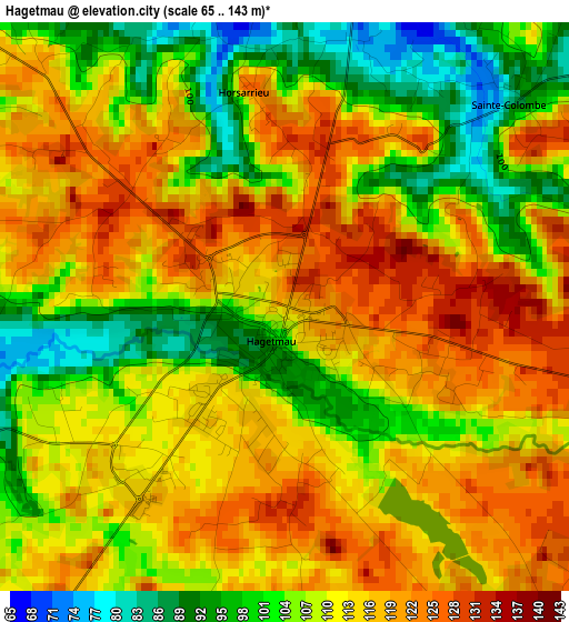
Below is the Elevation map of Hagetmau, which displays elevation range with different colors. Scale of the first map is from 65 to 143 m (213 to 469 ft) with average elevation of 110.8 meters (=364 ft) [note 1]
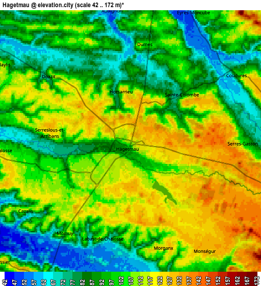
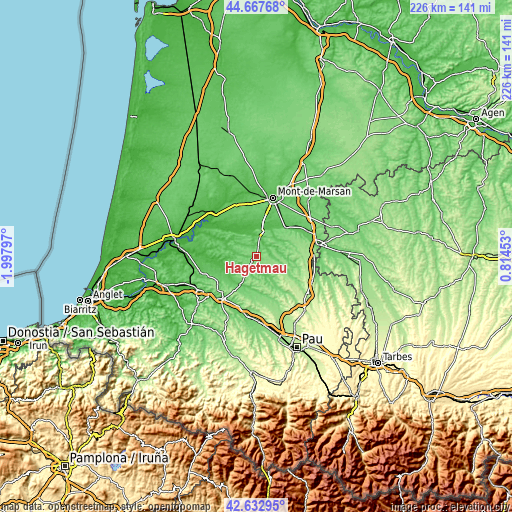
These maps also provides idea of topography and contour of this city, they are displayed at different zoom levels. More info about maps, scale and edge coordinates you can find below images.
| \ | Map #1 | Map #2 | Topo.Map |
| Scale [m] | 65..143 m | 42..172 m | × |
| Scale [ft] | 213..469 ft | 138..564 ft | × |
| Average | 110.8 m = 364 ft | 100.7 m = 330 ft | × |
| Width | 7.07 km = 4.4 mi | 14.14 km = 8.8 mi | 226.2 km = 140.6 mi |
| Height | 7.07 km = 4.4 mi | 14.14 km = 8.8 mi | 226.2 km = 140.6 mi |
| ↑Max Latitude | 43.690714° | 43.722482° | 44.66768° |
| Latitude at center | 43.65893° | 43.65893° | 43.65893° |
| ↓Min Latitude | 43.627129° | 43.595311° | 42.63295° |
| ← Min Longitude | -0.635665° | -0.679611° | -1.99797° |
| Longitude center | -0.59172° | -0.59172° | -0.59172° |
| →Max Longitude | -0.547775° | -0.503829° | 0.81453° |
Nearby cities:
Cities around Hagetmau sort by population:
• Orthez elevation 78 m
23.9 km,  217°
217°
• Saint-Sever 105 m
11 km,  7°
7°
• Grenade-sur-l’Adour 55 m
18.5 km,  44°
44°
• Arthez-de-Béarn 161 m
21.4 km,  181°
181°
• Amou 52 m
14.5 km,  239°
239°
• Pomarez 50 m
19.4 km,  260°
260°
• Mugron 82 m
16.3 km,  308°
308°
• Benquet 71 m
20.4 km,  20°
20°
• Montfort-en-Chalosse 108 m
20.8 km,  286°
286°
• Souprosse 50 m
17.3 km,  326°
326°
• Samadet 137 m
8.7 km,  105°
105°
• Saint-Perdon 81 m
23 km,  0°
0°
Multilingual:
 En español:
Hagetmau elevación 118 m.
 En France:
Hagetmau élévation 118 m.
 Auf Deutsch:
Hagetmau höhe über dem Meeresspiegel ist 118 m.

Sources and notes:
- [note 1] Map square and city borders are not equal. Map elevation data is calculated only from area inside that square.
- [src 1] Elevation data from geonames database provided with same terms of usage.
- [src 2] The elevation map of Hagetmau is generated using elevation data from NASA's 3 arcsec (90m) resolution SRTM data.
- [src 3] Base (background) map © OpenStreetMap contributors tiles are generated by Geofabrik and OpenTopoMap.
Copyright & License:
This Hagetmau Elevation Map is licensed under CC BY-SA. You may reuse any part from this page, if you give a proper credit by linking to this URL:
 More info on terms of use page.