Orthez elevation
Orthez (Nouvelle-Aquitaine, Département des Pyrénées-Atlantiques), France elevation is 78 meters and Orthez elevation in feet is 256 ft above sea level [src 1]. Orthez is a populated place (feature code) with elevation that is 96 meters (315 ft) smaller than average city elevation in France.
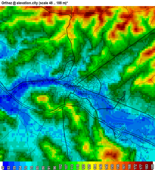
Below is the Elevation map of Orthez, which displays elevation range with different colors. Scale of the first map is from 48 to 188 m (157 to 617 ft) with average elevation of 95.7 meters (=314 ft) [note 1]
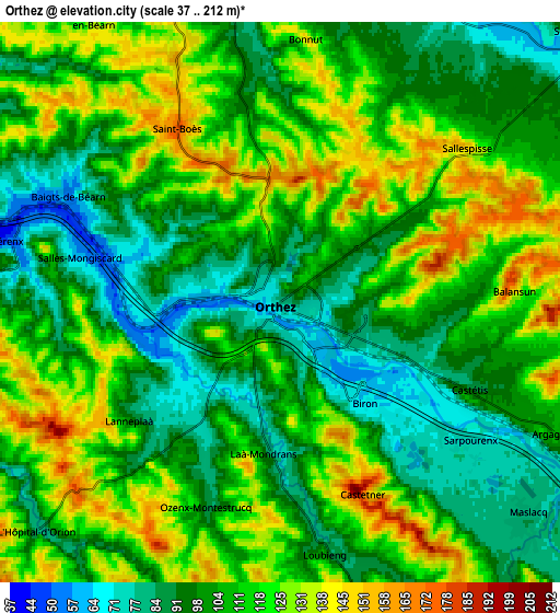
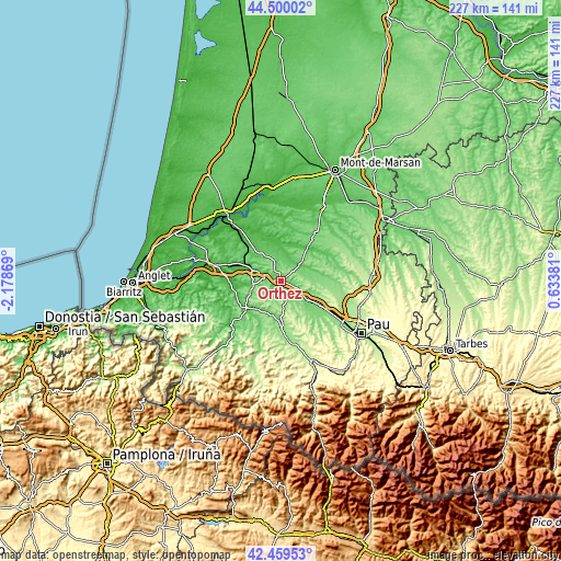
These maps also provides idea of topography and contour of this city, they are displayed at different zoom levels. More info about maps, scale and edge coordinates you can find below images.
| \ | Map #1 | Map #2 | Topo.Map |
| Scale [m] | 48..188 m | 37..212 m | × |
| Scale [ft] | 157..617 ft | 121..696 ft | × |
| Average | 95.7 m = 314 ft | 108.6 m = 356 ft | × |
| Width | 7.09 km = 4.4 mi | 14.18 km = 8.8 mi | 226.9 km = 141 mi |
| Height | 7.09 km = 4.4 mi | 14.18 km = 8.8 mi | 226.9 km = 141 mi |
| ↑Max Latitude | 43.520265° | 43.552122° | 44.50002° |
| Latitude at center | 43.48839° | 43.48839° | 43.48839° |
| ↓Min Latitude | 43.456499° | 43.42459° | 42.45953° |
| ← Min Longitude | -0.816385° | -0.860331° | -2.17869° |
| Longitude center | -0.77244° | -0.77244° | -0.77244° |
| →Max Longitude | -0.728495° | -0.684549° | 0.63381° |
Nearby cities:
Cities around Orthez sort by population:
• Mourenx elevation 111 m
18.2 km,  129°
129°
• Salies-de-Béarn 70 m
12.4 km,  262°
262°
• Arthez-de-Béarn 161 m
14.1 km,  99°
99°
• Amou 52 m
11.8 km,  10°
10°
• Pomarez 50 m
16.4 km,  343°
343°
• Sauveterre-de-Béarn 89 m
16.3 km,  232°
232°
• Habas 110 m
15.7 km,  306°
306°
• Lagor 114 m
15.3 km,  139°
139°
• Navarrenx 129 m
18.6 km,  176°
176°
• Labatut 48 m
18.3 km,  291°
291°
• Puyoô 40 m
12 km, 289°
• Mont 115 m
11.6 km,  121°
121°
Multilingual:
 En español:
Orthez elevación 78 m.
 En France:
Orthez élévation 78 m.


Sources and notes:
- [note 1] Map square and city borders are not equal. Map elevation data is calculated only from area inside that square.
- [src 1] Elevation data from geonames database provided with same terms of usage.
- [src 2] The elevation map of Orthez is generated using elevation data from NASA's 3 arcsec (90m) resolution SRTM data.
- [src 3] Base (background) map © OpenStreetMap contributors tiles are generated by Geofabrik and OpenTopoMap.
Copyright & License:
This Orthez Elevation Map is licensed under CC BY-SA. You may reuse any part from this page, if you give a proper credit by linking to this URL:
 More info on terms of use page.