Hermies elevation
Hermies (Hauts-de-France, Pas-de-Calais), France elevation is 115 meters and Hermies elevation in feet is 377 ft above sea level [src 1]. Hermies is a populated place (feature code) with elevation that is 59 meters (194 ft) smaller than average city elevation in France.
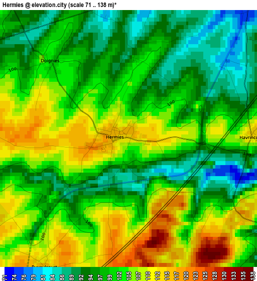
Below is the Elevation map of Hermies, which displays elevation range with different colors. Scale of the first map is from 71 to 138 m (233 to 453 ft) with average elevation of 101.2 meters (=332 ft) [note 1]
These maps also provides idea of topography and contour of this city, they are displayed at different zoom levels. More info about maps, scale and edge coordinates you can find below images.
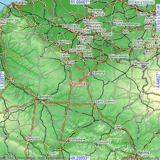
| \ | Map #1 | Topo.Map |
| Scale [m] | 71..138 m | × |
| Scale [ft] | 233..453 ft | × |
| Average | 101.2 m = 332 ft | × |
| Width | 6.27 km = 3.9 mi | 200.6 km = 124.6 mi |
| Height | 6.27 km = 3.9 mi | 200.5 km = 124.6 mi |
| ↑Max Latitude | 50.139434° | 51.00461° |
| Latitude at center | 50.11126° | 50.11126° |
| ↓Min Latitude | 50.08307° | 49.20093° |
| ← Min Longitude | 2.998075° | 1.63577° |
| Longitude center | 3.04202° | 3.04202° |
| →Max Longitude | 3.085965° | 4.44827° |
Nearby cities:
Cities around Hermies sort by population:
• Bapaume elevation 124 m
13.7 km,  266°
266°
• Proville 52 m
13 km,  64°
64°
• Masnières 69 m
11.9 km,  88°
88°
• Raillencourt-Sainte-Olle 70 m
12 km,  47°
47°
• Marcoing 56 m
9.4 km,  83°
83°
• Fontaine-Notre-Dame 71 m
10.3 km, 53°
• Rumilly-en-Cambrésis 84 m
12.7 km, 82°
• Gouzeaucourt 123 m
8.5 km,  136°
136°
• Bourlon 80 m
8.9 km,  35°
35°
• Vaulx-Vraucourt 91 m
10.4 km,  293°
293°
• Épehy 134 m
14 km,  152°
152°
• Marquion 52 m
11.6 km,  16°
16°
Multilingual:
 En español:
Hermies elevación 115 m.
 En France:
Hermies élévation 115 m.


Sources and notes:
- [note 1] Map square and city borders are not equal. Map elevation data is calculated only from area inside that square.
- [src 1] Elevation data from geonames database provided with same terms of usage.
- [src 2] The elevation map of Hermies is generated using elevation data from NASA's 3 arcsec (90m) resolution SRTM data.
- [src 3] Base (background) map © OpenStreetMap contributors tiles are generated by Geofabrik and OpenTopoMap.
Copyright & License:
This Hermies Elevation Map is licensed under CC BY-SA. You may reuse any part from this page, if you give a proper credit by linking to this URL:
 More info on terms of use page.