Masnières elevation
Masnières (Hauts-de-France, Nord), France elevation is 69 meters and Masnières elevation in feet is 226 ft above sea level [src 1]. Masnières is a populated place (feature code) with elevation that is 105 meters (344 ft) smaller than average city elevation in France.
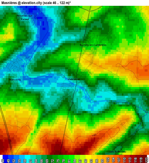
Below is the Elevation map of Masnières, which displays elevation range with different colors. Scale of the first map is from 46 to 122 m (151 to 400 ft) with average elevation of 79 meters (=259 ft) [note 1]
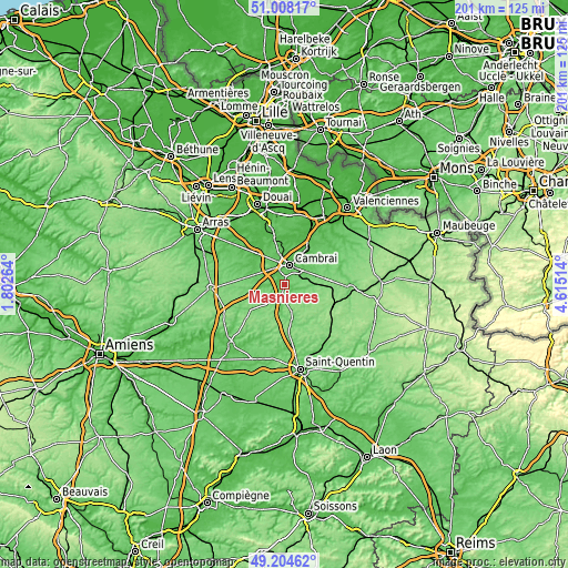
These maps also provides idea of topography and contour of this city, they are displayed at different zoom levels. More info about maps, scale and edge coordinates you can find below images.
| \ | Map #1 | Topo.Map |
| Scale [m] | 46..122 m | × |
| Scale [ft] | 151..400 ft | × |
| Average | 79 m = 259 ft | × |
| Width | 6.27 km = 3.9 mi | 200.5 km = 124.6 mi |
| Height | 6.27 km = 3.9 mi | 200.5 km = 124.6 mi |
| ↑Max Latitude | 50.143062° | 51.00817° |
| Latitude at center | 50.11489° | 50.11489° |
| ↓Min Latitude | 50.086702° | 49.20462° |
| ← Min Longitude | 3.164945° | 1.80264° |
| Longitude center | 3.20889° | 3.20889° |
| →Max Longitude | 3.252835° | 4.61514° |
Nearby cities:
Cities around Masnières sort by population:
• Cambrai elevation 66 m
7 km,  15°
15°
• Neuville-Saint-Rémy 46 m
8 km,  7°
7°
• Proville 52 m
5.2 km,  357°
357°
• Escaudœuvres 50 m
10.3 km, 23°
• Raillencourt-Sainte-Olle 70 m
8.2 km,  338°
338°
• Selvigny 139 m
10.7 km,  111°
111°
• Walincourt-Selvigny 129 m
10.4 km,  121°
121°
• Marcoing 56 m
2.6 km,  285°
285°
• Fontaine-Notre-Dame 71 m
6.8 km,  327°
327°
• Rumilly-en-Cambrésis 84 m
1.5 km,  27°
27°
• Gouzeaucourt 123 m
8.9 km,  222°
222°
• Bourlon 80 m
9.6 km,  315°
315°
Multilingual:
 En español:
Masnières elevación 69 m.
 En France:
Masnières élévation 69 m.
 Auf Deutsch:
Masnières höhe über dem Meeresspiegel ist 69 m.

Sources and notes:
- [note 1] Map square and city borders are not equal. Map elevation data is calculated only from area inside that square.
- [src 1] Elevation data from geonames database provided with same terms of usage.
- [src 2] The elevation map of Masnières is generated using elevation data from NASA's 3 arcsec (90m) resolution SRTM data.
- [src 3] Base (background) map © OpenStreetMap contributors tiles are generated by Geofabrik and OpenTopoMap.
Copyright & License:
This Masnières Elevation Map is licensed under CC BY-SA. You may reuse any part from this page, if you give a proper credit by linking to this URL:
 More info on terms of use page.