Igny elevation
Igny (Île-de-France, Département de l'Essonne), France elevation is 93 meters and Igny elevation in feet is 305 ft above sea level [src 1]. Igny is a populated place (feature code) with elevation that is 81 meters (266 ft) smaller than average city elevation in France.
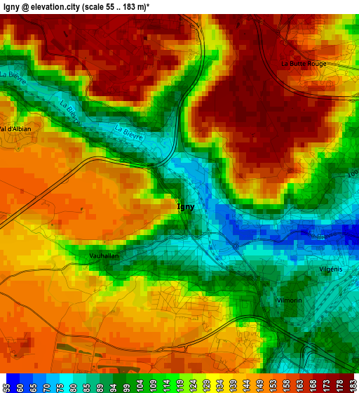
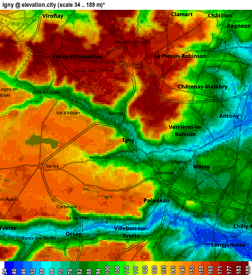
Below is the Elevation map of Igny, which displays elevation range with different colors. Scale of the first map is from 55 to 183 m (180 to 600 ft) with average elevation of 130.2 meters (=427 ft) [note 1]
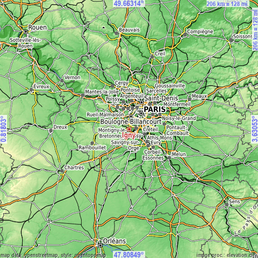
These maps also provides idea of topography and contour of this city, they are displayed at different zoom levels. More info about maps, scale and edge coordinates you can find below images.
| \ | Map #1 | Map #2 | Topo.Map |
| Scale [m] | 55..183 m | 34..189 m | × |
| Scale [ft] | 180..600 ft | 112..620 ft | × |
| Average | 130.2 m = 427 ft | 121.5 m = 399 ft | × |
| Width | 6.44 km = 4 mi | 12.89 km = 8 mi | 206.2 km = 128.1 mi |
| Height | 6.44 km = 4 mi | 12.89 km = 8 mi | 206.2 km = 128.1 mi |
| ↑Max Latitude | 48.77334° | 48.802293° | 49.66314° |
| Latitude at center | 48.74437° | 48.74437° | 48.74437° |
| ↓Min Latitude | 48.715383° | 48.68638° | 47.80849° |
| ← Min Longitude | 2.180335° | 2.136389° | 0.81803° |
| Longitude center | 2.22428° | 2.22428° | 2.22428° |
| →Max Longitude | 2.268225° | 2.312171° | 3.63053° |
Nearby cities:
Cities around Igny sort by population:
• Antony elevation 52 m
5.4 km,  79°
79°
• Massy 84 m
4.7 km,  114°
114°
• Châtenay-Malabry 116 m
3.9 km,  53°
53°
• Palaiseau 93 m
3.5 km,  147°
147°
• Vélizy-Villacoublay 180 m
4.7 km,  332°
332°
• Verrières-le-Buisson 85 m
3.2 km,  87°
87°
• Villebon-sur-Yvette 65 m
4.4 km,  164°
164°
• Jouy-en-Josas 147 m
4.3 km,  292°
292°
• Bièvres 102 m
1.5 km,  344°
344°
• Saclay 155 m
4.2 km,  252°
252°
• Champlan 78 m
5.7 km,  134°
134°
• Vauhallan 103 m
2 km,  232°
232°
Multilingual:
 En español:
Igny elevación 93 m.
 En France:
Igny élévation 93 m.


Sources and notes:
- [note 1] Map square and city borders are not equal. Map elevation data is calculated only from area inside that square.
- [src 1] Elevation data from geonames database provided with same terms of usage.
- [src 2] The elevation map of Igny is generated using elevation data from NASA's 3 arcsec (90m) resolution SRTM data.
- [src 3] Base (background) map © OpenStreetMap contributors tiles are generated by Geofabrik and OpenTopoMap.
Copyright & License:
This Igny Elevation Map is licensed under CC BY-SA. You may reuse any part from this page, if you give a proper credit by linking to this URL:
 More info on terms of use page.