Ingersheim elevation
Ingersheim (Grand Est, Haut-Rhin), France elevation is 217 meters and Ingersheim elevation in feet is 712 ft above sea level [src 1]. Ingersheim is a populated place (feature code) with elevation that is 43 meters (141 ft) bigger than average city elevation in France.
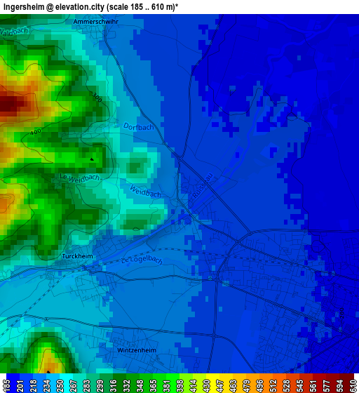
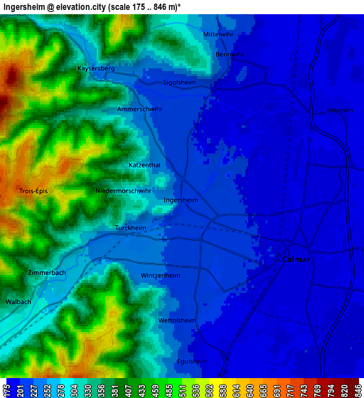
Below is the Elevation map of Ingersheim, which displays elevation range with different colors. Scale of the first map is from 185 to 610 m (607 to 2001 ft) with average elevation of 244.2 meters (=801 ft) [note 1]
These maps also provides idea of topography and contour of this city, they are displayed at different zoom levels. More info about maps, scale and edge coordinates you can find below images.
| \ | Map #1 | Map #2 | Topo.Map |
| Scale [m] | 185..610 m | 175..846 m | × |
| Scale [ft] | 607..2001 ft | 574..2776 ft | × |
| Average | 244.2 m = 801 ft | 294.1 m = 965 ft | × |
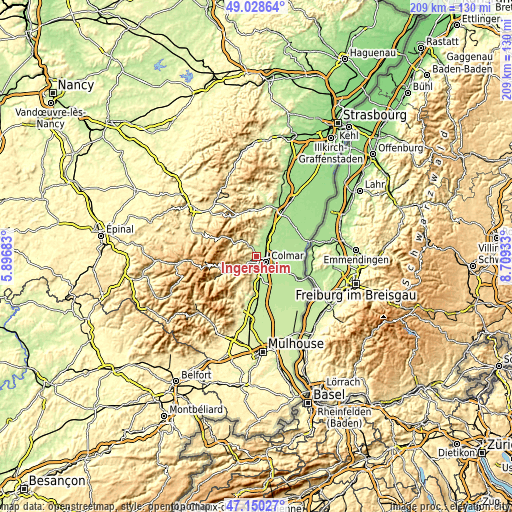
| Width | 6.53 km = 4.1 mi | 13.05 km = 8.1 mi | 208.9 km = 129.8 mi |
| Height | 6.53 km = 4.1 mi | 13.05 km = 8.1 mi | 208.8 km = 129.7 mi |
| ↑Max Latitude | 48.127371° | 48.156695° | 49.02864° |
| Latitude at center | 48.09803° | 48.09803° | 48.09803° |
| ↓Min Latitude | 48.068672° | 48.039298° | 47.15027° |
| ← Min Longitude | 7.259135° | 7.215189° | 5.89683° |
| Longitude center | 7.30308° | 7.30308° | 7.30308° |
| →Max Longitude | 7.347025° | 7.390971° | 8.70933° |
Nearby cities:
Cities around Ingersheim sort by population:
• Colmar elevation 190 m
4.4 km,  116°
116°
• Wintzenheim 230 m
3 km,  198°
198°
• Horbourg-Wihr 188 m
7 km,  105°
105°
• Turckheim 240 m
2.3 km,  238°
238°
• Kaysersberg 251 m
5.3 km,  326°
326°
• Ammerschwihr 239 m
3.4 km, 333°
• Wettolsheim 222 m
4.5 km,  184°
184°
• Houssen 183 m
6.3 km,  60°
60°
• Eguisheim 210 m
6.1 km, 177°
• Riquewihr 309 m
7.7 km,  356°
356°
• Bennwihr 207 m
5.4 km,  17°
17°
• Sigolsheim 228 m
4.1 km, 356°
Multilingual:
 En español:
Ingersheim elevación 217 m.
 En France:
Ingersheim élévation 217 m.
 Auf Deutsch:
Ingersheim höhe über dem Meeresspiegel ist 217 m.

Sources and notes:
- [note 1] Map square and city borders are not equal. Map elevation data is calculated only from area inside that square.
- [src 1] Elevation data from geonames database provided with same terms of usage.
- [src 2] The elevation map of Ingersheim is generated using elevation data from NASA's 3 arcsec (90m) resolution SRTM data.
- [src 3] Base (background) map © OpenStreetMap contributors tiles are generated by Geofabrik and OpenTopoMap.
Copyright & License:
This Ingersheim Elevation Map is licensed under CC BY-SA. You may reuse any part from this page, if you give a proper credit by linking to this URL:
 More info on terms of use page.