Isle elevation
Isle (Nouvelle-Aquitaine, Haute-Vienne), France elevation is 246 meters and Isle elevation in feet is 807 ft above sea level [src 1]. Isle is a populated place (feature code) with elevation that is 72 meters (236 ft) bigger than average city elevation in France.
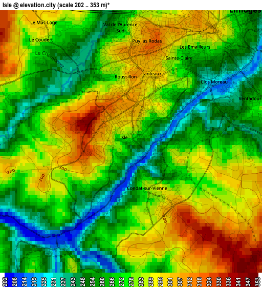
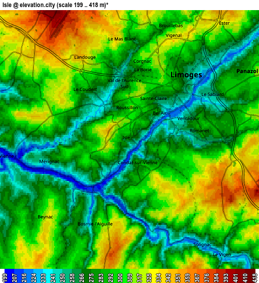
Below is the Elevation map of Isle, which displays elevation range with different colors. Scale of the first map is from 202 to 353 m (663 to 1158 ft) with average elevation of 275.2 meters (=903 ft) [note 1]
These maps also provides idea of topography and contour of this city, they are displayed at different zoom levels. More info about maps, scale and edge coordinates you can find below images.
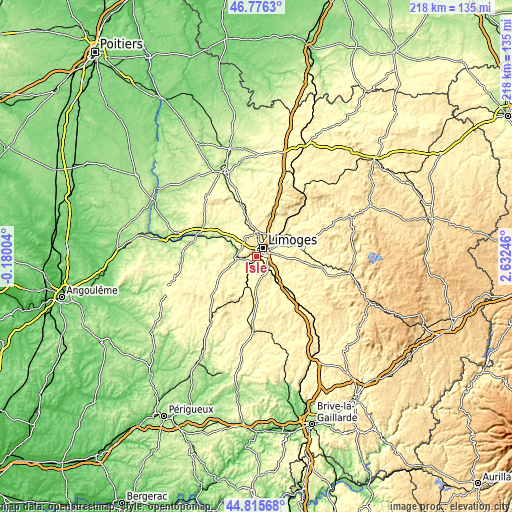
| \ | Map #1 | Map #2 | Topo.Map |
| Scale [m] | 202..353 m | 199..418 m | × |
| Scale [ft] | 663..1158 ft | 653..1371 ft | × |
| Average | 275.2 m = 903 ft | 293.3 m = 962 ft | × |
| Width | 6.81 km = 4.2 mi | 13.63 km = 8.5 mi | 218 km = 135.5 mi |
| Height | 6.81 km = 4.2 mi | 13.63 km = 8.5 mi | 218 km = 135.5 mi |
| ↑Max Latitude | 45.835236° | 45.865846° | 46.7763° |
| Latitude at center | 45.80461° | 45.80461° | 45.80461° |
| ↓Min Latitude | 45.773967° | 45.743307° | 44.81568° |
| ← Min Longitude | 1.182265° | 1.138319° | -0.18004° |
| Longitude center | 1.22621° | 1.22621° | 1.22621° |
| →Max Longitude | 1.270155° | 1.314101° | 2.63246° |
Nearby cities:
Cities around Isle sort by population:
• Limoges elevation 289 m
3.6 km,  27°
27°
• Panazol 308 m
7.5 km,  59°
59°
• Couzeix 366 m
8 km,  6°
6°
• Aixe-sur-Vienne 222 m
7.1 km,  262°
262°
• Feytiat 341 m
8.1 km,  85°
85°
• Condat-sur-Vienne 266 m
1.3 km,  160°
160°
• Verneuil-sur-Vienne 312 m
9.1 km,  302°
302°
• Bosmie-l'Aiguille 250 m
6.4 km,  198°
198°
• Boisseuil 370 m
9 km,  115°
115°
• Le Vigen 242 m
7.6 km,  140°
140°
• Saint-Priest-sous-Aixe 283 m
9.9 km,  278°
278°
• Solignac 241 m
6.7 km,  145°
145°
Multilingual:
 En español:
Isle elevación 246 m.
 En France:
Isle élévation 246 m.


Sources and notes:
- [note 1] Map square and city borders are not equal. Map elevation data is calculated only from area inside that square.
- [src 1] Elevation data from geonames database provided with same terms of usage.
- [src 2] The elevation map of Isle is generated using elevation data from NASA's 3 arcsec (90m) resolution SRTM data.
- [src 3] Base (background) map © OpenStreetMap contributors tiles are generated by Geofabrik and OpenTopoMap.
Copyright & License:
This Isle Elevation Map is licensed under CC BY-SA. You may reuse any part from this page, if you give a proper credit by linking to this URL:
 More info on terms of use page.