Issoire elevation
Issoire (Auvergne-Rhône-Alpes, Département du Puy-de-Dôme), France elevation is 387 meters and Issoire elevation in feet is 1270 ft above sea level [src 1]. Issoire is a seat of a third-order administrative division (feature code) with elevation that is 213 meters (699 ft) bigger than average city elevation in France.
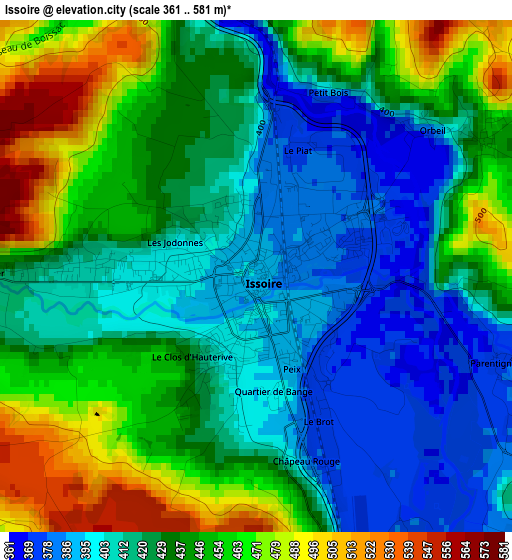
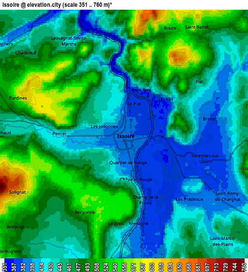
Below is the Elevation map of Issoire, which displays elevation range with different colors. Scale of the first map is from 361 to 581 m (1184 to 1906 ft) with average elevation of 431.4 meters (=1415 ft) [note 1]
These maps also provides idea of topography and contour of this city, they are displayed at different zoom levels. More info about maps, scale and edge coordinates you can find below images.
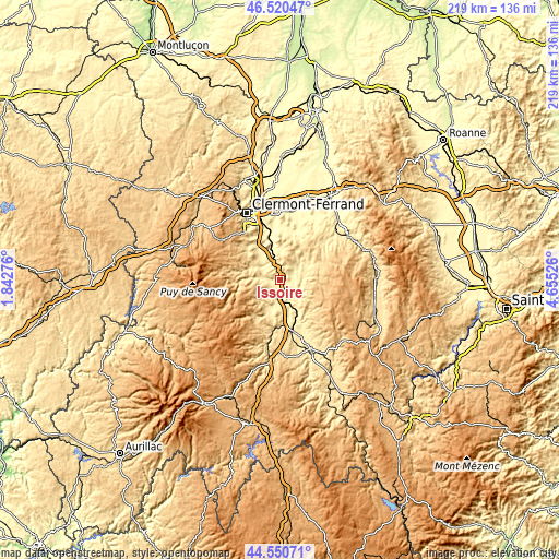
| \ | Map #1 | Map #2 | Topo.Map |
| Scale [m] | 361..581 m | 351..760 m | × |
| Scale [ft] | 1184..1906 ft | 1152..2493 ft | × |
| Average | 431.4 m = 1415 ft | 461.3 m = 1513 ft | × |
| Width | 6.84 km = 4.3 mi | 13.69 km = 8.5 mi | 219 km = 136.1 mi |
| Height | 6.84 km = 4.3 mi | 13.69 km = 8.5 mi | 219 km = 136.1 mi |
| ↑Max Latitude | 45.574989° | 45.605741° | 46.52047° |
| Latitude at center | 45.54422° | 45.54422° | 45.54422° |
| ↓Min Latitude | 45.513434° | 45.482631° | 44.55071° |
| ← Min Longitude | 3.205065° | 3.161119° | 1.84276° |
| Longitude center | 3.24901° | 3.24901° | 3.24901° |
| →Max Longitude | 3.292955° | 3.336901° | 4.65526° |
Nearby cities:
Cities around Issoire sort by population:
• Vic-le-Comte elevation 484 m
11 km,  358°
358°
• Veyre-Monton 365 m
15.1 km,  336°
336°
• Brassac-les-Mines 403 m
15.8 km,  156°
156°
• Sainte-Florine 402 m
16.4 km, 160°
• Auzat-la-Combelle 457 m
11.6 km,  152°
152°
• Mirefleurs 396 m
16.7 km,  353°
353°
• Saint-Germain-Lembron 415 m
9.6 km,  184°
184°
• Champeix 476 m
10.6 km,  297°
297°
• Tallende 395 m
17 km,  325°
325°
• Sauxillanges 467 m
9.6 km,  85°
85°
• Plauzat 424 m
11.6 km,  317°
317°
• Le Breuil-sur-Couze 393 m
8.5 km,  172°
172°
Multilingual:
 En español:
Issoire elevación 387 m.
 En France:
Issoire élévation 387 m.


Sources and notes:
- [note 1] Map square and city borders are not equal. Map elevation data is calculated only from area inside that square.
- [src 1] Elevation data from geonames database provided with same terms of usage.
- [src 2] The elevation map of Issoire is generated using elevation data from NASA's 3 arcsec (90m) resolution SRTM data.
- [src 3] Base (background) map © OpenStreetMap contributors tiles are generated by Geofabrik and OpenTopoMap.
Copyright & License:
This Issoire Elevation Map is licensed under CC BY-SA. You may reuse any part from this page, if you give a proper credit by linking to this URL:
 More info on terms of use page.