Issoudun elevation
Issoudun (Centre, Département de l'Indre), France elevation is 146 meters and Issoudun elevation in feet is 479 ft above sea level [src 1]. Issoudun is a seat of a third-order administrative division (feature code) with elevation that is 28 meters (92 ft) smaller than average city elevation in France.
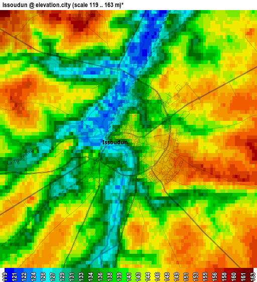
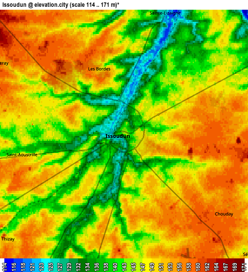
Below is the Elevation map of Issoudun, which displays elevation range with different colors. Scale of the first map is from 119 to 163 m (390 to 535 ft) with average elevation of 141.6 meters (=465 ft) [note 1]
These maps also provides idea of topography and contour of this city, they are displayed at different zoom levels. More info about maps, scale and edge coordinates you can find below images.
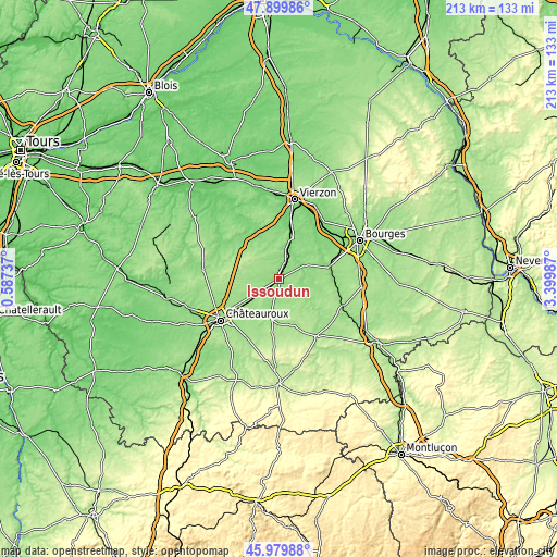
| \ | Map #1 | Map #2 | Topo.Map |
| Scale [m] | 119..163 m | 114..171 m | × |
| Scale [ft] | 390..535 ft | 374..561 ft | × |
| Average | 141.6 m = 465 ft | 147.2 m = 483 ft | × |
| Width | 6.67 km = 4.1 mi | 13.34 km = 8.3 mi | 213.5 km = 132.7 mi |
| Height | 6.67 km = 4.1 mi | 13.34 km = 8.3 mi | 213.5 km = 132.7 mi |
| ↑Max Latitude | 46.978471° | 47.008445° | 47.89986° |
| Latitude at center | 46.94848° | 46.94848° | 46.94848° |
| ↓Min Latitude | 46.918472° | 46.888447° | 45.97988° |
| ← Min Longitude | 1.949675° | 1.905729° | 0.58737° |
| Longitude center | 1.99362° | 1.99362° | 1.99362° |
| →Max Longitude | 2.037565° | 2.081511° | 3.39987° |
Nearby cities:
Cities around Issoudun sort by population:
• Déols elevation 149 m
25.7 km,  238°
238°
• Saint-Florent-sur-Cher 145 m
20.2 km,  74°
74°
• Méreau 105 m
24.2 km,  10°
10°
• Vatan 129 m
19.7 km,  315°
315°
• Reuilly 126 m
15.6 km, 13°
• Montierchaume 157 m
19.3 km, 240°
• Graçay 107 m
24.4 km,  332°
332°
• Lunery 131 m
20.9 km,  93°
93°
• Massay 122 m
22.8 km,  359°
359°
• Neuvy-Pailloux 150 m
12.3 km,  234°
234°
• Sainte-Lizaigne 126 m
6.9 km,  18°
18°
• Chârost 126 m
10.6 km,  61°
61°
Multilingual:
 En español:
Issoudun elevación 146 m.
 En France:
Issoudun élévation 146 m.
 Auf Deutsch:
Issoudun höhe über dem Meeresspiegel ist 146 m.

Sources and notes:
- [note 1] Map square and city borders are not equal. Map elevation data is calculated only from area inside that square.
- [src 1] Elevation data from geonames database provided with same terms of usage.
- [src 2] The elevation map of Issoudun is generated using elevation data from NASA's 3 arcsec (90m) resolution SRTM data.
- [src 3] Base (background) map © OpenStreetMap contributors tiles are generated by Geofabrik and OpenTopoMap.
Copyright & License:
This Issoudun Elevation Map is licensed under CC BY-SA. You may reuse any part from this page, if you give a proper credit by linking to this URL:
 More info on terms of use page.