Jeumont elevation
Jeumont (Hauts-de-France, Nord), France elevation is 132 meters and Jeumont elevation in feet is 433 ft above sea level [src 1]. Jeumont is a populated place (feature code) with elevation that is 42 meters (138 ft) smaller than average city elevation in France.
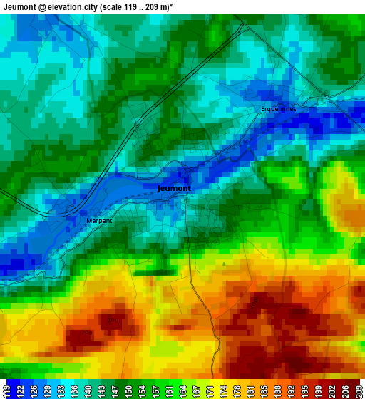
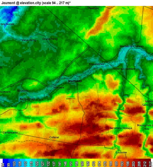
Below is the Elevation map of Jeumont, which displays elevation range with different colors. Scale of the first map is from 119 to 209 m (390 to 686 ft) with average elevation of 154.6 meters (=507 ft) [note 1]
These maps also provides idea of topography and contour of this city, they are displayed at different zoom levels. More info about maps, scale and edge coordinates you can find below images.
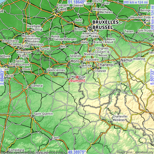
| \ | Map #1 | Map #2 | Topo.Map |
| Scale [m] | 119..209 m | 94..217 m | × |
| Scale [ft] | 390..686 ft | 308..712 ft | × |
| Average | 154.6 m = 507 ft | 156.6 m = 514 ft | × |
| Width | 6.24 km = 3.9 mi | 12.49 km = 7.8 mi | 199.8 km = 124.1 mi |
| Height | 6.24 km = 3.9 mi | 12.49 km = 7.8 mi | 199.8 km = 124.1 mi |
| ↑Max Latitude | 50.324645° | 50.352693° | 51.18645° |
| Latitude at center | 50.29658° | 50.29658° | 50.29658° |
| ↓Min Latitude | 50.268499° | 50.240401° | 49.38975° |
| ← Min Longitude | 4.057135° | 4.013189° | 2.69483° |
| Longitude center | 4.10108° | 4.10108° | 4.10108° |
| →Max Longitude | 4.145025° | 4.188971° | 5.50733° |
Nearby cities:
Cities around Jeumont sort by population:
• Maubeuge elevation 143 m
9.3 km,  257°
257°
• Hautmont 141 m
13.7 km,  248°
248°
• Louvroil 161 m
10.5 km, 249°
• Feignies 149 m
13.2 km,  270°
270°
• Ferrière-la-Grande 140 m
9 km,  239°
239°
• Rousies 130 m
7.4 km, 249°
• Boussois 125 m
4.3 km, 258°
• Marpent 134 m
1.6 km, 253°
• Recquignies 127 m
4.7 km, 252°
• Cousolre 154 m
6.6 km,  148°
148°
• Solre-le-Château 187 m
13.6 km,  183°
183°
• Colleret 172 m
4.6 km,  198°
198°
Multilingual:
 En español:
Jeumont elevación 132 m.
 En France:
Jeumont élévation 132 m.


Sources and notes:
- [note 1] Map square and city borders are not equal. Map elevation data is calculated only from area inside that square.
- [src 1] Elevation data from geonames database provided with same terms of usage.
- [src 2] The elevation map of Jeumont is generated using elevation data from NASA's 3 arcsec (90m) resolution SRTM data.
- [src 3] Base (background) map © OpenStreetMap contributors tiles are generated by Geofabrik and OpenTopoMap.
Copyright & License:
This Jeumont Elevation Map is licensed under CC BY-SA. You may reuse any part from this page, if you give a proper credit by linking to this URL:
 More info on terms of use page.