Maubeuge elevation
Maubeuge (Hauts-de-France, Nord), France elevation is 143 meters and Maubeuge elevation in feet is 469 ft above sea level [src 1]. Maubeuge is a populated place (feature code) with elevation that is 31 meters (102 ft) smaller than average city elevation in France.
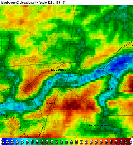
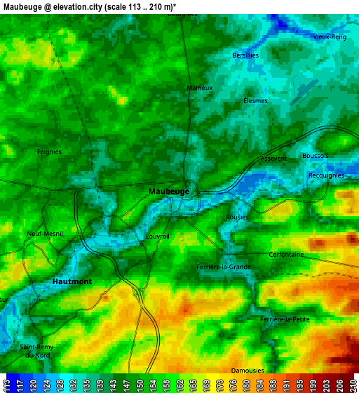
Below is the Elevation map of Maubeuge, which displays elevation range with different colors. Scale of the first map is from 121 to 169 m (397 to 554 ft) with average elevation of 144.6 meters (=474 ft) [note 1]
These maps also provides idea of topography and contour of this city, they are displayed at different zoom levels. More info about maps, scale and edge coordinates you can find below images.
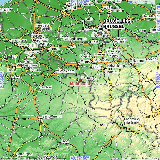
| \ | Map #1 | Map #2 | Topo.Map |
| Scale [m] | 121..169 m | 113..210 m | × |
| Scale [ft] | 397..554 ft | 371..689 ft | × |
| Average | 144.6 m = 474 ft | 151.2 m = 496 ft | × |
| Width | 6.25 km = 3.9 mi | 12.49 km = 7.8 mi | 199.8 km = 124.1 mi |
| Height | 6.25 km = 3.9 mi | 12.49 km = 7.8 mi | 199.8 km = 124.1 mi |
| ↑Max Latitude | 50.306825° | 50.334884° | 51.16895° |
| Latitude at center | 50.27875° | 50.27875° | 50.27875° |
| ↓Min Latitude | 50.250658° | 50.22255° | 49.37158° |
| ← Min Longitude | 3.928725° | 3.884779° | 2.56642° |
| Longitude center | 3.97267° | 3.97267° | 3.97267° |
| →Max Longitude | 4.016615° | 4.060561° | 5.37892° |
Nearby cities:
Cities around Maubeuge sort by population:
• Hautmont elevation 141 m
4.8 km,  229°
229°
• Jeumont 132 m
9.3 km,  77°
77°
• Louvroil 161 m
1.8 km,  203°
203°
• Feignies 149 m
4.6 km,  297°
297°
• Ferrière-la-Grande 140 m
3 km,  151°
151°
• Rousies 130 m
2.3 km,  104°
104°
• Boussois 125 m
5 km, 76°
• Marpent 134 m
7.7 km, 78°
• Recquignies 127 m
4.6 km, 82°
• Bachant 143 m
10.2 km, 226°
• La Longueville 145 m
8.3 km,  278°
278°
• Colleret 172 m
8.1 km,  107°
107°
Multilingual:
 En español:
Maubeuge elevación 143 m.
 En France:
Maubeuge élévation 143 m.
 Auf Deutsch:
Maubeuge höhe über dem Meeresspiegel ist 143 m.

Sources and notes:
- [note 1] Map square and city borders are not equal. Map elevation data is calculated only from area inside that square.
- [src 1] Elevation data from geonames database provided with same terms of usage.
- [src 2] The elevation map of Maubeuge is generated using elevation data from NASA's 3 arcsec (90m) resolution SRTM data.
- [src 3] Base (background) map © OpenStreetMap contributors tiles are generated by Geofabrik and OpenTopoMap.
Copyright & License:
This Maubeuge Elevation Map is licensed under CC BY-SA. You may reuse any part from this page, if you give a proper credit by linking to this URL:
 More info on terms of use page.