La Chapelle-Gauthier elevation
La Chapelle-Gauthier (Île-de-France, Seine-et-Marne), France elevation is 105 meters and La Chapelle-Gauthier elevation in feet is 344 ft above sea level [src 1]. La Chapelle-Gauthier is a populated place (feature code) with elevation that is 69 meters (226 ft) smaller than average city elevation in France.
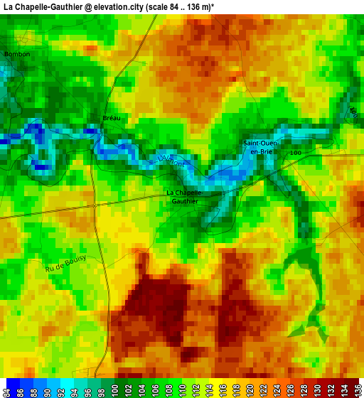
Below is the Elevation map of La Chapelle-Gauthier, which displays elevation range with different colors. Scale of the first map is from 84 to 136 m (276 to 446 ft) with average elevation of 113 meters (=371 ft) [note 1]
These maps also provides idea of topography and contour of this city, they are displayed at different zoom levels. More info about maps, scale and edge coordinates you can find below images.
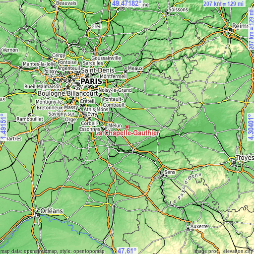
| \ | Map #1 | Topo.Map |
| Scale [m] | 84..136 m | × |
| Scale [ft] | 276..446 ft | × |
| Average | 113 m = 371 ft | × |
| Width | 6.47 km = 4 mi | 207 km = 128.6 mi |
| Height | 6.47 km = 4 mi | 207 km = 128.6 mi |
| ↑Max Latitude | 48.578552° | 49.47182° |
| Latitude at center | 48.54947° | 48.54947° |
| ↓Min Latitude | 48.520371° | 47.61° |
| ← Min Longitude | 2.853815° | 1.49151° |
| Longitude center | 2.89776° | 2.89776° |
| →Max Longitude | 2.941705° | 4.30401° |
Nearby cities:
Cities around La Chapelle-Gauthier sort by population:
• Nangis elevation 129 m
8.5 km,  85°
85°
• Le Châtelet-en-Brie 93 m
9.1 km,  238°
238°
• Mormant 110 m
6.6 km,  355°
355°
• Chaumes-en-Brie 101 m
13.9 km,  342°
342°
• Héricy 51 m
14.9 km,  221°
221°
• Guignes 93 m
11.8 km,  322°
322°
• Samois-sur-Seine 83 m
15.3 km,  225°
225°
• Maincy 62 m
14.5 km,  270°
270°
• Ozouer-le-Voulgis 97 m
15.3 km, 323°
• Courpalay 108 m
12.1 km,  22°
22°
• Moisenay 81 m
12 km,  276°
276°
• Bailly-Carrois 120 m
7.6 km,  63°
63°
Multilingual:
 En español:
La Chapelle-Gauthier elevación 105 m.
 En France:
La Chapelle-Gauthier élévation 105 m.
 Auf Deutsch:
La Chapelle-Gauthier höhe über dem Meeresspiegel ist 105 m.
 На русском:
La Chapelle-Gauthier высота над уровнем моря 105 м
Sources and notes:
- [note 1] Map square and city borders are not equal. Map elevation data is calculated only from area inside that square.
- [src 1] Elevation data from geonames database provided with same terms of usage.
- [src 2] The elevation map of La Chapelle-Gauthier is generated using elevation data from NASA's 3 arcsec (90m) resolution SRTM data.
- [src 3] Base (background) map © OpenStreetMap contributors tiles are generated by Geofabrik and OpenTopoMap.
Copyright & License:
This La Chapelle-Gauthier Elevation Map is licensed under CC BY-SA. You may reuse any part from this page, if you give a proper credit by linking to this URL:
 More info on terms of use page.