Nangis elevation
Nangis (Île-de-France, Seine-et-Marne), France elevation is 129 meters and Nangis elevation in feet is 423 ft above sea level [src 1]. Nangis is a populated place (feature code) with elevation that is 45 meters (148 ft) smaller than average city elevation in France.
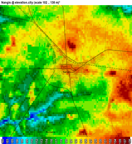
Below is the Elevation map of Nangis, which displays elevation range with different colors. Scale of the first map is from 102 to 138 m (335 to 453 ft) with average elevation of 121.2 meters (=398 ft) [note 1]
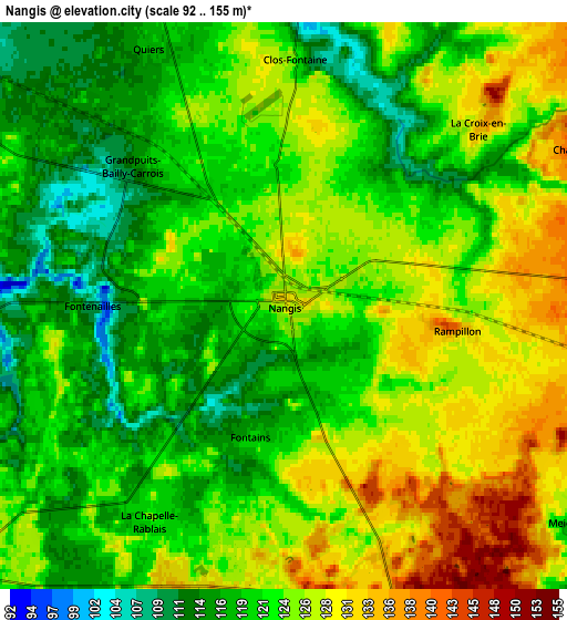
These maps also provides idea of topography and contour of this city, they are displayed at different zoom levels. More info about maps, scale and edge coordinates you can find below images.
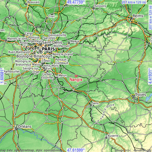
| \ | Map #1 | Map #2 | Topo.Map |
| Scale [m] | 102..138 m | 92..155 m | × |
| Scale [ft] | 335..453 ft | 302..509 ft | × |
| Average | 121.2 m = 398 ft | 122.7 m = 403 ft | × |
| Width | 6.47 km = 4 mi | 12.94 km = 8 mi | 207 km = 128.6 mi |
| Height | 6.47 km = 4 mi | 12.94 km = 8 mi | 207 km = 128.6 mi |
| ↑Max Latitude | 48.584429° | 48.613491° | 49.47759° |
| Latitude at center | 48.55535° | 48.55535° | 48.55535° |
| ↓Min Latitude | 48.526254° | 48.497142° | 47.61599° |
| ← Min Longitude | 2.969115° | 2.925169° | 1.60681° |
| Longitude center | 3.01306° | 3.01306° | 3.01306° |
| →Max Longitude | 3.057005° | 3.100951° | 4.41931° |
Nearby cities:
Cities around Nangis sort by population:
• Le Châtelet-en-Brie elevation 93 m
17.2 km,  251°
251°
• Mormant 110 m
10.8 km,  303°
303°
• Rozay-en-Brie 102 m
14.8 km,  344°
344°
• Donnemarie-Dontilly 75 m
12.3 km,  134°
134°
• Jouy-le-Châtel 125 m
15.1 km,  34°
34°
• Courpalay 108 m
11.1 km, 339°
• La Chapelle-Gauthier 105 m
8.5 km,  265°
265°
• Montigny-Lencoup 87 m
12.2 km,  161°
161°
• Chenoise 146 m
14.9 km,  63°
63°
• Bailly-Carrois 120 m
3.2 km,  329°
329°
• Châtenay-sur-Seine 51 m
16.4 km, 158°
• Salins 75 m
14.9 km,  177°
177°
Multilingual:
 En español:
Nangis elevación 129 m.
 En France:
Nangis élévation 129 m.


Sources and notes:
- [note 1] Map square and city borders are not equal. Map elevation data is calculated only from area inside that square.
- [src 1] Elevation data from geonames database provided with same terms of usage.
- [src 2] The elevation map of Nangis is generated using elevation data from NASA's 3 arcsec (90m) resolution SRTM data.
- [src 3] Base (background) map © OpenStreetMap contributors tiles are generated by Geofabrik and OpenTopoMap.
Copyright & License:
This Nangis Elevation Map is licensed under CC BY-SA. You may reuse any part from this page, if you give a proper credit by linking to this URL:
 More info on terms of use page.