La Chapelle-Saint-Luc elevation
La Chapelle-Saint-Luc (Grand Est, Département de l'Aube), France elevation is 107 meters and La Chapelle-Saint-Luc elevation in feet is 351 ft above sea level [src 1]. La Chapelle-Saint-Luc is a populated place (feature code) with elevation that is 67 meters (220 ft) smaller than average city elevation in France.
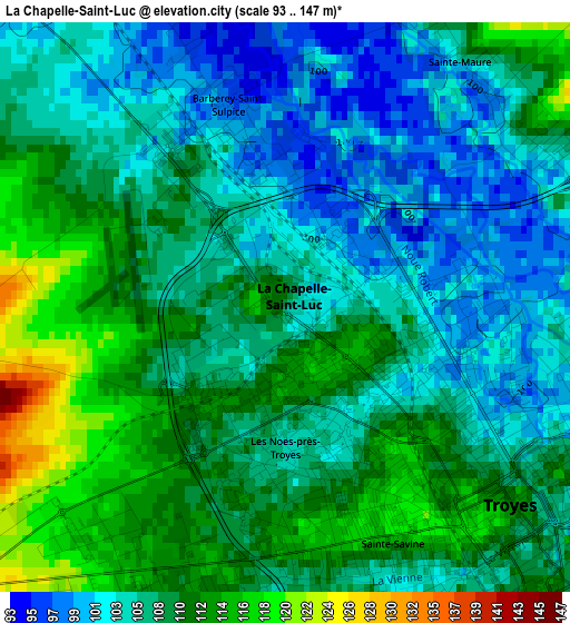
Below is the Elevation map of La Chapelle-Saint-Luc, which displays elevation range with different colors. Scale of the first map is from 93 to 147 m (305 to 482 ft) with average elevation of 107.5 meters (=353 ft) [note 1]
These maps also provides idea of topography and contour of this city, they are displayed at different zoom levels. More info about maps, scale and edge coordinates you can find below images.
| \ | Map #1 | Map #2 | Topo.Map |
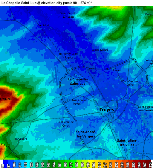
| Scale [m] | 93..147 m | 90..274 m | × |
| Scale [ft] | 305..482 ft | 295..899 ft | × |
| Average | 107.5 m = 353 ft | 119 m = 390 ft | × |
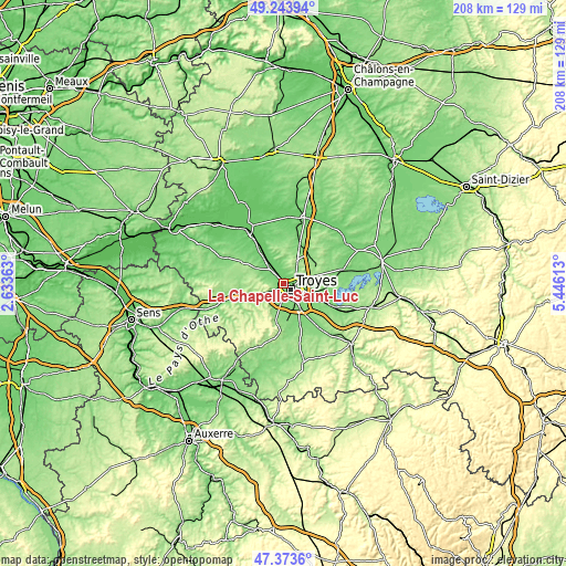
| Width | 6.5 km = 4 mi | 13 km = 8.1 mi | 208 km = 129.2 mi |
| Height | 6.5 km = 4 mi | 13 km = 8.1 mi | 207.9 km = 129.2 mi |
| ↑Max Latitude | 48.346555° | 48.375754° | 49.24394° |
| Latitude at center | 48.31734° | 48.31734° | 48.31734° |
| ↓Min Latitude | 48.288108° | 48.258859° | 47.3736° |
| ← Min Longitude | 3.995935° | 3.951989° | 2.63363° |
| Longitude center | 4.03988° | 4.03988° | 4.03988° |
| →Max Longitude | 4.083825° | 4.127771° | 5.44613° |
Nearby cities:
Cities around La Chapelle-Saint-Luc sort by population:
• Troyes elevation 105 m
3.8 km,  118°
118°
• Saint-André-les-Vergers 105 m
3.7 km,  165°
165°
• Sainte-Savine 112 m
2.4 km, 168°
• Saint-Julien-les-Villas 110 m
6.7 km,  139°
139°
• Pont-Sainte-Marie 104 m
4 km,  88°
88°
• Les Noës-près-Troyes 106 m
1.6 km,  164°
164°
• La Rivière-de-Corps 113 m
3.6 km,  205°
205°
• Rosières-près-Troyes 114 m
6.7 km, 157°
• Saint-Lyé 96 m
6.1 km,  330°
330°
• Saint-Parres-aux-Tertres 115 m
6.1 km,  110°
110°
• Saint-Germain 118 m
6.7 km,  184°
184°
• Sainte-Maure 111 m
3.6 km,  23°
23°
Multilingual:
 En español:
La Chapelle-Saint-Luc elevación 107 m.
 En France:
La Chapelle-Saint-Luc élévation 107 m.
 Auf Deutsch:
La Chapelle-Saint-Luc höhe über dem Meeresspiegel ist 107 m.

Sources and notes:
- [note 1] Map square and city borders are not equal. Map elevation data is calculated only from area inside that square.
- [src 1] Elevation data from geonames database provided with same terms of usage.
- [src 2] The elevation map of La Chapelle-Saint-Luc is generated using elevation data from NASA's 3 arcsec (90m) resolution SRTM data.
- [src 3] Base (background) map © OpenStreetMap contributors tiles are generated by Geofabrik and OpenTopoMap.
Copyright & License:
This La Chapelle-Saint-Luc Elevation Map is licensed under CC BY-SA. You may reuse any part from this page, if you give a proper credit by linking to this URL:
 More info on terms of use page.