La Flèche elevation
La Flèche (Pays de la Loire, Sarthe), France elevation is 33 meters and La Flèche elevation in feet is 108 ft above sea level [src 1]. La Flèche is a seat of a third-order administrative division (feature code) with elevation that is 141 meters (463 ft) smaller than average city elevation in France.
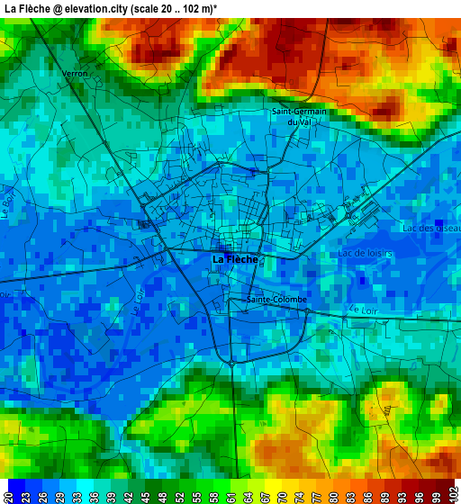
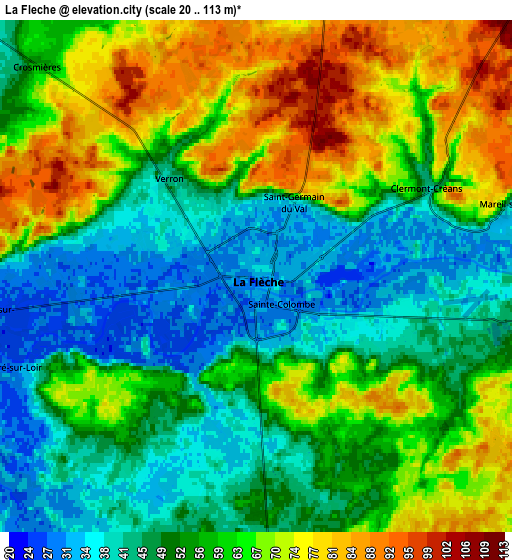
Below is the Elevation map of La Flèche, which displays elevation range with different colors. Scale of the first map is from 20 to 102 m (66 to 335 ft) with average elevation of 44.5 meters (=146 ft) [note 1]
These maps also provides idea of topography and contour of this city, they are displayed at different zoom levels. More info about maps, scale and edge coordinates you can find below images.
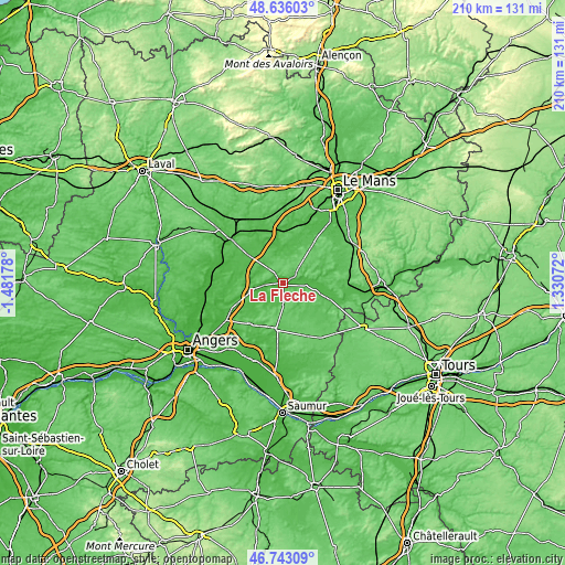
| \ | Map #1 | Map #2 | Topo.Map |
| Scale [m] | 20..102 m | 20..113 m | × |
| Scale [ft] | 66..335 ft | 66..371 ft | × |
| Average | 44.5 m = 146 ft | 57.1 m = 187 ft | × |
| Width | 6.58 km = 4.1 mi | 13.15 km = 8.2 mi | 210.5 km = 130.8 mi |
| Height | 6.58 km = 4.1 mi | 13.15 km = 8.2 mi | 210.5 km = 130.8 mi |
| ↑Max Latitude | 47.727718° | 47.75727° | 48.63603° |
| Latitude at center | 47.69815° | 47.69815° | 47.69815° |
| ↓Min Latitude | 47.668565° | 47.638963° | 46.74309° |
| ← Min Longitude | -0.119475° | -0.163421° | -1.48178° |
| Longitude center | -0.07553° | -0.07553° | -0.07553° |
| →Max Longitude | -0.031585° | 0.012361° | 1.33072° |
Nearby cities:
Cities around La Flèche sort by population:
• Le Lude elevation 51 m
18.3 km,  108°
108°
• Durtal 38 m
12.2 km,  256°
256°
• Baugé-en-Anjou 65 m
17.2 km,  187°
187°
• Cérans-Foulletourte 70 m
18.3 km,  38°
38°
• Malicorne-sur-Sarthe 37 m
12.8 km,  357°
357°
• Parcé-sur-Sarthe 44 m
18.7 km,  329°
329°
• Luché-Pringé 43 m
11.3 km,  87°
87°
• Mézeray 42 m
14.9 km,  16°
16°
• Mansigné 61 m
16.6 km,  70°
70°
• Bazouges-sur-le-Loir 30 m
7.1 km, 261°
• Vion 48 m
18.2 km,  317°
317°
• Clermont-Créans 40 m
5.1 km,  63°
63°
Multilingual:
 En español:
La Flèche elevación 33 m.
 En France:
La Flèche élévation 33 m.
 Auf Deutsch:
La Flèche höhe über dem Meeresspiegel ist 33 m.

Sources and notes:
- [note 1] Map square and city borders are not equal. Map elevation data is calculated only from area inside that square.
- [src 1] Elevation data from geonames database provided with same terms of usage.
- [src 2] The elevation map of La Flèche is generated using elevation data from NASA's 3 arcsec (90m) resolution SRTM data.
- [src 3] Base (background) map © OpenStreetMap contributors tiles are generated by Geofabrik and OpenTopoMap.
Copyright & License:
This La Flèche Elevation Map is licensed under CC BY-SA. You may reuse any part from this page, if you give a proper credit by linking to this URL:
 More info on terms of use page.