Lagnieu elevation
Lagnieu (Auvergne-Rhône-Alpes, Département de l'Ain), France elevation is 235 meters and Lagnieu elevation in feet is 771 ft above sea level [src 1]. Lagnieu is a populated place (feature code) with elevation that is 61 meters (200 ft) bigger than average city elevation in France.
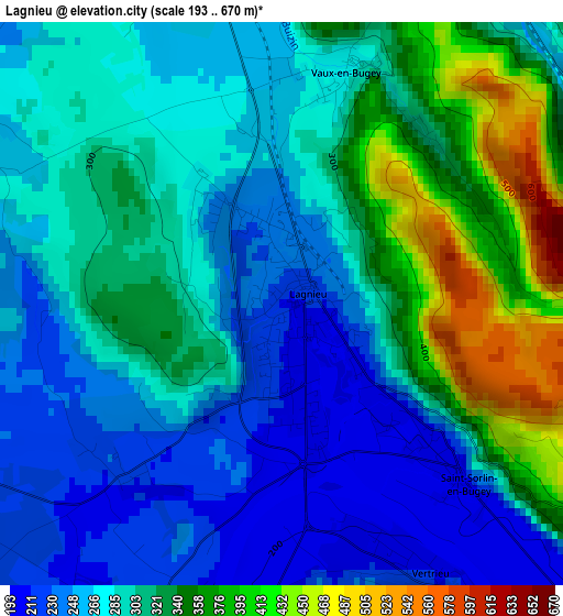
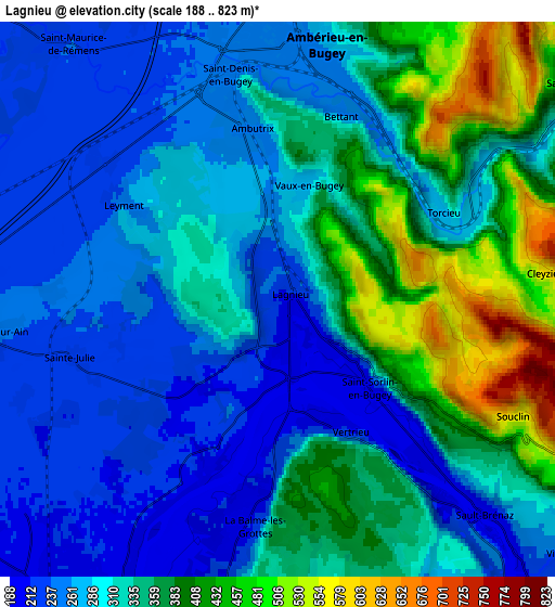
Below is the Elevation map of Lagnieu, which displays elevation range with different colors. Scale of the first map is from 193 to 670 m (633 to 2198 ft) with average elevation of 297.6 meters (=976 ft) [note 1]
These maps also provides idea of topography and contour of this city, they are displayed at different zoom levels. More info about maps, scale and edge coordinates you can find below images.
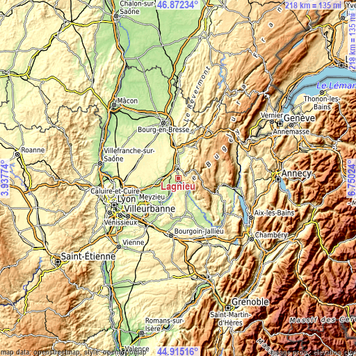
| \ | Map #1 | Map #2 | Topo.Map |
| Scale [m] | 193..670 m | 188..823 m | × |
| Scale [ft] | 633..2198 ft | 617..2700 ft | × |
| Average | 297.6 m = 976 ft | 320.7 m = 1052 ft | × |
| Width | 6.8 km = 4.2 mi | 13.6 km = 8.5 mi | 217.6 km = 135.2 mi |
| Height | 6.8 km = 4.2 mi | 13.6 km = 8.5 mi | 217.6 km = 135.2 mi |
| ↑Max Latitude | 45.932942° | 45.963498° | 46.87234° |
| Latitude at center | 45.90237° | 45.90237° | 45.90237° |
| ↓Min Latitude | 45.871781° | 45.841175° | 44.91516° |
| ← Min Longitude | 5.300045° | 5.256099° | 3.93774° |
| Longitude center | 5.34399° | 5.34399° | 5.34399° |
| →Max Longitude | 5.387935° | 5.431881° | 6.75024° |
Nearby cities:
Cities around Lagnieu sort by population:
• Ambérieu-en-Bugey elevation 300 m
6.4 km,  5°
5°
• Saint-Rambert-en-Bugey 420 m
8.7 km,  54°
54°
• Saint-Denis-en-Bugey 247 m
5.4 km,  346°
346°
• Château-Gaillard 235 m
8.4 km,  338°
338°
• Porcieu 264 m
8.8 km,  149°
149°
• Châtillon-la-Palud 221 m
10.4 km,  317°
317°
• Chazey-sur-Ain 238 m
7.1 km,  261°
261°
• Vaux-en-Bugey 344 m
2.8 km, 11°
• Villebois 262 m
9.2 km,  131°
131°
• Saint-Sorlin-en-Bugey 439 m
2.6 km,  136°
136°
• Sault-Brénaz 270 m
6.3 km, 136°
• Leyment 266 m
4.7 km,  300°
300°
Multilingual:
 En español:
Lagnieu elevación 235 m.
 En France:
Lagnieu élévation 235 m.


Sources and notes:
- [note 1] Map square and city borders are not equal. Map elevation data is calculated only from area inside that square.
- [src 1] Elevation data from geonames database provided with same terms of usage.
- [src 2] The elevation map of Lagnieu is generated using elevation data from NASA's 3 arcsec (90m) resolution SRTM data.
- [src 3] Base (background) map © OpenStreetMap contributors tiles are generated by Geofabrik and OpenTopoMap.
Copyright & License:
This Lagnieu Elevation Map is licensed under CC BY-SA. You may reuse any part from this page, if you give a proper credit by linking to this URL:
 More info on terms of use page.