Descartes elevation
Descartes (Centre, Département d'Indre-et-Loire), France elevation is 46 meters and Descartes elevation in feet is 151 ft above sea level [src 1]. Descartes is a populated place (feature code) with elevation that is 128 meters (420 ft) smaller than average city elevation in France.
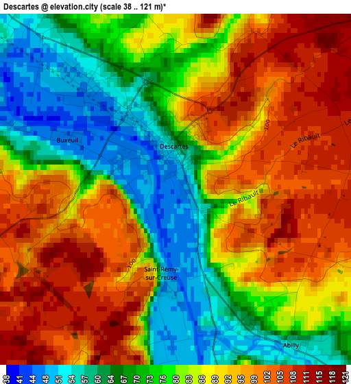
Below is the Elevation map of Descartes, which displays elevation range with different colors. Scale of the first map is from 38 to 121 m (125 to 397 ft) with average elevation of 83.8 meters (=275 ft) [note 1]
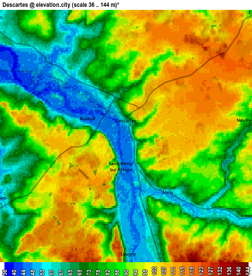
These maps also provides idea of topography and contour of this city, they are displayed at different zoom levels. More info about maps, scale and edge coordinates you can find below images.
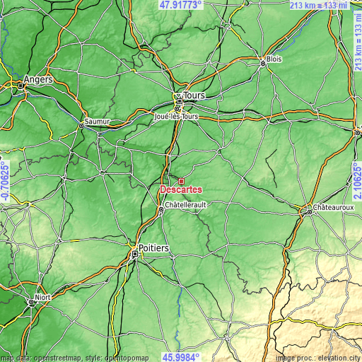
| \ | Map #1 | Map #2 | Topo.Map |
| Scale [m] | 38..121 m | 36..144 m | × |
| Scale [ft] | 125..397 ft | 118..472 ft | × |
| Average | 83.8 m = 275 ft | 87.3 m = 286 ft | × |
| Width | 6.67 km = 4.1 mi | 13.34 km = 8.3 mi | 213.4 km = 132.6 mi |
| Height | 6.67 km = 4.1 mi | 13.34 km = 8.3 mi | 213.4 km = 132.6 mi |
| ↑Max Latitude | 46.996651° | 47.026615° | 47.91773° |
| Latitude at center | 46.96667° | 46.96667° | 46.96667° |
| ↓Min Latitude | 46.936672° | 46.906658° | 45.9984° |
| ← Min Longitude | 0.656055° | 0.612109° | -0.70625° |
| Longitude center | 0.7° | 0.7° | 0.7° |
| →Max Longitude | 0.743945° | 0.787891° | 2.10625° |
Nearby cities:
Cities around Descartes sort by population:
• Châtellerault elevation 63 m
20.4 km,  215°
215°
• Sainte-Maure-de-Touraine 78 m
17.1 km,  339°
339°
• Dangé-Saint-Romain 42 m
8.4 km,  243°
243°
• Ligueil 79 m
12.3 km,  47°
47°
• Les Ormes 70 m
7.2 km,  274°
274°
• Manthelan 109 m
20.1 km,  20°
20°
• Abilly 72 m
4.5 km,  145°
145°
• Antran 48 m
17.3 km, 224°
• La Celle-Saint-Avant 59 m
9.5 km,  310°
310°
• Preuilly-sur-Claise 87 m
21.5 km,  125°
125°
• Le Grand-Pressigny 64 m
9.4 km,  123°
123°
• Saint-Sauveur 103 m
18.5 km,  198°
198°
Multilingual:
 En español:
Descartes elevación 46 m.
 En France:
Descartes élévation 46 m.
 Auf Deutsch:
Descartes höhe über dem Meeresspiegel ist 46 m.

Sources and notes:
- [note 1] Map square and city borders are not equal. Map elevation data is calculated only from area inside that square.
- [src 1] Elevation data from geonames database provided with same terms of usage.
- [src 2] The elevation map of Descartes is generated using elevation data from NASA's 3 arcsec (90m) resolution SRTM data.
- [src 3] Base (background) map © OpenStreetMap contributors tiles are generated by Geofabrik and OpenTopoMap.
Copyright & License:
This Descartes Elevation Map is licensed under CC BY-SA. You may reuse any part from this page, if you give a proper credit by linking to this URL:
 More info on terms of use page.