Châtellerault elevation
Châtellerault (Nouvelle-Aquitaine, Vienne), France elevation is 63 meters and Châtellerault elevation in feet is 207 ft above sea level [src 1]. Châtellerault is a seat of a third-order administrative division (feature code) with elevation that is 111 meters (364 ft) smaller than average city elevation in France.
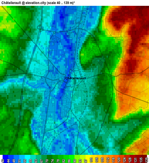
Below is the Elevation map of Châtellerault, which displays elevation range with different colors. Scale of the first map is from 40 to 139 m (131 to 456 ft) with average elevation of 74.9 meters (=246 ft) [note 1]
These maps also provides idea of topography and contour of this city, they are displayed at different zoom levels. More info about maps, scale and edge coordinates you can find below images.
| \ | Map #1 | Map #2 | Topo.Map |
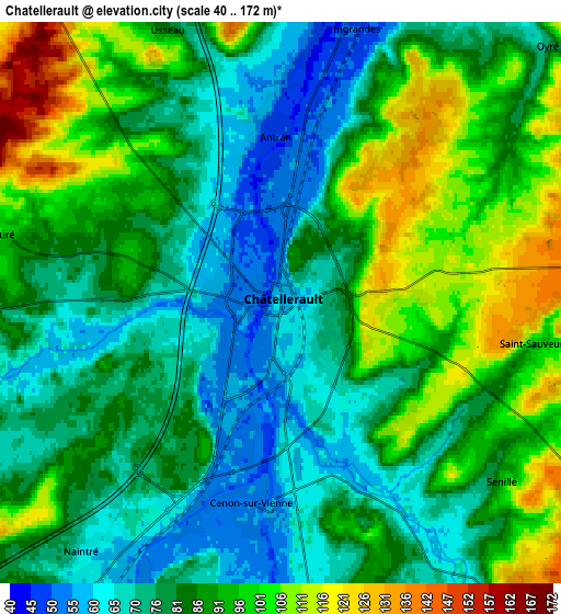
| Scale [m] | 40..139 m | 40..172 m | × |
| Scale [ft] | 131..456 ft | 131..564 ft | × |
| Average | 74.9 m = 246 ft | 85 m = 279 ft | × |
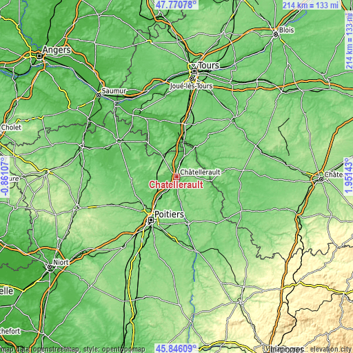
| Width | 6.69 km = 4.2 mi | 13.38 km = 8.3 mi | 214 km = 133 mi |
| Height | 6.69 km = 4.2 mi | 13.38 km = 8.3 mi | 214 km = 133 mi |
| ↑Max Latitude | 46.847115° | 46.877163° | 47.77078° |
| Latitude at center | 46.81705° | 46.81705° | 46.81705° |
| ↓Min Latitude | 46.786968° | 46.75687° | 45.84609° |
| ← Min Longitude | 0.501235° | 0.457289° | -0.86107° |
| Longitude center | 0.54518° | 0.54518° | 0.54518° |
| →Max Longitude | 0.589125° | 0.633071° | 1.95143° |
Nearby cities:
Cities around Châtellerault sort by population:
• Naintré elevation 62 m
7.7 km,  218°
218°
• Dangé-Saint-Romain 42 m
13.6 km,  17°
17°
• Thuré 83 m
6.7 km,  284°
284°
• Scorbé-Clairvaux 90 m
10 km,  267°
267°
• Vouneuil-sur-Vienne 59 m
11.1 km,  181°
181°
• Cenon-sur-Vienne 54 m
4.8 km,  187°
187°
• Beaumont 145 m
12.5 km, 224°
• Colombiers 141 m
10.4 km,  241°
241°
• Saint-Gervais-les-Trois-Clochers 83 m
14 km,  311°
311°
• Antran 48 m
4.2 km,  356°
356°
• Marigny-Brizay 108 m
15 km, 238°
• Saint-Sauveur 103 m
6 km,  99°
99°
Multilingual:
 En español:
Châtellerault elevación 63 m.
 En France:
Châtellerault élévation 63 m.
 Auf Deutsch:
Châtellerault höhe über dem Meeresspiegel ist 63 m.

Sources and notes:
- [note 1] Map square and city borders are not equal. Map elevation data is calculated only from area inside that square.
- [src 1] Elevation data from geonames database provided with same terms of usage.
- [src 2] The elevation map of Châtellerault is generated using elevation data from NASA's 3 arcsec (90m) resolution SRTM data.
- [src 3] Base (background) map © OpenStreetMap contributors tiles are generated by Geofabrik and OpenTopoMap.
Copyright & License:
This Châtellerault Elevation Map is licensed under CC BY-SA. You may reuse any part from this page, if you give a proper credit by linking to this URL:
 More info on terms of use page.