Lamorlaye elevation
Lamorlaye (Hauts-de-France, Département de l'Oise), France elevation is 60 meters and Lamorlaye elevation in feet is 197 ft above sea level [src 1]. Lamorlaye is a populated place (feature code) with elevation that is 114 meters (374 ft) smaller than average city elevation in France.
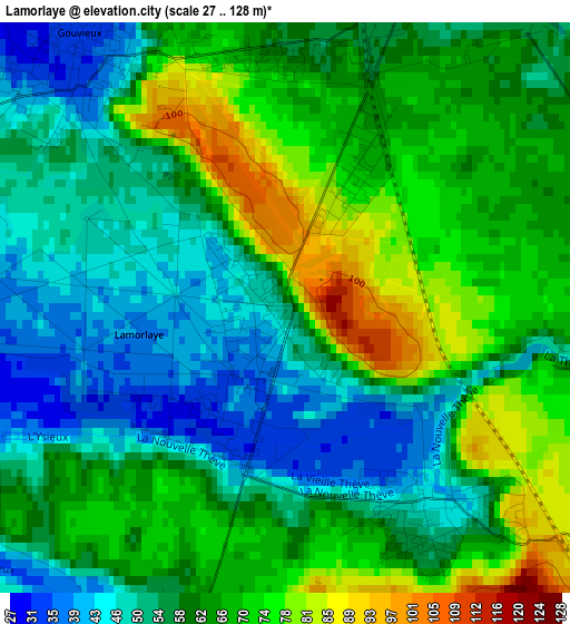
Below is the Elevation map of Lamorlaye, which displays elevation range with different colors. Scale of the first map is from 27 to 128 m (89 to 420 ft) with average elevation of 61.1 meters (=200 ft) [note 1]
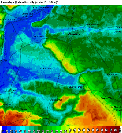
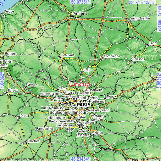
These maps also provides idea of topography and contour of this city, they are displayed at different zoom levels. More info about maps, scale and edge coordinates you can find below images.
| \ | Map #1 | Map #2 | Topo.Map |
| Scale [m] | 27..128 m | 18..164 m | × |
| Scale [ft] | 89..420 ft | 59..538 ft | × |
| Average | 61.1 m = 200 ft | 63.9 m = 210 ft | × |
| Width | 6.39 km = 4 mi | 12.78 km = 7.9 mi | 204.5 km = 127.1 mi |
| Height | 6.39 km = 4 mi | 12.78 km = 7.9 mi | 204.5 km = 127.1 mi |
| ↑Max Latitude | 49.191188° | 49.2199° | 50.07351° |
| Latitude at center | 49.16246° | 49.16246° | 49.16246° |
| ↓Min Latitude | 49.133715° | 49.104954° | 48.23434° |
| ← Min Longitude | 2.402925° | 2.358979° | 1.04062° |
| Longitude center | 2.44687° | 2.44687° | 2.44687° |
| →Max Longitude | 2.490815° | 2.534761° | 3.85312° |
Nearby cities:
Cities around Lamorlaye sort by population:
• Chantilly elevation 53 m
4 km,  26°
26°
• Gouvieux 32 m
3.6 km,  319°
319°
• Viarmes 49 m
6.6 km,  237°
237°
• Luzarches 75 m
5.8 km,  198°
198°
• Coye-la-Forêt 44 m
2.8 km,  142°
142°
• Orry-la-Ville 75 m
5.7 km,  124°
124°
• Chaumontel 51 m
4.3 km,  194°
194°
• Saint-Maximin 60 m
6.6 km,  4°
4°
• Boran-sur-Oise 39 m
6.5 km,  274°
274°
• Villers-sous-Saint-Leu 38 m
6.7 km,  325°
325°
• Vineuil-Saint-Firmin 58 m
5.5 km,  40°
40°
• Seugy 76 m
5.9 km,  220°
220°
Multilingual:
 En español:
Lamorlaye elevación 60 m.
 En France:
Lamorlaye élévation 60 m.
 Auf Deutsch:
Lamorlaye höhe über dem Meeresspiegel ist 60 m.

Sources and notes:
- [note 1] Map square and city borders are not equal. Map elevation data is calculated only from area inside that square.
- [src 1] Elevation data from geonames database provided with same terms of usage.
- [src 2] The elevation map of Lamorlaye is generated using elevation data from NASA's 3 arcsec (90m) resolution SRTM data.
- [src 3] Base (background) map © OpenStreetMap contributors tiles are generated by Geofabrik and OpenTopoMap.
Copyright & License:
This Lamorlaye Elevation Map is licensed under CC BY-SA. You may reuse any part from this page, if you give a proper credit by linking to this URL:
 More info on terms of use page.