La Motte-Saint-Martin elevation
La Motte-Saint-Martin (Auvergne-Rhône-Alpes, Département de l'Isère), France elevation is 730 meters and La Motte-Saint-Martin elevation in feet is 2395 ft above sea level [src 1]. La Motte-Saint-Martin is a populated place (feature code) with elevation that is 556 meters (1824 ft) bigger than average city elevation in France.
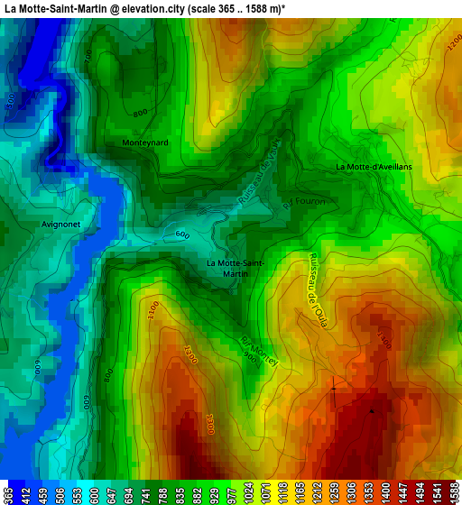
Below is the Elevation map of La Motte-Saint-Martin, which displays elevation range with different colors. Scale of the first map is from 365 to 1588 m (1198 to 5210 ft) with average elevation of 927.2 meters (=3042 ft) [note 1]
These maps also provides idea of topography and contour of this city, they are displayed at different zoom levels. More info about maps, scale and edge coordinates you can find below images.
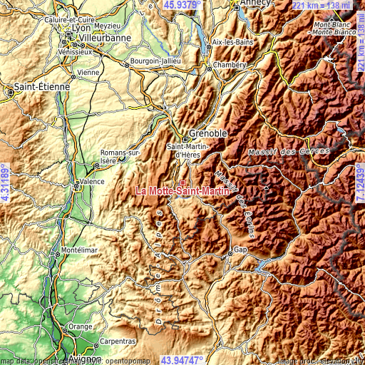
| \ | Map #1 | Topo.Map |
| Scale [m] | 365..1588 m | × |
| Scale [ft] | 1198..5210 ft | × |
| Average | 927.2 m = 3042 ft | × |
| Width | 6.92 km = 4.3 mi | 221.3 km = 137.5 mi |
| Height | 6.92 km = 4.3 mi | 221.3 km = 137.5 mi |
| ↑Max Latitude | 44.982402° | 45.9379° |
| Latitude at center | 44.95131° | 44.95131° |
| ↓Min Latitude | 44.920201° | 43.94747° |
| ← Min Longitude | 5.674195° | 4.31189° |
| Longitude center | 5.71814° | 5.71814° |
| →Max Longitude | 5.762085° | 7.12439° |
Nearby cities:
Cities around La Motte-Saint-Martin sort by population:
• Vizille elevation 279 m
14.7 km,  16°
16°
• Vif 314 m
12.2 km,  342°
342°
• Allières-et-Risset 262 m
16.7 km,  349°
349°
• La Mure 822 m
7.9 km,  134°
134°
• Champ-sur-Drac 318 m
13.2 km,  4°
4°
• Saint-Georges-de-Commiers 419 m
10.5 km, 354°
• Saint-Paul-de-Varces 386 m
14.7 km, 336°
• Le Gua 960 m
10.8 km,  312°
312°
• La Motte-d’Aveillans 886 m
2.3 km,  64°
64°
• Mens 868 m
15.3 km,  170°
170°
• Pierre-Châtel 914 m
4.5 km,  81°
81°
• Notre-Dame-de-Mésage 299 m
12.8 km,  14°
14°
Multilingual:
 En español:
La Motte-Saint-Martin elevación 730 m.
 En France:
La Motte-Saint-Martin élévation 730 m.
 Auf Deutsch:
La Motte-Saint-Martin höhe über dem Meeresspiegel ist 730 m.
 На русском:
La Motte-Saint-Martin высота над уровнем моря 730 м
Sources and notes:
- [note 1] Map square and city borders are not equal. Map elevation data is calculated only from area inside that square.
- [src 1] Elevation data from geonames database provided with same terms of usage.
- [src 2] The elevation map of La Motte-Saint-Martin is generated using elevation data from NASA's 3 arcsec (90m) resolution SRTM data.
- [src 3] Base (background) map © OpenStreetMap contributors tiles are generated by Geofabrik and OpenTopoMap.
Copyright & License:
This La Motte-Saint-Martin Elevation Map is licensed under CC BY-SA. You may reuse any part from this page, if you give a proper credit by linking to this URL:
 More info on terms of use page.