Vif elevation
Vif (Auvergne-Rhône-Alpes, Département de l'Isère), France elevation is 314 meters and Vif elevation in feet is 1030 ft above sea level [src 1]. Vif is a populated place (feature code) with elevation that is 140 meters (459 ft) bigger than average city elevation in France.
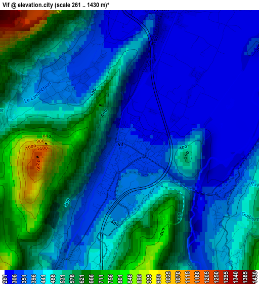
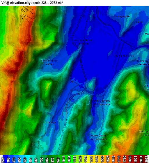
Below is the Elevation map of Vif, which displays elevation range with different colors. Scale of the first map is from 261 to 1430 m (856 to 4692 ft) with average elevation of 467.2 meters (=1533 ft) [note 1]
These maps also provides idea of topography and contour of this city, they are displayed at different zoom levels. More info about maps, scale and edge coordinates you can find below images.
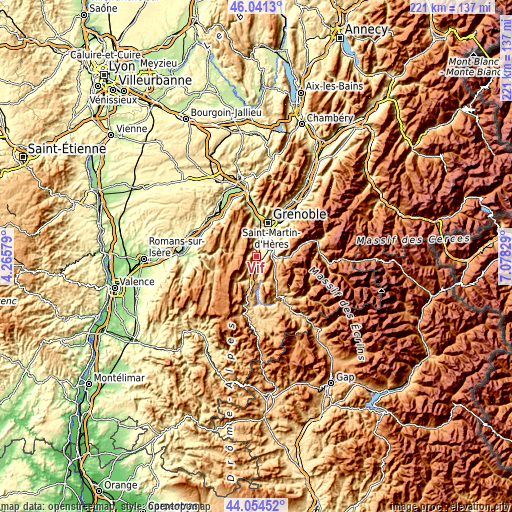
| \ | Map #1 | Map #2 | Topo.Map |
| Scale [m] | 261..1430 m | 238..2072 m | × |
| Scale [ft] | 856..4692 ft | 781..6798 ft | × |
| Average | 467.2 m = 1533 ft | 774.9 m = 2542 ft | × |
| Width | 6.9 km = 4.3 mi | 13.81 km = 8.6 mi | 220.9 km = 137.3 mi |
| Height | 6.9 km = 4.3 mi | 13.81 km = 8.6 mi | 220.9 km = 137.3 mi |
| ↑Max Latitude | 45.087575° | 45.118593° | 46.0413° |
| Latitude at center | 45.05654° | 45.05654° | 45.05654° |
| ↓Min Latitude | 45.025488° | 44.99442° | 44.05452° |
| ← Min Longitude | 5.628095° | 5.584149° | 4.26579° |
| Longitude center | 5.67204° | 5.67204° | 5.67204° |
| →Max Longitude | 5.715985° | 5.759931° | 7.07829° |
Nearby cities:
Cities around Vif sort by population:
• Le Pont-de-Claix elevation 246 m
7.7 km,  15°
15°
• Claix 263 m
7 km,  0°
0°
• Vizille 279 m
8.1 km,  72°
72°
• Allières-et-Risset 262 m
4.8 km,  6°
6°
• Villard-de-Lans 1052 m
9.2 km,  280°
280°
• Jarrie 394 m
9.6 km,  45°
45°
• Champ-sur-Drac 318 m
4.9 km, 72°
• Saint-Georges-de-Commiers 419 m
3 km,  114°
114°
• Saint-Paul-de-Varces 386 m
2.9 km,  306°
306°
• Le Gua 960 m
6.2 km,  224°
224°
• Notre-Dame-de-Mésage 299 m
6.8 km,  84°
84°
• Champagnier 411 m
7.5 km,  35°
35°
Multilingual:
 En español:
Vif elevación 314 m.
 En France:
Vif élévation 314 m.


Sources and notes:
- [note 1] Map square and city borders are not equal. Map elevation data is calculated only from area inside that square.
- [src 1] Elevation data from geonames database provided with same terms of usage.
- [src 2] The elevation map of Vif is generated using elevation data from NASA's 3 arcsec (90m) resolution SRTM data.
- [src 3] Base (background) map © OpenStreetMap contributors tiles are generated by Geofabrik and OpenTopoMap.
Copyright & License:
This Vif Elevation Map is licensed under CC BY-SA. You may reuse any part from this page, if you give a proper credit by linking to this URL:
 More info on terms of use page.