Laneuveville-devant-Nancy elevation
Laneuveville-devant-Nancy (Grand Est, Meurthe-et-Moselle), France elevation is 202 meters and Laneuveville-devant-Nancy elevation in feet is 663 ft above sea level [src 1]. Laneuveville-devant-Nancy is a populated place (feature code) with elevation that is 28 meters (92 ft) bigger than average city elevation in France.
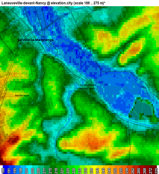
Below is the Elevation map of Laneuveville-devant-Nancy, which displays elevation range with different colors. Scale of the first map is from 188 to 275 m (617 to 902 ft) with average elevation of 218.9 meters (=718 ft) [note 1]
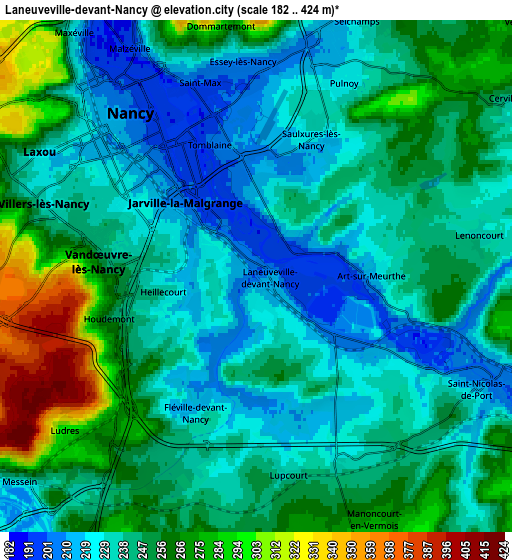
These maps also provides idea of topography and contour of this city, they are displayed at different zoom levels. More info about maps, scale and edge coordinates you can find below images.
| \ | Map #1 | Map #2 | Topo.Map |
| Scale [m] | 188..275 m | 182..424 m | × |
| Scale [ft] | 617..902 ft | 597..1391 ft | × |
| Average | 218.9 m = 718 ft | 245.7 m = 806 ft | × |
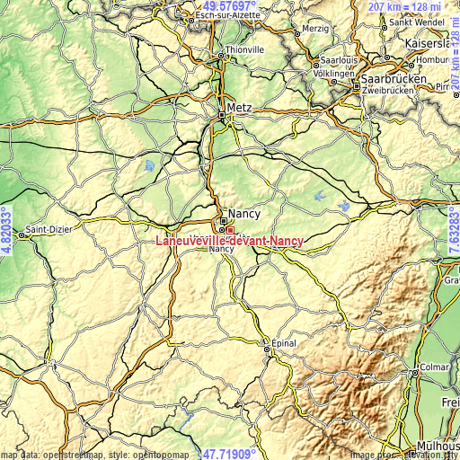
| Width | 6.46 km = 4 mi | 12.91 km = 8 mi | 206.6 km = 128.4 mi |
| Height | 6.46 km = 4 mi | 12.91 km = 8 mi | 206.6 km = 128.4 mi |
| ↑Max Latitude | 48.685611° | 48.714615° | 49.57697° |
| Latitude at center | 48.65659° | 48.65659° | 48.65659° |
| ↓Min Latitude | 48.627553° | 48.598499° | 47.71909° |
| ← Min Longitude | 6.182635° | 6.138689° | 4.82033° |
| Longitude center | 6.22658° | 6.22658° | 6.22658° |
| →Max Longitude | 6.270525° | 6.314471° | 7.63283° |
Nearby cities:
Cities around Laneuveville-devant-Nancy sort by population:
• Nancy elevation 212 m
4.3 km,  315°
315°
• Vandœuvre-lès-Nancy 239 m
3.3 km,  257°
257°
• Saint-Max 207 m
5.5 km,  344°
344°
• Jarville-la-Malgrange 200 m
2.1 km,  303°
303°
• Essey-lès-Nancy 212 m
5.4 km,  0°
0°
• Tomblaine 210 m
3.1 km,  345°
345°
• Heillecourt 220 m
2.4 km,  253°
253°
• Pulnoy 222 m
5.7 km,  23°
23°
• Saulxures-lès-Nancy 224 m
3.8 km, 19°
• Fléville-devant-Nancy 237 m
3.9 km,  205°
205°
• Houdemont 238 m
4 km, 249°
• Art-sur-Meurthe 240 m
3 km,  88°
88°
Multilingual:
 En español:
Laneuveville-devant-Nancy elevación 202 m.
 En France:
Laneuveville-devant-Nancy élévation 202 m.
 Auf Deutsch:
Laneuveville-devant-Nancy höhe über dem Meeresspiegel ist 202 m.
 На русском:
Laneuveville-devant-Nancy высота над уровнем моря 202 м
Sources and notes:
- [note 1] Map square and city borders are not equal. Map elevation data is calculated only from area inside that square.
- [src 1] Elevation data from geonames database provided with same terms of usage.
- [src 2] The elevation map of Laneuveville-devant-Nancy is generated using elevation data from NASA's 3 arcsec (90m) resolution SRTM data.
- [src 3] Base (background) map © OpenStreetMap contributors tiles are generated by Geofabrik and OpenTopoMap.
Copyright & License:
This Laneuveville-devant-Nancy Elevation Map is licensed under CC BY-SA. You may reuse any part from this page, if you give a proper credit by linking to this URL:
 More info on terms of use page.